Category:West End, Eastleigh
Jump to navigation
Jump to search
village and civil parish in Hampshire, United Kingdom _-_geograph.org.uk_-_1404576.jpg) | |||||
| Upload media | |||||
| Instance of | |||||
|---|---|---|---|---|---|
| Location | Eastleigh, Hampshire, South East England, England | ||||
| Population |
| ||||
| Said to be the same as | West End (Wikimedia duplicated page, civil parish) | ||||
| official website | |||||
 | |||||
English: West End, Hampshire is a village and civil parish in the borough of Eastleigh, northeast of Southampton, England. The parish also includes the settlement of Chartwell Green and Moorgreen Hospital.
Subcategories
This category has the following 10 subcategories, out of 10 total.
Media in category "West End, Eastleigh"
The following 200 files are in this category, out of 237 total.
(previous page) (next page)-
 2016, a year on Geograph (Day 55) - geograph.org.uk - 4838980.jpg 640 × 480; 56 KB
-

-

-

-

-

-

-

-

-

-

-

-

-

-
 A Townhill Way bus stop in the fog - geograph.org.uk - 2938624.jpg 1,024 × 765; 116 KB
-
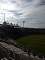
 About to be out at The Ageas Rose Bowl - geograph.org.uk - 4452303.jpg 1,024 × 731; 872 KB
-
 Access road to West End Cemetery - geograph.org.uk - 2226945.jpg 427 × 640; 198 KB
-
 Allington Lane - geograph.org.uk - 3284770.jpg 640 × 480; 63 KB
-
 Allington Lane - geograph.org.uk - 3284818.jpg 640 × 480; 73 KB
-
 Allington Lane bridge over M27 - geograph.org.uk - 2918978.jpg 640 × 500; 55 KB
-
 Allington Lane bridge over M27 - geograph.org.uk - 3572553.jpg 1,024 × 768; 99 KB
-
 Allington Lane Bridge, M27 - geograph.org.uk - 2857297.jpg 640 × 366; 31 KB
-
 Allington Lane railway bridge - geograph.org.uk - 2227061.jpg 640 × 427; 209 KB
-
 Allington Manor Business Centre - geograph.org.uk - 5174123.jpg 640 × 480; 68 KB
-
 Andiron Court, off Allington Lane - geograph.org.uk - 2226825.jpg 640 × 427; 209 KB
-
 Arthurs Gardens - geograph.org.uk - 1036817.jpg 640 × 427; 106 KB
-
 Arturis Garden Centre - geograph.org.uk - 5119804.jpg 640 × 480; 108 KB
-
 Atalantic Park View - geograph.org.uk - 4733828.jpg 640 × 480; 78 KB
-
 B3035 bridge over M27 - geograph.org.uk - 2918965.jpg 640 × 465; 51 KB
-
 B3035 bridge over M27 - geograph.org.uk - 3572294.jpg 1,024 × 768; 88 KB
-
 B3035 Bridge, M27 - geograph.org.uk - 2857304.jpg 640 × 286; 36 KB
-
 Barbe Baker Avenue - geograph.org.uk - 1859869.jpg 640 × 480; 85 KB
-
 Barbe Baker Avenue - geograph.org.uk - 3613845.jpg 640 × 480; 88 KB
-
 Barbe Baker Avenue, West End - geograph.org.uk - 2226973.jpg 640 × 427; 167 KB
-
 Boardwalk at Moorgreen Farm - geograph.org.uk - 5315791.jpg 640 × 427; 127 KB
-
 Borough of Eastleigh , M27 Motorway - geograph.org.uk - 5738890.jpg 6,000 × 4,000; 5.65 MB
-
 Borough of Eastleigh , M27 Motorway - geograph.org.uk - 5738893.jpg 6,000 × 4,000; 5.81 MB
-
 Borough of Eastleigh , M27 Motorway - geograph.org.uk - 5738894.jpg 6,000 × 4,000; 5.8 MB
-
 Borough of Eastleigh , M27 Motorway - geograph.org.uk - 5738896.jpg 6,000 × 4,000; 6.82 MB
-
 Borough of Eastleigh , M27 Motorway - geograph.org.uk - 5738897.jpg 6,000 × 4,000; 5.96 MB
-
 Borough of Eastleigh , M27 Motorway - geograph.org.uk - 5738899.jpg 6,000 × 4,000; 5.88 MB
-
 Borough of Eastleigh , M27 Motorway - geograph.org.uk - 5738901.jpg 6,000 × 4,000; 6.15 MB
-
 Borough of Eastleigh , M27 Motorway - geograph.org.uk - 5738903.jpg 6,000 × 4,000; 6.07 MB
-
 Botley Road bridge over M27 - geograph.org.uk - 4725433.jpg 640 × 465; 48 KB
-
 Bridge carrying Moorgreen Road over M27 - geograph.org.uk - 2227049.jpg 640 × 427; 160 KB
-
 Bridge E13-9 ETF Burnett's Lane - geograph.org.uk - 4969435.jpg 640 × 427; 177 KB
-
 Bridge repairs, Allington Lane - geograph.org.uk - 5119805.jpg 640 × 439; 77 KB
-

-
 Bridge taking Quob Lane over M27 - geograph.org.uk - 2226895.jpg 640 × 427; 141 KB
-
 Brookside Way, West End - geograph.org.uk - 2227001.jpg 640 × 427; 152 KB
-
 Building Site on Moorgreen Road - geograph.org.uk - 2226732.jpg 640 × 427; 219 KB
-

-
 Cerne Close, Southampton - geograph.org.uk - 2382900.jpg 640 × 480; 70 KB
-
 Chalk Hill - geograph.org.uk - 4733793.jpg 640 × 480; 98 KB
-
 Chapel Road, West End - geograph.org.uk - 1859874.jpg 640 × 480; 95 KB
-
 Charles Watts Way - geograph.org.uk - 2918957.jpg 640 × 466; 56 KB
-
 Chartwell Green sign - geograph.org.uk - 2938591.jpg 1,024 × 765; 172 KB
-
 Cheriton Avenue - geograph.org.uk - 3018928.jpg 640 × 297; 61 KB
-
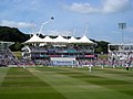
 County cricket at The Ageas Rose Bowl - geograph.org.uk - 4451992.jpg 1,024 × 732; 689 KB
-
 Demolishing a house - geograph.org.uk - 4888426.jpg 640 × 480; 120 KB
-

-
 Drive to Moorgreen Farm - geograph.org.uk - 2226758.jpg 640 × 427; 214 KB
-
 Drive to Moorgreen Farm - geograph.org.uk - 2226760.jpg 640 × 427; 118 KB
-
 Duckboarded footpath at Moorgreen Farm - geograph.org.uk - 2226791.jpg 427 × 640; 285 KB
-
 Dumbleton Close, Thornhill - geograph.org.uk - 2652413.jpg 640 × 480; 93 KB
-
 Eastbound M27 - geograph.org.uk - 3284832.jpg 640 × 480; 56 KB
-
 Eastbound M27 - geograph.org.uk - 3735046.jpg 640 × 480; 241 KB
-
 Eastbound M27 - geograph.org.uk - 3735070.jpg 640 × 480; 250 KB
-
 Eastbound M27, Eastleigh - geograph.org.uk - 3735164.jpg 640 × 480; 228 KB
-
 Entrance to West End Cemetery - geograph.org.uk - 2226903.jpg 640 × 427; 199 KB
-

-

-

-

-
 Field near Little Moorgreen Farm - geograph.org.uk - 2841230.jpg 640 × 482; 48 KB
-
 Field north of Moorlands Farm - geograph.org.uk - 1404231.jpg 640 × 427; 183 KB
-
 Field west of Quob Lane - geograph.org.uk - 2226880.jpg 640 × 427; 144 KB
-

-
 Footpath approaching Andiron Court - geograph.org.uk - 2226822.jpg 640 × 427; 212 KB
-

-

-

-
 Footpath from Beacon Road at West End - geograph.org.uk - 5294784.jpg 4,000 × 3,000; 4.13 MB
-

-
 Footpath into High Wood - geograph.org.uk - 3284807.jpg 640 × 480; 105 KB
-
 Footpath leaving Moorgreen Road - geograph.org.uk - 2226744.jpg 427 × 640; 185 KB
-
 Footpath through trees near Moorgreen - geograph.org.uk - 5316788.jpg 640 × 427; 117 KB
-

-

-
 Former Moorgreen Methodist Chapel - geograph.org.uk - 3432851.jpg 2,582 × 2,328; 1.12 MB
-
 Greenacres, Allington Lane - geograph.org.uk - 2226845.jpg 640 × 427; 149 KB
-
 Harbourne Gardens - geograph.org.uk - 3611434.jpg 640 × 480; 74 KB
-
 High Street (B3035) in West End - geograph.org.uk - 5294798.jpg 4,000 × 3,000; 3.16 MB
-
 High Street - geograph.org.uk - 4733785.jpg 640 × 480; 79 KB
-
 Holiday Inn Express Hotel, West End - geograph.org.uk - 699352.jpg 640 × 480; 108 KB
-
 Houses in Arun Road - geograph.org.uk - 2965774.jpg 640 × 482; 92 KB
-
 Houses in Arun Road - geograph.org.uk - 6230351.jpg 1,024 × 576; 160 KB
-
 Houses in Swincombe Rise - geograph.org.uk - 6230353.jpg 1,024 × 576; 165 KB
-
 Houses on Telegraph Road - geograph.org.uk - 3050225.jpg 640 × 482; 80 KB
-

-

-
 Itchen Valley Country Park, Wind turbine - geograph.org.uk - 5943736.jpg 1,024 × 699; 102 KB
-
 Itchen Way (43) - geograph.org.uk - 3357426.jpg 800 × 578; 200 KB
-
 Jukes Walk, West End - geograph.org.uk - 2227045.jpg 640 × 427; 156 KB
-
 Junction of Bubb Lane and Burnetts Lane - geograph.org.uk - 2226737.jpg 640 × 427; 143 KB
-
 Junction of Quob Lane and Allington Lane - geograph.org.uk - 2226850.jpg 640 × 427; 158 KB
-
 Keeper's Cottage, Allington Lane - geograph.org.uk - 2226829.jpg 640 × 427; 229 KB
-

-
 M27 - 1-2 mile to junction 5 - geograph.org.uk - 3205338.jpg 640 × 428; 65 KB
-
 M27 - geograph.org.uk - 156928.jpg 640 × 480; 41 KB
-
 M27 - Moorgreen Road bridge - geograph.org.uk - 3205189.jpg 640 × 428; 88 KB
-
 M27 - Quob Lane bridge - geograph.org.uk - 3205222.jpg 640 × 428; 75 KB
-
 M27 gantry - geograph.org.uk - 4725430.jpg 640 × 477; 49 KB
-
 M27 heading north (westbound) - geograph.org.uk - 2918962.jpg 640 × 480; 49 KB
-
 M27 motorway seen from Moorgreen Road - geograph.org.uk - 2227051.jpg 640 × 427; 111 KB
-
 M27 motorway seen from Moorgreen Road - geograph.org.uk - 2227055.jpg 640 × 427; 111 KB
-
 M27 motorway seen from Quob Lane - geograph.org.uk - 2226886.jpg 640 × 427; 182 KB
-
 M27 motorway seen from Quob Lane - geograph.org.uk - 2226891.jpg 640 × 427; 129 KB
-
 M27 over river Itchen - geograph.org.uk - 2918982.jpg 640 × 469; 48 KB
-

-
 M27 west crossing the river Itchen - geograph.org.uk - 2864876.jpg 640 × 428; 58 KB
-
 M27 westbound - geograph.org.uk - 2918967.jpg 640 × 486; 59 KB
-
 M27, Allington Lane Bridge - geograph.org.uk - 3735031.jpg 640 × 480; 294 KB
-
 M27, Dummer's Copse - geograph.org.uk - 3735049.jpg 640 × 480; 276 KB
-
 M27, eastbound - geograph.org.uk - 4250082.jpg 640 × 384; 35 KB
-
 M27, eastbound - geograph.org.uk - 4250088.jpg 640 × 347; 32 KB
-
 Manège at Moorgreen Farm - geograph.org.uk - 2226769.jpg 640 × 427; 156 KB
-
 Megan Green, West End - geograph.org.uk - 2226995.jpg 640 × 427; 198 KB
-
 Monarch Way, West End - geograph.org.uk - 2227019.jpg 640 × 427; 125 KB
-
 Moor Green Road Bridge, M27 - geograph.org.uk - 2857303.jpg 640 × 430; 31 KB
-
 Moorgreen Farm - geograph.org.uk - 2226764.jpg 640 × 427; 138 KB
-
 Moorgreen Park, Moorgreen Road - geograph.org.uk - 2227038.jpg 640 × 427; 120 KB
-
 Moorgreen Road (A27) Bridge over the M27 - geograph.org.uk - 3735061.jpg 640 × 480; 231 KB
-
 Moorgreen Road - geograph.org.uk - 2226724.jpg 640 × 427; 202 KB
-
 Moorgreen Road bridge over M27 - geograph.org.uk - 2918971.jpg 640 × 476; 50 KB
-
 Moorgreen Road bridge over M27 - geograph.org.uk - 3572297.jpg 1,024 × 768; 90 KB
-
 Nearing Quob Lane Bridge, M27 - geograph.org.uk - 2857299.jpg 640 × 400; 34 KB
-
 Nelson's Gardens Play Area - geograph.org.uk - 1036853.jpg 640 × 427; 148 KB
-

-

-
 Oaktree Park - geograph.org.uk - 5120825.jpg 640 × 480; 97 KB
-

-

-
 Ordnance Survey Flush Bracket S1427 - geograph.org.uk - 5354883.jpg 4,000 × 3,000; 3.99 MB
-
 Pinewood Park, Thornhill - geograph.org.uk - 2652395.jpg 640 × 480; 119 KB
-
 Pond in stream at Moorgreen Farm - geograph.org.uk - 5315789.jpg 640 × 427; 114 KB
-
 Quob Farm Close - geograph.org.uk - 2226964.jpg 640 × 427; 155 KB
-
 Quob Lane - geograph.org.uk - 2227003.jpg 640 × 427; 177 KB
-
 Quob Lane bridge over M27 - geograph.org.uk - 2918975.jpg 640 × 476; 52 KB
-

-

-
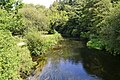 River Itchen at Itchen Valley Country Park - geograph.org.uk - 6242657.jpg 1,024 × 683; 322 KB
-
 River Itchen, Gaters Mill and Bypass Channel - geograph.org.uk - 5943648.jpg 1,024 × 768; 244 KB
-

-

-
 Roddington Forge - geograph.org.uk - 5119807.jpg 640 × 480; 52 KB
-
 Rose Bowl pavilion May 2013.jpeg 1,536 × 2,048; 588 KB
-
 Rosebowl20132.jpeg 2,448 × 3,264; 2.25 MB
-
 Roundabout, Thornhill - geograph.org.uk - 2918955.jpg 640 × 480; 86 KB
-
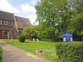 Saint James, West End, churchyard (a) - geograph.org.uk - 4528941.jpg 640 × 480; 120 KB
-
 Saint James, West End, churchyard (b) - geograph.org.uk - 4528942.jpg 640 × 480; 112 KB
-
 Saint James, West End, churchyard (c) - geograph.org.uk - 4528943.jpg 640 × 480; 109 KB
-
 Saint James, West End, churchyard (d) - geograph.org.uk - 4528945.jpg 640 × 480; 119 KB
-

-
 Saint James, West End, churchyard (f) - geograph.org.uk - 4528950.jpg 640 × 480; 121 KB
-
 Saint James, West End, churchyard (g) - geograph.org.uk - 4528952.jpg 640 × 480; 102 KB
-

-
 South Lodge, Quob Lane - geograph.org.uk - 2226858.jpg 640 × 427; 185 KB
-
 Southampton , Aerial Scenery - geograph.org.uk - 3127234.jpg 2,560 × 1,920; 2.32 MB
-

-
 Spring flowers beside Allington Lane (geograph 5315782).jpg 640 × 427; 109 KB
-

-

-

-
 Stream on Moorgreen Farm - geograph.org.uk - 2226800.jpg 640 × 427; 198 KB
-

-
 Sunnycroft Care Home, Moorgreen Road - geograph.org.uk - 2226717.jpg 640 × 427; 135 KB
-
 Telegraph Woods - geograph.org.uk - 3284853.jpg 640 × 480; 134 KB
-
 Tennis Centre West end - geograph.org.uk - 27590.jpg 640 × 480; 81 KB
-
 Test Match at the Rose Bowl - geograph.org.uk - 4143623.jpg 2,048 × 1,536; 487 KB
-
 The Ageas Bowl - geograph.org.uk - 5806027.jpg 3,840 × 2,160; 3.5 MB
-
 The Ageas Rose Bowl, behind the Pavilion - geograph.org.uk - 4451798.jpg 767 × 1,024; 878 KB
-
 The Ageas Rose Bowl, Hampshire v Nottinghamshire - geograph.org.uk - 4452008.jpg 1,024 × 731; 819 KB
-
 The Ageas Rose Bowl, lunch in the Arlott Atrium - geograph.org.uk - 4451976.jpg 1,024 × 732; 865 KB
-
 The Ageas Rose Bowl, towards the Pavilion End - geograph.org.uk - 4452070.jpg 1,024 × 1,024; 1.08 MB
-
 The Master Builder - geograph.org.uk - 3613847.jpg 640 × 480; 71 KB
-
 The Rose Bowl (aerial) - geograph.org.uk - 5796500.jpg 640 × 480; 436 KB
-
 The Southampton Arms pub, Moorgreen Road - geograph.org.uk - 2227058.jpg 640 × 427; 147 KB
-
 The Southampton Arms public house - geograph.org.uk - 2841235.jpg 640 × 482; 52 KB
-
 Thornhill Park Road - geograph.org.uk - 2918950.jpg 640 × 480; 71 KB
-
 Townhill Way - geograph.org.uk - 3611432.jpg 640 × 480; 86 KB
-
 Traffic calming on Moorgreen Road - geograph.org.uk - 2226700.jpg 640 × 427; 179 KB
-
 Trees in field near Moorgreen Farm - geograph.org.uk - 5315784.jpg 640 × 427; 79 KB
-
-

-
-

-
 West End allotments, Moorgreen Road - geograph.org.uk - 2226706.jpg 640 × 427; 159 KB
-
 West End Carnival - geograph.org.uk - 990170.jpg 640 × 481; 120 KB
-
 West End Carnival - geograph.org.uk - 990175.jpg 640 × 481; 135 KB
_-_geograph.org.uk_-_4838980.jpg)
_-_geograph.org.uk_-_4537179.jpg)
_-_geograph.org.uk_-_4537180.jpg)
_-_geograph.org.uk_-_4537196.jpg)
_-_geograph.org.uk_-_4537202.jpg)
_-_geograph.org.uk_-_4537794.jpg)
_-_geograph.org.uk_-_4537819.jpg)
_-_geograph.org.uk_-_4537796.jpg)
_-_geograph.org.uk_-_4537798.jpg)
_-_geograph.org.uk_-_4537802.jpg)
_-_geograph.org.uk_-_4537806.jpg)
_-_geograph.org.uk_-_4537841.jpg)
_-_geograph.org.uk_-_4537842.jpg)
_-_geograph.org.uk_-_4537843.jpg)


_-_geograph.org.uk_-_3350918.jpg)
_-_geograph.org.uk_-_3350922.jpg)


_in_West_End_-_geograph.org.uk_-_5294798.jpg)


_-_geograph.org.uk_-_3357426.jpg)


_-_geograph.org.uk_-_430472.jpg)


_-_geograph.org.uk_-_2918962.jpg)


_Bridge_over_the_M27_-_geograph.org.uk_-_3735061.jpg)


_-_geograph.org.uk_-_5943673.jpg)
_-_geograph.org.uk_-_5943715.jpg)


_-_geograph.org.uk_-_4528941.jpg)
_-_geograph.org.uk_-_4528942.jpg)
_-_geograph.org.uk_-_4528943.jpg)
_-_geograph.org.uk_-_4528945.jpg)
_-_geograph.org.uk_-_4528948.jpg)
_-_geograph.org.uk_-_4528950.jpg)
_-_geograph.org.uk_-_4528952.jpg)
_-_geograph.org.uk_-_4528954.jpg)


_-_geograph.org.uk_-_430506.jpg)
.jpg)


_-_geograph.org.uk_-_5796500.jpg)


