Category:West Derby
Jump to navigation
Jump to search
district of Liverpool, England | |||||
| Upload media | |||||
| Instance of | |||||
|---|---|---|---|---|---|
| Location | Liverpool, Merseyside, North West England, England | ||||
 | |||||
Subcategories
This category has the following 36 subcategories, out of 36 total.
- Benchmarks in West Derby (4 F)
A
- Alder Road bridge (6 F)
B
- Basil Grange, Liverpool (2 F)
- Brookside Close (8 F)
C
- Crosby Green bridge (3 F)
F
J
L
M
- St Mary's, West Derby (15 F)
- Muirhead Post Office (2 F)
S
- Sandforth Road bridge (5 F)
- St. Edward's College (9 F)
T
- Three But Lane bridge (4 F)
W
- West Derby library (2 F)
- West Derby Lodge (4 F)
- West Derby railway station (22 F)
- West Derby School (3 F)
- West Derby village cross (5 F)
- West Derby village hall (2 F)
- West Derby War Memorial (5 F)
Media in category "West Derby"
The following 45 files are in this category, out of 45 total.
-
A view of West Derby Golf Course from Yew Tree Lane - geograph.org.uk - 4254158.jpg 2,787 × 4,187; 7.13 MB
-
Academy 1nternational, Eaton Road, Liverpool L12.JPG 4,320 × 3,240; 2.64 MB
-
Alder Sports Club.jpg 4,938 × 2,910; 6.44 MB
-
Alder Veterinary Hospital, Eaton Road, Liverpool L12.JPG 4,320 × 3,240; 2.85 MB
-
Birth certificate of Richard James Hancox.png 3,487 × 2,483; 14.8 MB
-
Cardinal Heenan & Broughton Hall Sixth Form Centre (1).JPG 4,320 × 3,240; 2.59 MB
-
Cardinal Heenan & Broughton Hall Sixth Form Centre (2).JPG 4,320 × 3,240; 2.59 MB
-
Cardinal Heenan Catholic High School.JPG 4,320 × 3,240; 2.68 MB
-
Colwell Court, Liverpool L14.JPG 4,320 × 3,240; 2.86 MB
-
Eaton Road police station, Liverpool L12.JPG 4,320 × 3,240; 4.04 MB
-
Entrance to Broughton Hall High School Technology College.JPG 4,320 × 3,240; 3.19 MB
-
Entrance to Cardinal Heenan Catholic Sports College.JPG 4,320 × 3,240; 4.54 MB
-
Entrance to St Vincent's School, Liverpool L12.JPG 4,320 × 3,240; 3.36 MB
-
Entrance to the Margaret Beavan School, West Derby.JPG 4,320 × 3,240; 5.4 MB
-
Flowerbed in West Derby village, Liverpool.JPG 4,608 × 3,456; 3.54 MB
-
Former school building on Bonsall Road, Liverpool L12.JPG 4,320 × 3,240; 3.04 MB
-
Job Centre Plus, Eaton Road, Liverpool L12.JPG 4,320 × 3,240; 2.78 MB
-
Jumbo Chinese Restaurant & Takeaway, Princess Drive, Liverpool.JPG 4,320 × 3,240; 2.39 MB
-
Junction of Croxteth Hall Lane & Deysbrook Lane, Liverpool.jpg 800 × 600; 139 KB
-
Larkhill Service Station, Liverpool.jpg 4,739 × 2,677; 6.13 MB
-
Leyfield Triangle - geograph.org.uk - 1116631.jpg 640 × 480; 153 KB
-
Norris Green Road, West Derby (1).JPG 4,320 × 3,240; 2.9 MB
-
Norris Green Road, West Derby (2).JPG 4,320 × 3,240; 2.91 MB
-
Park View, Eaton Road, West Derby.JPG 4,320 × 3,240; 2.97 MB
-
Princess Drive - geograph.org.uk - 605956.jpg 640 × 480; 86 KB
-
Rice Farm, Liverpool L12 (1).JPG 4,320 × 3,240; 3.4 MB
-
Rice Farm, Liverpool L12 (2).JPG 4,320 × 3,240; 3.1 MB
-
Shops on Eaton Road, Liverpool L12.JPG 4,320 × 3,240; 3.02 MB
-
Shops on Eaton Road, West Derby.JPG 4,320 × 3,240; 2.87 MB
-
St Mary's primary school, West Derby - geograph.org.uk - 37454.jpg 480 × 640; 117 KB
-
St Vincent's School for the Blind - geograph.org.uk - 81523.jpg 640 × 480; 60 KB
-
Three But Lane, Liverpool L12.JPG 4,608 × 3,456; 3.47 MB
-
Town Row, West Derby.JPG 4,320 × 3,240; 3.08 MB
-
Trackside structure near West Derby station.jpg 5,152 × 3,864; 7.49 MB
-
Walker Playing Fields, Liverpool.JPG 4,320 × 3,240; 3.62 MB
-
West Derby delivery office (1).JPG 4,320 × 3,240; 3.64 MB
-
West Derby delivery office (2).JPG 3,240 × 4,320; 2.91 MB
-
West Derby Golf Club, Liverpool L12.JPG 4,320 × 3,240; 3.16 MB
-
West Derby Rec Bowling Club.jpg 5,152 × 3,864; 9.02 MB
-
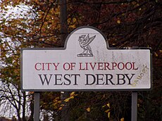
West Derby Sign.jpg 1,984 × 1,488; 640 KB
-
West Derby Village Stocks - geograph.org.uk - 630105.jpg 640 × 480; 61 KB
-
Westderbycastle.gif 292 × 228; 1.93 MB
-
White Cross Vets, Liverpool L13.JPG 4,320 × 3,240; 3.21 MB
-
Yeoman's House, West Derby - geograph.org.uk - 630109.jpg 640 × 480; 61 KB
-
Village centre, West Derby - geograph.org.uk - 37407.jpg 640 × 480; 62 KB


