Category:West Bridgford
Jump to navigation
Jump to search
town in Nottinghamshire, England  | |||||
| Upload media | |||||
| Instance of | |||||
|---|---|---|---|---|---|
| Location | Rushcliffe, Nottinghamshire, East Midlands, England | ||||
 | |||||
West Bridgford is a district of Nottingham, England.
Subcategories
This category has the following 9 subcategories, out of 9 total.
Media in category "West Bridgford"
The following 200 files are in this category, out of 426 total.
(previous page) (next page)-
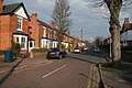
 113 and 115 Melton Road, West Bridgford - geograph.org.uk - 5291023.jpg 1,280 × 960; 423 KB
-
 35 Henry Road, West Bridgford - geograph.org.uk - 4782486.jpg 3,264 × 2,448; 3.88 MB
-
 A bend in the road - geograph.org.uk - 1279385.jpg 640 × 427; 106 KB
-
 A Curve in The Trent - geograph.org.uk - 793772.jpg 427 × 640; 140 KB
-
 A July evening at Lady Bay - geograph.org.uk - 5044620.jpg 1,024 × 768; 885 KB
-
 A July evening in West Bridgford Park - geograph.org.uk - 4563008.jpg 1,024 × 1,024; 1.6 MB
-
 A July evening in West Bridgford Park - geograph.org.uk - 5044629.jpg 819 × 1,024; 1.31 MB
-
-
 A summer evening in Lady Bay - geograph.org.uk - 2506484.jpg 1,024 × 766; 895 KB
-
 A wet afternoon in West Bridgford - geograph.org.uk - 2422782.jpg 1,024 × 768; 796 KB
-
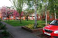
 Abbey Circus, West Bridgford - geograph.org.uk - 893786.jpg 640 × 480; 85 KB
-
 Above Trent Lock on the Grantham Canal - geograph.org.uk - 785802.jpg 640 × 561; 171 KB
-
-
 Adbolton Grove, Lady Bay - geograph.org.uk - 3631465.jpg 640 × 480; 59 KB
-
 Adbolton Lane - geograph.org.uk - 1760548.jpg 640 × 480; 67 KB
-
 Alford Road - geograph.org.uk - 1772591.jpg 1,280 × 959; 184 KB
-
 Allotments in Lady Bay - geograph.org.uk - 785964.jpg 640 × 427; 108 KB
-
 An April evening in West Bridgford Park - geograph.org.uk - 3957728.jpg 1,024 × 759; 1,023 KB
-
 Approaching Lady Bay Bridge - geograph.org.uk - 785284.jpg 640 × 427; 104 KB
-
 Asda wb.jpg 320 × 240; 30 KB
-
 ASDA, Loughborough Road - geograph.org.uk - 985290.jpg 640 × 480; 79 KB
-

-
 Bank Building, West Bridgford - geograph.org.uk - 1948624.jpg 640 × 480; 71 KB
-
 BecketUpperSchool.jpg 604 × 453; 53 KB
-
 Beckside - geograph.org.uk - 983101.jpg 640 × 480; 77 KB
-
 Bede-Ling, West Bridgford - geograph.org.uk - 3279763.jpg 1,024 × 768; 171 KB
-
 Bench mark, 113 Melton Road, West Bridgford - geograph.org.uk - 5291020.jpg 1,280 × 960; 486 KB
-
 Bench mark, 16 Selby Road, West Bridgford - geograph.org.uk - 5291039.jpg 960 × 1,280; 526 KB
-
 Bench mark, 197 Loughborough Road, West Bridgford - geograph.org.uk - 5291002.jpg 1,280 × 1,280; 388 KB
-

-
 Bench mark, Loughborough Road, West Bridgford - geograph.org.uk - 5290992.jpg 1,280 × 1,280; 575 KB
-

-
 Bench mark, Malvern Road, West Bridgford - geograph.org.uk - 5291013.jpg 1,280 × 960; 552 KB
-

-

-
 Benchmark on west end of suspension bridge - geograph.org.uk - 5900199.jpg 1,024 × 683; 210 KB
-
 Between Crosby Road and Edward Road - geograph.org.uk - 1748626.jpg 480 × 640; 90 KB
-
 Birkin Memorial Drinking Fountain.jpg 960 × 1,280; 354 KB
-
 Boundary Road, West Bridgford - geograph.org.uk - 3320314.jpg 2,256 × 1,504; 1.15 MB
-
 Boundary Road, West Bridgford - geograph.org.uk - 3573561.jpg 640 × 480; 70 KB
-
 Bridgford Park, West Bridgford - geograph.org.uk - 3305887.jpg 640 × 427; 111 KB
-
 Bridgford Park, West Bridgford - geograph.org.uk - 722363.jpg 640 × 427; 80 KB
-
 Bridgford Road - geograph.org.uk - 1403366.jpg 640 × 480; 80 KB
-
 Buckfast Way turning circle, Abbey Park (geograph 3253150).jpg 1,024 × 768; 136 KB
-
 Bus on Beckside - geograph.org.uk - 3006422.jpg 1,024 × 768; 173 KB
-
 Bus on Musters Road, West Bridgford - geograph.org.uk - 3017739.jpg 1,024 × 768; 147 KB
-
 Bus to Ruddington - geograph.org.uk - 985280.jpg 640 × 455; 93 KB
-
 Bus to Ruddington - geograph.org.uk - 985308.jpg 640 × 433; 107 KB
-

-
 By St Giles Church - geograph.org.uk - 1270185.jpg 640 × 427; 112 KB
-
 Canoeing on the Trent - geograph.org.uk - 5079214.jpg 1,024 × 768; 1.06 MB
-

-
 Cemetery entrance - geograph.org.uk - 985221.jpg 640 × 480; 161 KB
-
 Charity runners on Victoria Embankment - geograph.org.uk - 4960114.jpg 1,024 × 768; 1.08 MB
-
 Christmas Day in West Bridgford - geograph.org.uk - 95302.jpg 640 × 480; 72 KB
-
 Church Croft, West Bridgford - geograph.org.uk - 1267726.jpg 640 × 427; 96 KB
-
 Church Croft, West Bridgford - geograph.org.uk - 1269539.jpg 640 × 427; 132 KB
-
 Church Croft, West Bridgford - geograph.org.uk - 1270161.jpg 640 × 427; 109 KB
-
 Church Drive, West Bridgford - geograph.org.uk - 1267549.jpg 640 × 427; 98 KB
-
 Church of the Holy Rood - Garden - geograph.org.uk - 1083918.jpg 640 × 426; 152 KB
-
 CLASP Block at Nottinghamshire County Hall.jpg 5,344 × 4,008; 9.67 MB
-
 Corner of Exchange Road and Clumber Road - geograph.org.uk - 1391400.jpg 640 × 480; 118 KB
-
 Council Offices - geograph.org.uk - 1747264.jpg 1,280 × 959; 225 KB
-
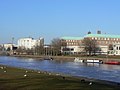
 County Hall WestBridgford Nottingham - geograph.org.uk - 1145558.jpg 640 × 480; 170 KB
-
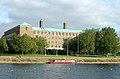
 County Hall, West Bridgford - geograph.org.uk - 985356.jpg 480 × 640; 91 KB
-
 County Hall, West Bridgford - geograph.org.uk - 985420.jpg 640 × 419; 102 KB
-
 County Seconds at Lady Bay - geograph.org.uk - 4509303.jpg 1,024 × 731; 667 KB
-
 Covers off - it's stopped - geograph.org.uk - 1601610.jpg 640 × 480; 58 KB
-
 Covert Road - geograph.org.uk - 1772592.jpg 1,280 × 959; 242 KB
-
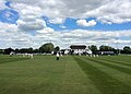
 Cricket at Lady Bay - geograph.org.uk - 3051888.jpg 1,024 × 735; 919 KB
-
 Crosby Road street sign, West Bridgford - geograph.org.uk - 1748605.jpg 640 × 427; 114 KB
-
 Crosby Road, West Bridgford - geograph.org.uk - 1748602.jpg 640 × 427; 95 KB
-
 Crosby Road, West Bridgford - geograph.org.uk - 1748638.jpg 640 × 427; 97 KB
-
 Crosby Road, West Bridgford - geograph.org.uk - 785055.jpg 640 × 427; 110 KB
-
 Davies Road, West Bridgford - geograph.org.uk - 1948632.jpg 640 × 480; 70 KB
-
 Devonshire Road - geograph.org.uk - 1367741.jpg 640 × 480; 110 KB
-
 Devonshire Road - geograph.org.uk - 1386308.jpg 640 × 480; 118 KB
-
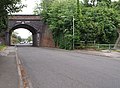
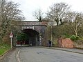 Devonshire Road railway bridge, West Bridgford - geograph.org.uk - 5291028.jpg 1,280 × 960; 478 KB
-
 Devonshire Road, West Bridgford - geograph.org.uk - 5291036.jpg 1,280 × 960; 352 KB
-

-
 Down off the Embankment (1) - geograph.org.uk - 1369365.jpg 480 × 640; 148 KB
-
 Down off the Embankment (2) - geograph.org.uk - 1369395.jpg 480 × 640; 135 KB
-
 Dunster Road - geograph.org.uk - 1772587.jpg 1,280 × 959; 275 KB
-
 East end of Wilford Lane, West Bridgford - geograph.org.uk - 3279747.jpg 1,024 × 768; 100 KB
-
 Eating out in West Bridgford - geograph.org.uk - 5078943.jpg 1,024 × 768; 1.08 MB
-
 Eccentric house on Wilford Lane, West Bridgford - geograph.org.uk - 3279750.jpg 1,024 × 768; 116 KB
-
 Edward Road - geograph.org.uk - 1476667.jpg 640 × 480; 101 KB
-
 Edward Road street sign, West Bridgford - geograph.org.uk - 1748681.jpg 640 × 480; 122 KB
-
 Edward Road, West Bridgford - geograph.org.uk - 1748646.jpg 640 × 427; 81 KB
-
 Edward Road, West Bridgford - geograph.org.uk - 1748655.jpg 640 × 427; 88 KB
-
 Edward Road, West Bridgford - geograph.org.uk - 1748677.jpg 640 × 427; 82 KB
-
 Edward Road, West Bridgford - geograph.org.uk - 785053.jpg 640 × 427; 93 KB
-
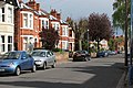
 Edwardian villas on Holme Road - geograph.org.uk - 785968.jpg 640 × 427; 88 KB
-
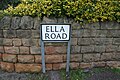 Ella Road street sign, West Bridgford - geograph.org.uk - 1748562.jpg 640 × 427; 118 KB
-
 Ella Road, West Bridgford - geograph.org.uk - 1748556.jpg 640 × 427; 83 KB
-
 Ella Road, West Bridgford - geograph.org.uk - 1748583.jpg 640 × 427; 85 KB
-
 Ella Road, West Bridgford - geograph.org.uk - 785062.jpg 640 × 427; 108 KB
-
 Emmanuel School - geograph.org.uk - 1243703.jpg 640 × 475; 93 KB
-
 Entrance to Bridgford Park - geograph.org.uk - 1748661.jpg 640 × 427; 95 KB
-
 Entrance to Bridgford Park - geograph.org.uk - 678011.jpg 640 × 427; 112 KB
-
 Epperstone Court, West Bridgford - geograph.org.uk - 1279256.jpg 640 × 427; 108 KB
-
 Epperstone Road. West Bridgford - geograph.org.uk - 1279240.jpg 640 × 427; 105 KB
-
 Evening sunshine in West Bridgford Park - geograph.org.uk - 3445829.jpg 1,200 × 1,200; 1.9 MB
-

-
 Florence Road, West Bridgford - geograph.org.uk - 1748527.jpg 640 × 427; 86 KB
-
 Former Midland Railway line, West Bridgford - geograph.org.uk - 5291031.jpg 1,280 × 960; 599 KB
-
 Former railway cutting, West Bridgford - geograph.org.uk - 3941751.jpg 1,024 × 768; 279 KB
-
 Gamston Bridge - geograph.org.uk - 1623168.jpg 640 × 479; 82 KB
-
 Glebe Road - geograph.org.uk - 1367753.jpg 640 × 480; 105 KB
-
 Gordon Road - geograph.org.uk - 1747274.jpg 1,280 × 959; 210 KB
-
 Grantham Canal - geograph.org.uk - 1407610.jpg 640 × 475; 91 KB
-
 Grantham Canal in West Bridgford - geograph.org.uk - 5603664.jpg 800 × 508; 138 KB
-
 Grantham Canal in West Bridgford - geograph.org.uk - 5603670.jpg 800 × 565; 210 KB
-

-
 Grantham Canal, Lady Bay - geograph.org.uk - 4440074.jpg 1,280 × 960; 483 KB
-
 Green Corridor - geograph.org.uk - 912546.jpg 640 × 480; 89 KB
-
 Green tiles - geograph.org.uk - 985293.jpg 640 × 458; 94 KB
-
 Greythorn Drive - geograph.org.uk - 985256.jpg 640 × 480; 89 KB
-
 Gurtrude Road, Lady Bay - geograph.org.uk - 785960.jpg 640 × 427; 82 KB
-
 Handy For The Train - geograph.org.uk - 1215922.jpg 640 × 480; 182 KB
-
 Helter-Skelter at the Riverside Festival 2016 - geograph.org.uk - 5065267.jpg 960 × 1,280; 453 KB
-
 Henry Road, West Bridgford - geograph.org.uk - 4782482.jpg 3,264 × 2,448; 3.64 MB
-
 Henry Road, West Bridgford - geograph.org.uk - 4782493.jpg 3,264 × 2,448; 4.57 MB
-
 Hill Farm Court - geograph.org.uk - 983156.jpg 640 × 480; 115 KB
-
 Hollycroft, West Bridgford - geograph.org.uk - 3941749.jpg 1,024 × 768; 204 KB
-
 Holme Road - geograph.org.uk - 1556745.jpg 640 × 427; 83 KB
-
 Hound Road - geograph.org.uk - 1407571.jpg 480 × 640; 126 KB
-
 House on Davies Road, West Bridgford - geograph.org.uk - 1948634.jpg 640 × 480; 72 KB
-

-
 Inland Boat Show - geograph.org.uk - 3155271.jpg 1,400 × 2,088; 812 KB
-
 Jewish Cemetery, Wilford Hill - geograph.org.uk - 985154.jpg 640 × 480; 95 KB
-
 Julian Road Lady Bay.jpg 2,304 × 1,728; 732 KB
-
 Julian Road, West Bridgford - geograph.org.uk - 912553.jpg 640 × 480; 95 KB
-
 Kingswood Road - geograph.org.uk - 985273.jpg 640 × 480; 101 KB
-
 Lady Bay Bridge, West Bridgford - geograph.org.uk - 785880.jpg 640 × 427; 90 KB
-
 Lady Bay Home Zone - geograph.org.uk - 1386357.jpg 640 × 479; 145 KB
-
 Lady Bay Road, Lady Bay - geograph.org.uk - 785941.jpg 640 × 427; 118 KB
-
 Lady Bay, after a downpour - geograph.org.uk - 3923912.jpg 1,200 × 896; 1.07 MB
-
 Lady Bay, chip shop and corner shop - geograph.org.uk - 3138385.jpg 1,024 × 681; 947 KB
-
 Lady Bay, evening light - geograph.org.uk - 3442948.jpg 1,200 × 1,200; 1.28 MB
-
 Lady Bay, evening sky - geograph.org.uk - 4001049.jpg 1,024 × 1,024; 984 KB
-
 Lady Bay, Holme Road - geograph.org.uk - 2389852.jpg 800 × 563; 521 KB
-
 Lady Bay, Holme Road - geograph.org.uk - 4906496.jpg 1,024 × 731; 924 KB
-

-
 Lansdowne Drive - geograph.org.uk - 985243.jpg 640 × 480; 97 KB
-
 Laughton Avenue - geograph.org.uk - 985259.jpg 640 × 450; 82 KB
-
 Light and shadow - geograph.org.uk - 3767559.jpg 1,110 × 1,280; 244 KB
-
 Local Shops - geograph.org.uk - 1506809.jpg 640 × 480; 76 KB
-
 Loughborough Road at Boundary Road - geograph.org.uk - 985211.jpg 640 × 480; 85 KB
-
 Lutterell Hall, Church Drive - geograph.org.uk - 5998397.jpg 1,024 × 683; 169 KB
-
 Lutterell Hall, Church Street, West Bridgford - geograph.org.uk - 5291061.jpg 1,280 × 960; 365 KB
-
 Lutterell Hall, Church Street, West Bridgford - geograph.org.uk - 5291063.jpg 960 × 1,280; 425 KB
-
 Lytham Drive - geograph.org.uk - 983106.jpg 640 × 480; 78 KB
-
 Mabel Grove street sign, West Bridgford - geograph.org.uk - 1748546.jpg 640 × 427; 101 KB
-
 Mabel Grove, West Bridgford - geograph.org.uk - 1748534.jpg 640 × 427; 105 KB
-
 Mabel Grove, West Bridgford - geograph.org.uk - 785059.jpg 640 × 480; 114 KB
-
 Malvern Road, West Bridgford - geograph.org.uk - 5291015.jpg 1,280 × 860; 293 KB
-
 Manvers Road - geograph.org.uk - 1414300.jpg 640 × 480; 446 KB
-

-
 Meadow Covert - geograph.org.uk - 983102.jpg 640 × 454; 94 KB
-
 Meadow Covert - geograph.org.uk - 983103.jpg 640 × 480; 88 KB
-
 Melbourne Road, Lady Bay - geograph.org.uk - 785936.jpg 640 × 427; 108 KB
-
 Mellors Road, West Bridgford - geograph.org.uk - 3941735.jpg 1,024 × 768; 140 KB
-
 Melton Road in the floods of March 1947 - geograph.org.uk - 1537395.jpg 467 × 640; 230 KB
-
 Melton Road near Edwalton - geograph.org.uk - 983158.jpg 640 × 479; 113 KB
-
 Melton Road, West Bridgford - geograph.org.uk - 3941739.jpg 1,024 × 768; 214 KB
-
 Memorial on Loughborough Road - geograph.org.uk - 985235.jpg 640 × 480; 94 KB
-
 Millicent Road - geograph.org.uk - 3061813.jpg 1,024 × 793; 1.16 MB
-
 Millicent Road, West Bridgford - geograph.org.uk - 1279294.jpg 640 × 427; 105 KB
-
 Modern housing, Wilford Lane, West Bridgford - geograph.org.uk - 4457896.jpg 1,024 × 768; 134 KB
-
 Mona Road, Lady bay - geograph.org.uk - 785945.jpg 640 × 427; 107 KB
-
 Musters Road - geograph.org.uk - 1403418.jpg 640 × 480; 117 KB
-
 Musters Road, West Bridgford - geograph.org.uk - 1267593.jpg 640 × 427; 88 KB
-
 Musters Road, West Bridgford - geograph.org.uk - 3320306.jpg 2,256 × 1,504; 1.03 MB
-
 Musters Road, West Bridgford - geograph.org.uk - 5291017.jpg 1,280 × 806; 245 KB
-
 Navdeep Court - geograph.org.uk - 1606141.jpg 640 × 480; 76 KB
-
 New and Old - the New - geograph.org.uk - 912491.jpg 640 × 480; 70 KB
-
 New and Old - the Old - geograph.org.uk - 912499.jpg 640 × 314; 60 KB
-
 New cemetery, Wilford - geograph.org.uk - 756424.jpg 640 × 480; 99 KB
-
 No. 6 bus - geograph.org.uk - 219849.jpg 640 × 480; 108 KB
-
 North end of Landmere Lane, West Bridgford - geograph.org.uk - 3279687.jpg 1,024 × 768; 140 KB
-
 North Road - geograph.org.uk - 985297.jpg 640 × 472; 138 KB
-
 Notice of intent - geograph.org.uk - 985109.jpg 480 × 640; 134 KB
-
 Nottingham - Ella Road - geograph.org.uk - 1215947.jpg 640 × 480; 187 KB
-
 Nottingham - Lady Bay Road - geograph.org.uk - 1215962.jpg 640 × 480; 181 KB
-
 Nottingham - NG2 (W. Bridgford) - geograph.org.uk - 2973531.jpg 800 × 600; 134 KB
-
 Nottingham - NG2 (W. Bridgford) - geograph.org.uk - 2973956.jpg 800 × 584; 124 KB
-
 Nottingham - NG2 (W. Bridgford) - geograph.org.uk - 2987062.jpg 3,603 × 2,493; 1.74 MB
-
 Nottingham - NG2 (W. Bridgford) - geograph.org.uk - 2987085.jpg 3,145 × 2,855; 1.74 MB
-
 Nottingham - NG2 (W. Bridgford) - geograph.org.uk - 2987110.jpg 3,958 × 2,809; 2.26 MB
-
 Nottingham - NG2 (W. Bridgford) - geograph.org.uk - 2987155.jpg 4,013 × 3,023; 2.28 MB
-
 Nottingham - NG2 (W. Bridgford) - geograph.org.uk - 2987214.jpg 3,973 × 2,316; 1.71 MB
-
 Nottingham - NG2 (W. Bridgford) - geograph.org.uk - 2987562.jpg 3,299 × 2,642; 1.84 MB
-
 Nottingham - NG2 (West Bridgford) - geograph.org.uk - 2987572.jpg 3,650 × 2,451; 2.11 MB
-
 Nottingham - NG2 (West Bridgford) - geograph.org.uk - 2987647.jpg 3,688 × 2,495; 1.63 MB
-
 Nottingham - NG2 (Wilford Area) - geograph.org.uk - 2985488.jpg 3,957 × 2,719; 1.97 MB
-
 Nottinghamshire World War One Centenary Memorial - geograph.org.uk - 6120267.jpg 1,024 × 732; 1.19 MB
-
 Old railway bed - geograph.org.uk - 983154.jpg 480 × 640; 196 KB
-
 Old Road on Wilford Hill - geograph.org.uk - 985064.jpg 480 × 640; 126 KB
-
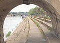
 Old Trent Bridge - geograph.org.uk - 5030963.jpg 1,024 × 637; 200 KB


.jpg)


_-_geograph.org.uk_-_1369365.jpg)
_-_geograph.org.uk_-_1369395.jpg)


_-_geograph.org.uk_-_2973531.jpg)
_-_geograph.org.uk_-_2973956.jpg)
_-_geograph.org.uk_-_2987062.jpg)
_-_geograph.org.uk_-_2987085.jpg)
_-_geograph.org.uk_-_2987110.jpg)
_-_geograph.org.uk_-_2987155.jpg)
_-_geograph.org.uk_-_2987214.jpg)
_-_geograph.org.uk_-_2987562.jpg)
_-_geograph.org.uk_-_2987572.jpg)
_-_geograph.org.uk_-_2987647.jpg)
_-_geograph.org.uk_-_2985488.jpg)


