Category:West Bergholt
Jump to navigation
Jump to search
English: West Bergholt, formerly known as Bergholt Sackville, is a large rural village and civil parish in Essex, England, lying on the border with Suffolk, near to the ancient town of Colchester. With a history going back to medieval times the village is now part of the Colchester Borough Council seat of West Bergholt and Eight Ash Green, and has its own concert band. In 2008 the village was winner of the Class 2 category, and 3rd placed overall, in the RCCE Best Kept Village in Essex competition.
village in United Kingdom  | |||||
| Upload media | |||||
| Instance of | |||||
|---|---|---|---|---|---|
| Location | Colchester, Essex, East of England, England | ||||
 | |||||
Subcategories
This category has the following 8 subcategories, out of 8 total.
C
- Cooks Hall, Essex (1 F)
I
- Iron Latch (5 F)
M
Q
- Queens Head, West Bergholt (1 F)
T
- The Treble Tile (1 F)
W
- West Bergholt Hall (3 F)
- White Hart, West Bergholt (4 F)
Media in category "West Bergholt"
The following 108 files are in this category, out of 108 total.
-
 A way from Fordham to West Bergholt - geograph.org.uk - 5018177.jpg 640 × 480; 106 KB
-
 A12 - geograph.org.uk - 3880966.jpg 640 × 341; 35 KB
-
 A12 Ipswich Road ^ The Braiswick Bridge - geograph.org.uk - 4115268.jpg 2,175 × 2,305; 581 KB
-
 A12 Ipswich Road, Braiswick - geograph.org.uk - 3644046.jpg 3,049 × 2,290; 896 KB
-
 A12 Ipswich Road, Braiswick - geograph.org.uk - 3644055.jpg 3,072 × 2,304; 1.22 MB
-
 A12 Ipswich Road, Braiswick - geograph.org.uk - 4115220.jpg 2,286 × 2,275; 642 KB
-
 A12 Ipswich Road, Braiswick - geograph.org.uk - 4963464.jpg 3,072 × 2,304; 1.75 MB
-
 A12 Ipswich Road, West Bergholt - geograph.org.uk - 4963460.jpg 3,072 × 2,304; 1.87 MB
-
 A12 overbridge carries B1508 - geograph.org.uk - 3546540.jpg 3,400 × 2,512; 1.03 MB
-
 A12 southbound - geograph.org.uk - 4222819.jpg 640 × 466; 46 KB
-
 A12 west of Lexden Wood Golf Course - geograph.org.uk - 3546521.jpg 3,648 × 2,736; 1.73 MB
-
 A12, Colchester Road Bridge - geograph.org.uk - 3259202.jpg 640 × 430; 40 KB
-
 Armoury Farm, East of West Bergholt - geograph.org.uk - 227454.jpg 640 × 426; 36 KB
-
 Armoury Road - geograph.org.uk - 6082392.jpg 678 × 1,024; 199 KB
-
 Austin truck (15164352784).jpg 1,638 × 1,921; 890 KB
-
 B1508 Colchester Road ^ A12 Bridge - geograph.org.uk - 4963427.jpg 3,072 × 2,304; 1.79 MB
-
 Bergholt Heath.jpg 1,408 × 1,056; 1.02 MB
-
 Bluebell View - geograph.org.uk - 1872137.jpg 428 × 640; 110 KB
-
 Bluebells in Hillhouse Wood, West Bergholt - geograph.org.uk - 6209374.jpg 1,600 × 1,200; 910 KB
-
 Bluebells ^ Wild Garlic - geograph.org.uk - 1872253.jpg 428 × 640; 97 KB
-
 Bourne Rd West Bergholt - geograph.org.uk - 6084346.jpg 678 × 1,024; 292 KB
-
 Bourne Road - geograph.org.uk - 5037098.jpg 640 × 480; 139 KB
-
 Bridge on the B1508 - geograph.org.uk - 1249927.jpg 640 × 428; 81 KB
-
 Coach House West Bergholt Hall - geograph.org.uk - 1872013.jpg 640 × 435; 102 KB
-
 Colchester Road (B1508) bridge over A12 - geograph.org.uk - 4083253.jpg 1,600 × 1,200; 1.16 MB
-
 Colchester Road bridge over A12 - geograph.org.uk - 5435174.jpg 1,600 × 1,198; 705 KB
-
 Colchester Road Bridge, A12 - geograph.org.uk - 2677851.jpg 640 × 368; 39 KB
-
 Colchester Road, West Bergholt - geograph.org.uk - 4791723.jpg 640 × 480; 100 KB
-
 Duck Pond by Lexden Rd - geograph.org.uk - 6084404.jpg 1,024 × 678; 254 KB
-
 Duck pond, West Bergholt - geograph.org.uk - 4791687.jpg 640 × 480; 174 KB
-
 Entering West Bergholt on Nayland Road - geograph.org.uk - 4963337.jpg 3,072 × 2,304; 1.83 MB
-
 Entering West Bergholt on the B1508 Colchester Road - geograph.org.uk - 4963409.jpg 3,072 × 2,304; 1.82 MB
-
 Farm Buildings near Cooks Hall - geograph.org.uk - 1872281.jpg 640 × 428; 69 KB
-
 Footpath Near Hillhouse Wood - geograph.org.uk - 1872294.jpg 428 × 640; 101 KB
-
 Footpath near West Bergholt Hall - geograph.org.uk - 1872027.jpg 428 × 640; 102 KB
-
 Footpath to Hillhouse Wood - geograph.org.uk - 1872043.jpg 428 × 640; 88 KB
-
 Footpath to Plummers Rd - geograph.org.uk - 208132.jpg 426 × 640; 138 KB
-
 Fosset Lane - geograph.org.uk - 6084434.jpg 1,024 × 306; 68 KB
-
 Fred Sims.jpg 1,408 × 1,056; 1.13 MB
-
 Grove Lodge on Colchester Road - geograph.org.uk - 6325895.jpg 4,608 × 3,072; 5.15 MB
-
 Hedgerow oak south of Hillhouse Wood - geograph.org.uk - 5018185.jpg 640 × 480; 134 KB
-
 Hillhouse Wood - geograph.org.uk - 1872060.jpg 428 × 640; 110 KB
-
 Hillhouse Wood - geograph.org.uk - 4451390.jpg 1,600 × 1,064; 780 KB
-
 Hillhouse Wood Scene - geograph.org.uk - 1872214.jpg 428 × 640; 138 KB
-
 Hillhouse Wood, with bluebells - geograph.org.uk - 4451889.jpg 1,064 × 1,600; 889 KB
-
 Ipswich Road Bridge, A12 - geograph.org.uk - 3880964.jpg 640 × 329; 38 KB
-
 Major Oak by the Essex Way - geograph.org.uk - 5386662.jpg 640 × 424; 78 KB
-
 Manor Rd to Manor House - geograph.org.uk - 6084320.jpg 678 × 1,024; 201 KB
-
 Moth ^ Wild Garlic - geograph.org.uk - 1872228.jpg 428 × 640; 52 KB
-
 Native Bluebells in Hillhouse Wood - geograph.org.uk - 1872108.jpg 428 × 640; 115 KB
-
 Nicely Maturing Hedge in Fosset Lane - geograph.org.uk - 6084426.jpg 1,024 × 678; 164 KB
-

-

-
 Orpen Memorial Hall, West Bergholt - geograph.org.uk - 4209858.jpg 4,320 × 3,240; 3.7 MB
-
 Pasture Near Coney Bayes Farm - geograph.org.uk - 6084422.jpg 1,024 × 678; 207 KB
-
 Path Across Bergholt Heath - geograph.org.uk - 6084327.jpg 1,024 × 678; 214 KB
-
 Peter's Dedication - geograph.org.uk - 1872189.jpg 640 × 256; 61 KB
-
 Play Area on the Memorial Way - geograph.org.uk - 6082397.jpg 1,024 × 678; 212 KB
-
 Pond and Peter's Seat - geograph.org.uk - 1872167.jpg 428 × 640; 144 KB
-
 Pond in Hillhouse Wood - geograph.org.uk - 5018189.jpg 640 × 480; 173 KB
-
 River Colne at New Bridge - geograph.org.uk - 4792927.jpg 640 × 480; 137 KB
-
 River Colne by Cook's Mill - geograph.org.uk - 5386652.jpg 640 × 424; 98 KB
-
 River Colne from "Newbridge" - geograph.org.uk - 69260.jpg 640 × 482; 105 KB
-
 River Colne upstream of New Bridge - geograph.org.uk - 4791675.jpg 640 × 480; 177 KB
-
 Ruined House Near Cooks Hall - geograph.org.uk - 5386645.jpg 640 × 424; 102 KB
-
 St Botolphs Brook - geograph.org.uk - 6084371.jpg 678 × 1,024; 261 KB
-
 Still Bourne Rd - geograph.org.uk - 6084351.jpg 678 × 1,024; 138 KB
-
 Stratford Martyers.JPG 4,320 × 3,240; 2.13 MB
-
 Stream ^ Wild Garlic - geograph.org.uk - 1872238.jpg 428 × 640; 132 KB
-
 Telecommunication Mast, Baker's Lane - geograph.org.uk - 2798468.jpg 480 × 640; 85 KB
-
 The approach to Newbridge Mill - geograph.org.uk - 793197.jpg 640 × 480; 81 KB
-
 The Bridge Over St Botolph's Brook - geograph.org.uk - 6084362.jpg 678 × 1,024; 269 KB
-
 The Essex Way 112 - oak tree - geograph.org.uk - 2308300.jpg 640 × 426; 85 KB
-
 The Essex Way 113 - ruined barn - geograph.org.uk - 2308303.jpg 640 × 426; 67 KB
-
 The Essex Way 114 - geograph.org.uk - 2308341.jpg 640 × 425; 38 KB
-
 The Essex Way 115 - geograph.org.uk - 2308345.jpg 640 × 426; 80 KB
-
 The Essex Way 116 - geograph.org.uk - 2308440.jpg 640 × 425; 72 KB
-
 The Essex Way 117 - Armoury Farm - geograph.org.uk - 2308530.jpg 640 × 426; 50 KB
-
 The Essex Way at Armoury Farm - geograph.org.uk - 6082371.jpg 1,024 × 678; 155 KB
-
 The Former Daniell's Brewery - geograph.org.uk - 6082386.jpg 678 × 1,024; 164 KB
-
 The Sun Shines on the Seven Arches - geograph.org.uk - 6084384.jpg 1,024 × 678; 156 KB
-
 Train on the Seven Arches - geograph.org.uk - 6084390.jpg 1,024 × 678; 134 KB
-
 Victorian Cottages on the B1508 - geograph.org.uk - 6084307.jpg 1,024 × 678; 141 KB
-
 View along hedgerow - geograph.org.uk - 736190.jpg 640 × 414; 117 KB
-
 View from Hillhouse Wood - geograph.org.uk - 6209375.jpg 1,024 × 939; 351 KB
-

-
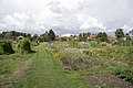 West Bergholt Allotments - geograph.org.uk - 227455.jpg 640 × 426; 51 KB
-
 West Bergholt Allotments - geograph.org.uk - 6084337.jpg 1,024 × 678; 151 KB
-
 West Bergholt Country Show 2011 (15598886908).jpg 967 × 1,445; 328 KB
-
 West Bergholt FC Clubhouse - geograph.org.uk - 1151857.jpg 640 × 480; 69 KB
-
 West Bergholt Village Name sign - geograph.org.uk - 4963369.jpg 2,291 × 3,046; 3.42 MB
-
 West Bergholt Village Name sign - geograph.org.uk - 4963418.jpg 2,935 × 2,199; 3.53 MB
-
 West Bergholt.jpg 1,280 × 960; 505 KB
-
 Wheat field boundary, near Highfield Farm, West Bergholt - geograph.org.uk - 4596930.jpg 3,648 × 2,432; 3.62 MB
-
 A view of Fordham Place - geograph.org.uk - 378091.jpg 640 × 414; 57 KB
-
 B1508 Towards the Grove - geograph.org.uk - 259885.jpg 640 × 480; 71 KB
-
 Bluebells in Hill House Wood - geograph.org.uk - 259894.jpg 640 × 480; 182 KB
-

-
 Duck Pond in West Bergholt - geograph.org.uk - 69255.jpg 640 × 482; 94 KB
-
 Duck Pond, centre of West Bergholt - geograph.org.uk - 227460.jpg 640 × 426; 60 KB
-
 Farmland looking towards Cooks Hall - geograph.org.uk - 259887.jpg 640 × 480; 98 KB
-
 Hill Ho Farm, East of West Bergholt - geograph.org.uk - 227451.jpg 640 × 426; 44 KB
-
 New bridge over the A12 - geograph.org.uk - 654195.jpg 640 × 427; 88 KB
-
 Orchard at Manor Farm - geograph.org.uk - 654192.jpg 640 × 427; 126 KB
-

-
 The Road to Fossetts Chancers - geograph.org.uk - 207604.jpg 640 × 426; 82 KB
-

-
 West Bergholt Village Sign - geograph.org.uk - 227449.jpg 426 × 640; 43 KB


.jpg)


_bridge_over_A12_-_geograph.org.uk_-_4083253.jpg)


_-_geograph.org.uk_-_4652744.jpg)


.jpg)


