Category:West Ardsley
Jump to navigation
Jump to search
settlement in West Yorkshire, England, UK  | |||||
| Upload media | |||||
| Instance of | |||||
|---|---|---|---|---|---|
| Location | Morley, Leeds, West Yorkshire, Yorkshire and the Humber, England | ||||
 | |||||
Subcategories
This category has the following 7 subcategories, out of 7 total.
A
- Ardsley Reservoir (43 F)
B
- Batley Road, West Ardsley (20 F)
H
- Hey Beck (5 F)
- Hey Beck Lane, West Ardsley (4 F)
W
- Westerton Road, West Ardsley (5 F)
Media in category "West Ardsley"
The following 44 files are in this category, out of 44 total.
-
 A splash of yellow by Hey Beck - geograph.org.uk - 2148672.jpg 1,024 × 768; 239 KB
-
 Baghill Road - Batley Road - geograph.org.uk - 3273192.jpg 640 × 480; 42 KB
-

-
 Bradford Road - geograph.org.uk - 1857148.jpg 1,600 × 1,200; 794 KB
-
 Bradford Road - geograph.org.uk - 1857174.jpg 1,600 × 1,200; 455 KB
-
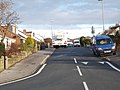
 Bus stop on Constable Road, West Ardsley - geograph.org.uk - 3032294.jpg 1,024 × 699; 123 KB
-

-

-
 Casson Avenue, Ardsley Common - geograph.org.uk - 2883467.jpg 1,024 × 768; 143 KB
-
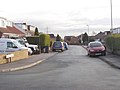
 Casson Drive - Common Lane - geograph.org.uk - 3204483.jpg 640 × 480; 70 KB
-
 Casson Grove - Casson Avenue - geograph.org.uk - 3204481.jpg 640 × 480; 84 KB
-
 Haigh Moor Avenue - Woollin Avenue - geograph.org.uk - 3272590.jpg 640 × 480; 52 KB
-

-
 Haigh Moor Crescent - Woollin Avenue - geograph.org.uk - 3272579.jpg 640 × 426; 46 KB
-
 Haigh Moor Road - geograph.org.uk - 990928.jpg 480 × 640; 50 KB
-
 Haigh Moor Road - geograph.org.uk - 990931.jpg 480 × 640; 72 KB
-

-

-
 Haigh Moor View - Haigh Moor Avenue - geograph.org.uk - 3272596.jpg 640 × 480; 58 KB
-
 Haigh Moor View - Woollin Avenue - geograph.org.uk - 3272599.jpg 640 × 480; 49 KB
-
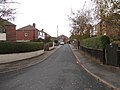
 Hey Beck Lane - geograph.org.uk - 1555294.jpg 640 × 480; 91 KB
-
 Hill Top Close - Hill Top Lane - geograph.org.uk - 3272821.jpg 640 × 480; 77 KB
-
 Hill Top Close - Hill Top Road - geograph.org.uk - 2520915.jpg 640 × 480; 55 KB
-
 Hill Top Court - Hill Top Lane - geograph.org.uk - 3272813.jpg 640 × 480; 68 KB
-
 Hill Top Gardens - Hill Top Lane - geograph.org.uk - 3272826.jpg 640 × 480; 58 KB
-
 Hill Top Green - Hill Top Lane - geograph.org.uk - 3272693.jpg 640 × 480; 57 KB
-
 Hill Top Grove - Hill Top Lane - geograph.org.uk - 3272817.jpg 640 × 480; 63 KB
-
 Hill Top Lane - Batley Road - geograph.org.uk - 3272689.jpg 640 × 480; 68 KB
-

-
 Hill Top View - Hill Top Lane - geograph.org.uk - 3272809.jpg 640 × 457; 58 KB
-
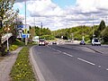
 M1 - viewed from Batley Road - geograph.org.uk - 3634895.jpg 640 × 480; 65 KB
-
 Nursery, Thorpe Lane, West Ardsley - geograph.org.uk - 1756672.jpg 640 × 434; 140 KB
-
 Old cottages and sheep - Nook Farm - geograph.org.uk - 5816445.jpg 4,890 × 3,708; 4.72 MB
-

-
 Post Office, Westerton Road, West Ardsley - geograph.org.uk - 2135348.jpg 1,498 × 2,000; 563 KB
-
 Redhill Avenue - Batley Road - geograph.org.uk - 3272572.jpg 640 × 480; 65 KB
-

-
 Redhill Close - Redhill Avenue - geograph.org.uk - 3272462.jpg 640 × 480; 64 KB
-

-
 Redhill Crescent - Redhill Drive - geograph.org.uk - 3272452.jpg 640 × 480; 62 KB
-
 Redhill Drive - Redhill Avenue - geograph.org.uk - 3272460.jpg 640 × 480; 53 KB
-
 Reservoir House - geograph.org.uk - 839209.jpg 565 × 428; 56 KB
-
 View of Red Lodge Farm from the west - geograph.org.uk - 5816396.jpg 5,067 × 3,801; 4.18 MB
-
 Woodkirk Mill Farm, West Ardsley - geograph.org.uk - 1747018.jpg 640 × 476; 117 KB


