Category:Wenhaston with Mells Hamlet
Jump to navigation
Jump to search
English: Wenhaston with Mells Hamlet is a civil parish in the English county of Suffolk. It forms part of Suffolk Coastal district.
civil parish in Suffolk, United Kingdom | |||||
| Upload media | |||||
| Instance of | |||||
|---|---|---|---|---|---|
| Location |
| ||||
| Has part(s) | |||||
| Population |
| ||||
 | |||||
Subcategories
This category has the following 4 subcategories, out of 4 total.
Media in category "Wenhaston with Mells Hamlet"
The following 200 files are in this category, out of 230 total.
(previous page) (next page)-
 A144 Bramfield Road - geograph.org.uk - 2396235.jpg 3,072 × 2,304; 1.29 MB
-
 A144 Bramfield Road - geograph.org.uk - 2396321.jpg 3,072 × 2,304; 1.65 MB
-
 A144 Bramfield Road - geograph.org.uk - 2396327.jpg 3,072 × 2,304; 1.23 MB
-
 A144 Bramfield Road - geograph.org.uk - 3063980.jpg 3,072 × 2,304; 1.18 MB
-
 A144 Bramfield Road Level Crossing - geograph.org.uk - 3198620.jpg 2,914 × 2,078; 1.02 MB
-
 A144 Bramfield Road ^ footpath to Mell Road - geograph.org.uk - 2396287.jpg 3,072 × 2,304; 1.47 MB
-
 A144 Bramfield Road, Halesworth - geograph.org.uk - 3200398.jpg 3,072 × 2,304; 1.24 MB
-
 A144 Bramfield Road, Halesworth - geograph.org.uk - 3200399.jpg 3,072 × 2,304; 1.48 MB
-
 A144 Bramfield Road, Mells - geograph.org.uk - 3437905.jpg 2,803 × 2,106; 1.08 MB
-
 A144 Bramfield Road, Mells - geograph.org.uk - 3437910.jpg 3,072 × 2,304; 1.56 MB
-
 A144 Bramfield Road, Mells - geograph.org.uk - 5794177.jpg 4,000 × 2,550; 3.17 MB
-
 A144 Bramfield Road, Mells - geograph.org.uk - 5795301.jpg 4,608 × 3,072; 1.82 MB
-
 A144 Bramfield Road, Mells - geograph.org.uk - 5795311.jpg 4,608 × 3,072; 1.87 MB
-
 A144 Halesworth Road - geograph.org.uk - 3063861.jpg 3,072 × 2,304; 1.27 MB
-
 A144 Halesworth Road - geograph.org.uk - 3063876.jpg 3,072 × 2,304; 1.44 MB
-
 A144 Halesworth Road - geograph.org.uk - 3063895.jpg 3,072 × 2,304; 1.33 MB
-
 Back Lane, Wenhaston - geograph.org.uk - 3087386.jpg 3,072 × 2,304; 1.29 MB
-
 Bartholomew's Lane - geograph.org.uk - 3085043.jpg 3,072 × 2,304; 1.47 MB
-
 Bartholomew's Lane - geograph.org.uk - 3085713.jpg 3,072 × 2,304; 1.5 MB
-
 Bartholomew's Lane - geograph.org.uk - 3087279.jpg 3,072 × 2,304; 1.32 MB
-
 Bartholomew's Lane - geograph.org.uk - 3087293.jpg 3,072 × 2,304; 1.27 MB
-
 Bartholomew's Lane junction - geograph.org.uk - 3084920.jpg 3,072 × 2,304; 1.44 MB
-
 Bartholomew's Lane junction - geograph.org.uk - 3084935.jpg 3,072 × 2,304; 1.35 MB
-
 Bartholomew's Lane junction - geograph.org.uk - 3084950.jpg 3,072 × 2,304; 1.4 MB
-
 Bartholomew's Lane junction - geograph.org.uk - 3085375.jpg 3,068 × 2,126; 1.4 MB
-
 Bartholomew's Lane junction - geograph.org.uk - 3085379.jpg 3,072 × 2,304; 1.63 MB
-
 Blackheath Road - geograph.org.uk - 3087345.jpg 3,072 × 2,304; 1.25 MB
-
 Blackheath Road ^ Star Corner Postbox - geograph.org.uk - 2029458.jpg 3,072 × 2,304; 1.44 MB
-
 Blackheath Road ^ Star Corner Postbox - geograph.org.uk - 2575434.jpg 3,072 × 2,304; 1.5 MB
-
 Blower's Common - geograph.org.uk - 3084020.jpg 640 × 478; 187 KB
-
 Blower's Common - geograph.org.uk - 3084047.jpg 640 × 478; 193 KB
-
 Blue Green And Tree - geograph.org.uk - 4384301.jpg 768 × 1,024; 314 KB
-
 Blyford Lane ^ The Station Postbox - geograph.org.uk - 2575474.jpg 3,072 × 2,304; 1.65 MB
-
 Blyford Lane ^ The Station Postbox - geograph.org.uk - 2575596.jpg 3,072 × 2,304; 1.67 MB
-
 Bramfield Level Crossing Control Box - geograph.org.uk - 3198629.jpg 2,304 × 3,072; 1.23 MB
-
 Bramfield Road (A144) - geograph.org.uk - 4786513.jpg 640 × 444; 66 KB
-
 Bramfield Road - geograph.org.uk - 3087307.jpg 3,072 × 2,304; 1.32 MB
-
 Bramfield Road sign - geograph.org.uk - 3087394.jpg 3,072 × 2,304; 1.55 MB
-
 Bramfield Road, Wenhaston - geograph.org.uk - 3087391.jpg 3,072 × 2,304; 1.34 MB
-
 Brook Farm - geograph.org.uk - 6419434.jpg 800 × 533; 121 KB
-
 Brook Hall Farms sign - geograph.org.uk - 3486173.jpg 2,304 × 3,072; 1.52 MB
-
 Brook Hall Farms sign - geograph.org.uk - 5795309.jpg 2,667 × 4,000; 5.19 MB
-
 Brook Hall Farms sign - geograph.org.uk - 5796124.jpg 2,565 × 3,861; 4.51 MB
-
 Bulls Corner Victorian Postbox - geograph.org.uk - 5795315.jpg 3,774 × 2,513; 5.2 MB
-
 Bulls Corner Victorian Postbox - geograph.org.uk - 5795316.jpg 4,608 × 3,072; 1.76 MB
-
 Chapel Lane, Wenhaston - geograph.org.uk - 3088518.jpg 2,304 × 3,072; 1.13 MB
-
 Chapel Lane, Wenhaston - geograph.org.uk - 3088568.jpg 2,304 × 3,072; 868 KB
-
 Coles Hill sign - geograph.org.uk - 3088493.jpg 3,072 × 2,304; 1.47 MB
-
 Coles Hill, Wenhaston - geograph.org.uk - 3088494.jpg 3,072 × 2,304; 1.33 MB
-
 Coles Hill, Wenhaston - geograph.org.uk - 3088498.jpg 3,072 × 2,304; 1.37 MB
-
 Coles Hill, Wenhaston - geograph.org.uk - 3088500.jpg 3,072 × 2,304; 1.46 MB
-
 Coles Hill, Wenhaston - geograph.org.uk - 3088503.jpg 3,072 × 2,304; 1.37 MB
-
 Coles Hill, Wenhaston - geograph.org.uk - 3088516.jpg 2,304 × 3,072; 1.15 MB
-
 Drainage Ditch - geograph.org.uk - 4385698.jpg 768 × 1,024; 282 KB
-
 Entrance of Brook Hall Farms - geograph.org.uk - 5795307.jpg 4,608 × 3,072; 1.86 MB
-
 Entrance to Brook Hall Farms - geograph.org.uk - 3486166.jpg 3,072 × 2,304; 1.7 MB
-
 Entrance to Brook Hall Farms - geograph.org.uk - 3486170.jpg 2,304 × 3,072; 1.43 MB
-
 Entrance to Brook Hall Farms - geograph.org.uk - 5796120.jpg 4,608 × 3,072; 1.94 MB
-
 Entrance to Nine Acres - geograph.org.uk - 3087129.jpg 3,072 × 2,304; 1.37 MB
-
 Entrance to Orsborn Cottages - geograph.org.uk - 5794403.jpg 4,608 × 3,072; 2.01 MB
-
 Field for silage near Wenhaston Grange - geograph.org.uk - 3795234.jpg 3,872 × 2,592; 4.38 MB
-
 Field near Home Covert - geograph.org.uk - 3795262.jpg 3,872 × 2,592; 4.97 MB
-
 Fields in front of Railway Wood - geograph.org.uk - 3795337.jpg 3,872 × 2,592; 4.39 MB
-
 Footpath - geograph.org.uk - 4384270.jpg 1,024 × 768; 339 KB
-
 Footpath - geograph.org.uk - 4384282.jpg 1,024 × 768; 296 KB
-
 Footpath along the edge of a field - geograph.org.uk - 2197412.jpg 700 × 525; 224 KB
-
 Footpath Crossing to the A144 Bramfield Road - geograph.org.uk - 3437886.jpg 2,304 × 3,072; 1.5 MB
-
 Footpath from Low Farm to Bulcamp - geograph.org.uk - 3083966.jpg 478 × 640; 197 KB
-
 Footpath from Low Farm to Laurel Farm - geograph.org.uk - 3049336.jpg 640 × 478; 190 KB
-

-
 Footpath Junction - geograph.org.uk - 4384302.jpg 1,024 × 768; 365 KB
-
 Footpath to Bramfield Road - geograph.org.uk - 3085003.jpg 3,072 × 2,304; 1.58 MB
-
 Footpath to Bramfield Road - geograph.org.uk - 3087281.jpg 3,072 × 2,304; 1.5 MB
-
 Footpath to Heath Road - geograph.org.uk - 3085030.jpg 3,072 × 2,304; 1.6 MB
-
 Footpath to Low Road - geograph.org.uk - 3087300.jpg 3,072 × 2,304; 1.26 MB
-
 Footpath to Low Road - geograph.org.uk - 3087335.jpg 3,072 × 2,304; 1.22 MB
-
 Footpath to Mells - geograph.org.uk - 3085386.jpg 2,304 × 3,072; 1.3 MB
-
 Footpath to Mells - geograph.org.uk - 3085778.jpg 2,304 × 3,072; 1.32 MB
-
 Footpath to Mells Road - geograph.org.uk - 2396290.jpg 2,304 × 3,072; 1.64 MB
-
 Footpath to Mells Road - geograph.org.uk - 2396294.jpg 2,304 × 3,072; 1.68 MB
-
 Footpath to Mells Road - geograph.org.uk - 2396325.jpg 2,304 × 3,072; 1.6 MB
-
 Footpath to St.Michael's Way - geograph.org.uk - 3088556.jpg 2,304 × 3,072; 1.4 MB
-
 Footpath to the A144 Bramfield Road - geograph.org.uk - 3437895.jpg 2,304 × 3,072; 1.68 MB
-
 Footpath to the A144 Bramfield Road - geograph.org.uk - 3437995.jpg 3,072 × 2,304; 2.5 MB
-
 Footpath to the A144 Bramfield Road - geograph.org.uk - 3438004.jpg 3,072 × 2,304; 1.37 MB
-
 Footpath to the A144 Bramfield Road ^ Saxons Way - geograph.org.uk - 3437993.jpg 3,072 × 2,304; 1.31 MB
-
 Footpath to the A144 Halesworth Road - geograph.org.uk - 3085013.jpg 3,072 × 2,304; 1.64 MB
-
 Footpath to Wash Lane, Mells - geograph.org.uk - 2396224.jpg 3,072 × 2,304; 1.33 MB
-
 Footpath to Wenhaston Crossing - geograph.org.uk - 3436495.jpg 3,072 × 2,304; 1.67 MB
-
 Footpath to Wenhaston Crossing - geograph.org.uk - 3436498.jpg 2,304 × 3,072; 1.63 MB
-
 Footpath to Wenhaston Crossing - geograph.org.uk - 3437852.jpg 2,872 × 2,158; 1.56 MB
-
 Footpath to Wenhaston Crossing - geograph.org.uk - 3437869.jpg 3,072 × 2,304; 1.52 MB
-
 Footpath to Wenhaston Crossing - geograph.org.uk - 3438025.jpg 1,200 × 1,600; 764 KB
-
 Footpath to Wenhaston Crossing ^ New Plantation - geograph.org.uk - 3437879.jpg 3,072 × 2,304; 1.33 MB
-

-
 Former entrance to Halesworth Golf Course - geograph.org.uk - 3437915.jpg 3,072 × 2,304; 1.36 MB
-
 Gate House at Bramfield Level Crossing - geograph.org.uk - 3200409.jpg 3,072 × 2,304; 1.36 MB
-
 Grange Road, Halesworth - geograph.org.uk - 5794401.jpg 4,608 × 3,072; 1.95 MB
-
 Grange Road, Halesworth - geograph.org.uk - 5795306.jpg 4,608 × 3,072; 1.8 MB
-
 Grange Road, Halesworth - geograph.org.uk - 5796099.jpg 4,608 × 3,072; 1.9 MB
-
 Grange Road, Halesworth - geograph.org.uk - 5796100.jpg 4,608 × 3,072; 1.9 MB
-
 Grange Road, Halesworth - geograph.org.uk - 5796108.jpg 4,608 × 3,072; 1.83 MB
-
 Grange Road, Halesworth - geograph.org.uk - 5796114.jpg 4,608 × 3,072; 1.99 MB
-
 Grange Road, Mells - geograph.org.uk - 5794327.jpg 4,608 × 3,072; 1.79 MB
-
 Grange Road, Mells - geograph.org.uk - 5794363.jpg 4,608 × 3,072; 1.84 MB
-
 Grange Road, Mells - geograph.org.uk - 5794374.jpg 4,608 × 3,072; 1.82 MB
-
 Green Footpath - geograph.org.uk - 4384289.jpg 768 × 1,024; 315 KB
-
 Halesworth from Osborne Cottages - geograph.org.uk - 3795218.jpg 3,872 × 2,592; 6.82 MB
-
 Halesworth Golf Club - geograph.org.uk - 4736699.jpg 640 × 425; 51 KB
-
 Halesworth Golf Club, clubhouse - geograph.org.uk - 2237243.jpg 640 × 480; 148 KB
-
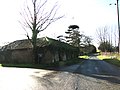
 Halesworth Golf Clubhouse - geograph.org.uk - 3063934.jpg 3,072 × 2,304; 1.38 MB
-
 Halesworth Golf Clubhouse - geograph.org.uk - 3063973.jpg 3,072 × 2,304; 1.4 MB
-
 Halesworth Golf Course - geograph.org.uk - 3438006.jpg 3,072 × 2,304; 1.34 MB
-
 Halesworth Golf Course sign - geograph.org.uk - 3437918.jpg 3,011 × 2,262; 1.48 MB
-
 Halesworth Golf Sign - geograph.org.uk - 3063885.jpg 3,072 × 2,304; 1.51 MB
-
 Halesworth Golf Sign - geograph.org.uk - 3064849.jpg 3,072 × 2,304; 1.47 MB
-
 Hall Road, Wenhaston - geograph.org.uk - 3088558.jpg 3,072 × 2,304; 1.3 MB
-
 Hall Road, Wenhaston - geograph.org.uk - 3088560.jpg 3,072 × 2,304; 1.27 MB
-
 Hazels Lane - geograph.org.uk - 2029419.jpg 3,072 × 2,304; 1.38 MB
-
 Heath Road - geograph.org.uk - 3085706.jpg 3,072 × 2,304; 1.35 MB
-
 Heath Road - geograph.org.uk - 3085723.jpg 3,072 × 2,304; 1.58 MB
-
 Heath Road - geograph.org.uk - 3085727.jpg 3,072 × 2,304; 1.63 MB
-
 Heath Road sign - geograph.org.uk - 3087374.jpg 3,072 × 2,304; 1.65 MB
-
 Heath Road to Mells - geograph.org.uk - 3085387.jpg 3,072 × 2,304; 1.26 MB
-
 Heath Road, Mells - geograph.org.uk - 3085391.jpg 3,072 × 2,304; 1.48 MB
-
 Heath Road, Mells - geograph.org.uk - 3087202.jpg 3,072 × 2,304; 1.37 MB
-
 Heath Road, Mells - geograph.org.uk - 3087215.jpg 3,072 × 2,304; 1.27 MB
-
 Heath Road, Mells - geograph.org.uk - 3087261.jpg 2,304 × 3,072; 1.43 MB
-
 Heath Road, Wenhaston - geograph.org.uk - 3087362.jpg 3,072 × 2,304; 1.49 MB
-
 Heath Road, Wenhaston - geograph.org.uk - 3087382.jpg 3,072 × 2,304; 1.5 MB
-

-
 Holton Road, Mells - geograph.org.uk - 3085397.jpg 3,072 × 2,304; 1.34 MB
-
 Home Covert - geograph.org.uk - 3795274.jpg 3,872 × 2,592; 4.78 MB
-
 In memory of William Herbert Dundonald Wilson - geograph.org.uk - 5046059.jpg 2,467 × 3,138; 2.6 MB
-
 Lane by Osborne Cottages - geograph.org.uk - 3795366.jpg 3,872 × 2,592; 4.31 MB
-

-

-
 Looking South East - geograph.org.uk - 4385631.jpg 1,024 × 768; 262 KB
-
 Looking towards Wenhaston Crossing - geograph.org.uk - 3437937.jpg 3,072 × 2,304; 1.28 MB
-
 Low Farm - geograph.org.uk - 3083988.jpg 1,024 × 765; 261 KB
-
 Low Farm - geograph.org.uk - 4385577.jpg 1,024 × 768; 186 KB
-
 Melles Court Farm Sun Club sign - geograph.org.uk - 3085400.jpg 3,072 × 2,304; 1.35 MB
-
 Mells Court Farm Sunclub - geograph.org.uk - 2231119.jpg 640 × 480; 158 KB
-
 Mells Hill Equestrian Centre sign - geograph.org.uk - 3087224.jpg 2,304 × 3,072; 1.45 MB
-
 Mells, New tree plantation at Brick Kiln Farm - geograph.org.uk - 6070021.jpg 5,766 × 3,843; 7.19 MB
-
 Minor Road - geograph.org.uk - 4384265.jpg 1,024 × 768; 286 KB
-
 Old barn at Wenhaston Grange - geograph.org.uk - 2237212.jpg 640 × 480; 160 KB
-
 Old Chapel Bridge, Mells - geograph.org.uk - 3088565.jpg 3,072 × 2,304; 1.47 MB
-
 Old farm buildings at Old Hall Farm - geograph.org.uk - 2197419.jpg 700 × 525; 135 KB
-
 Old Farmers Bridge - geograph.org.uk - 4385648.jpg 1,024 × 768; 258 KB
-
 Old Water Tanks - geograph.org.uk - 4384286.jpg 1,024 × 768; 271 KB
-

-
 Path - geograph.org.uk - 4384299.jpg 768 × 1,024; 449 KB
-
 Path from Church Lane to Bramfield Road - geograph.org.uk - 3085083.jpg 2,592 × 1,936; 2.94 MB
-
 PJN Motor Engineering sign - geograph.org.uk - 3087369.jpg 2,304 × 3,072; 1.46 MB
-
 Pond near Brook Hall Farm - geograph.org.uk - 3795333.jpg 3,872 × 2,592; 3.24 MB
-
 Post Office The Street Postbox - geograph.org.uk - 2575450.jpg 3,072 × 2,304; 1.5 MB
-
 Post Office The Street Postbox - geograph.org.uk - 2575452.jpg 2,304 × 3,072; 1.51 MB
-
 Railway Arches - geograph.org.uk - 2857420.jpg 2,304 × 3,072; 1.51 MB
-
 Railway Bridge - geograph.org.uk - 4384255.jpg 1,024 × 768; 300 KB
-
 Railway Lines - geograph.org.uk - 3437855.jpg 3,072 × 2,304; 1.39 MB
-
 Railway Lines - geograph.org.uk - 3437857.jpg 3,072 × 2,304; 1.45 MB
-
 Railway sign - geograph.org.uk - 3437894.jpg 2,304 × 3,072; 1.49 MB
-
 Railway Viaduct - geograph.org.uk - 3437930.jpg 3,072 × 2,304; 1.4 MB
-
 River Blyth at Mells Bridge - geograph.org.uk - 3200354.jpg 3,072 × 2,304; 1.67 MB
-
 River Blyth at Mells Bridge - geograph.org.uk - 3200362.jpg 3,072 × 2,304; 1.65 MB
-
 River Blyth at Mells Bridge - geograph.org.uk - 3202193.jpg 2,304 × 3,072; 1.67 MB
-
 River Blyth at Mells Bridge - geograph.org.uk - 3202197.jpg 2,304 × 3,072; 1.69 MB
-
 Road Junction - geograph.org.uk - 4384261.jpg 1,024 × 768; 317 KB
-
 Road Junction - geograph.org.uk - 4754174.jpg 1,024 × 768; 135 KB
-
 Road to Walpole Lane - geograph.org.uk - 1472670.jpg 3,072 × 2,304; 1.45 MB
-
 Roadsign on Blackheath Road - geograph.org.uk - 3087309.jpg 2,152 × 2,869; 1.65 MB
-
 Roadsign on Blyford Road - geograph.org.uk - 2575504.jpg 2,304 × 3,072; 1.36 MB
-
 Roadsign on Bramfield Road - geograph.org.uk - 3084942.jpg 2,304 × 3,072; 1.63 MB
-
 Roadsign on Grange Road - geograph.org.uk - 5794310.jpg 2,618 × 3,941; 3.44 MB
-
 Roadsign on Grange Road - geograph.org.uk - 5794332.jpg 2,604 × 3,921; 3.97 MB
-
 Roadsign on Grange Road - geograph.org.uk - 5796167.jpg 2,592 × 3,901; 4.69 MB
-
 Roadsign on Heath Road - geograph.org.uk - 3085393.jpg 2,304 × 3,072; 1.64 MB
-
 Roadsigns on Grange Road - geograph.org.uk - 5795302.jpg 2,651 × 3,990; 3.42 MB
-
 Rough field near Home Covert - geograph.org.uk - 3795251.jpg 3,872 × 2,592; 4.23 MB
-
 Route Of The Southwold Railway - geograph.org.uk - 4385569.jpg 768 × 1,024; 382 KB
-
 Silte of the footpath to Wenhaston Crossing - geograph.org.uk - 3437863.jpg 2,304 × 3,072; 1.37 MB
-
 Snowy flood plain - geograph.org.uk - 2802728.jpg 2,848 × 2,136; 1.47 MB
-
 Star Corner Postbox - geograph.org.uk - 2029464.jpg 2,304 × 3,072; 1.61 MB
-
 Star Corner Postbox - geograph.org.uk - 2575427.jpg 2,304 × 3,072; 1.61 MB
-
 Star Corner Postbox - geograph.org.uk - 2575429.jpg 2,304 × 3,072; 1.5 MB
-
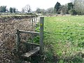 Stile - geograph.org.uk - 4385655.jpg 1,024 × 768; 341 KB
-
 Stile of the footpath to Wenhaston Crossing - geograph.org.uk - 3436497.jpg 2,304 × 3,072; 1.65 MB
-
 Stile ^ footpath sign of the footpath to Mells Road - geograph.org.uk - 2396316.jpg 3,072 × 2,304; 1.63 MB
-
 Swan Lane footpath - geograph.org.uk - 3085688.jpg 3,072 × 2,304; 1.69 MB
-
 Swan Lane footpath to the A144 Saxons Way - geograph.org.uk - 3085681.jpg 3,072 × 2,304; 1.6 MB
-
 Swan Lane footpath to the A144 Saxons Way - geograph.org.uk - 3085683.jpg 3,072 × 2,304; 1.46 MB
-
 Swan Lane footpath to the A144 Saxons Way - geograph.org.uk - 3085690.jpg 2,304 × 3,072; 1.44 MB
-
 Telephone box, Wenhaston, Suffolk - geograph.org.uk - 2900382.jpg 1,600 × 1,071; 368 KB
-
 The entrance of Halesworth Golf - geograph.org.uk - 3063961.jpg 3,072 × 2,304; 1.26 MB
-
 The entrance of Halesworth Golf - geograph.org.uk - 3063967.jpg 3,072 × 2,304; 1.35 MB
-
 The entrance to Mells Hill Farm - geograph.org.uk - 3087220.jpg 3,072 × 2,304; 1.51 MB
-
 The entrance to Wenhaston Quarry - geograph.org.uk - 3087265.jpg 3,072 × 2,304; 1.38 MB
-
 The Leaning Pole Of Wenhaston - geograph.org.uk - 4384294.jpg 768 × 1,024; 151 KB
-
 The Southwold Railway Trackbed - geograph.org.uk - 1885722.jpg 800 × 531; 148 KB


_-_geograph.org.uk_-_4786513.jpg)


