Category:Welton Dale, East Riding of Yorkshire
Jump to navigation
Jump to search
Subcategories
This category has the following 2 subcategories, out of 2 total.
R
- Raikes Mausoleum (6 F)
Media in category "Welton Dale, East Riding of Yorkshire"
The following 40 files are in this category, out of 40 total.
-
 Baah...you don't scare me! (geograph 4407029).jpg 640 × 427; 44 KB
-
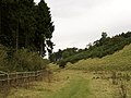
 Bridleway at Welton Top (geograph 4880380).jpg 4,608 × 3,456; 3.7 MB
-
 Dale Cottage - geograph.org.uk - 578789.jpg 640 × 480; 151 KB
-
 Dale Plantation Woodland - geograph.org.uk - 713873.jpg 480 × 640; 164 KB
-
 Entering the Woods - geograph.org.uk - 578802.jpg 640 × 480; 126 KB
-
 Gate in Upper Welton Dale - geograph.org.uk - 788668.jpg 640 × 480; 166 KB
-
 Gorse Bushes in Welton Dale - geograph.org.uk - 788662.jpg 640 × 480; 102 KB
-
 Gorse in Welton Dale (geograph 4942131).jpg 640 × 427; 63 KB
-
 In the woods at Welton. - geograph.org.uk - 329091.jpg 640 × 480; 136 KB
-
 Looking down Upper Welton Dale - geograph.org.uk - 788669.jpg 480 × 640; 155 KB
-
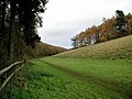
 Lower Welton Dale - geograph.org.uk - 565138.jpg 640 × 480; 86 KB
-
 Mini Snowman, Welton Dale (geograph 5700032).jpg 1,600 × 1,064; 393 KB
-
 The footpath in Upper Welton Dale - geograph.org.uk - 1380915.jpg 480 × 640; 162 KB
-
 The path through Dale Plantation - geograph.org.uk - 565123.jpg 640 × 480; 155 KB
-
 The road up Welton Dale - geograph.org.uk - 788658.jpg 480 × 640; 160 KB
-
 The track from Welton Dale to Welton - geograph.org.uk - 565144.jpg 640 × 480; 163 KB
-
 The Yorkshire Wolds Way - geograph.org.uk - 578738.jpg 640 × 480; 128 KB
-
 The Yorkshire Wolds Way through Welton Dale (geograph 6493744).jpg 1,799 × 1,199; 345 KB
-
 Tree Trimming in Welton Dale - geograph.org.uk - 788665.jpg 640 × 480; 122 KB
-
 Tree Trimming in Welton Dale - geograph.org.uk - 788666.jpg 480 × 640; 129 KB
-
 Upper Weltondale - geograph.org.uk - 11257.jpg 640 × 480; 122 KB
-
 Walkers in Welton Dale - geograph.org.uk - 565131.jpg 640 × 480; 116 KB
-
 Walkers in Welton Dale - geograph.org.uk - 565135.jpg 640 × 480; 100 KB
-
 Welton Dale (geograph 3553274).jpg 640 × 371; 41 KB
-
 Welton Dale (geograph 5952239).jpg 1,024 × 768; 305 KB
-
 Welton Dale - geograph.org.uk - 1380018.jpg 530 × 640; 143 KB
-
 Welton Dale - geograph.org.uk - 213192.jpg 640 × 480; 100 KB
-
 Welton Dale - geograph.org.uk - 283505.jpg 640 × 480; 155 KB
-
 Welton Dale - geograph.org.uk - 283511.jpg 640 × 480; 97 KB
-
 Welton Dale 1908 (archive ref PO-1-148-13) (25603340550).jpg 749 × 442; 58 KB
-
 Welton Dale Estate, Welton (geograph 5700029).jpg 1,600 × 1,064; 809 KB
-
 Welton Dale from above - geograph.org.uk - 667996.jpg 480 × 640; 163 KB
-
 Welton Dale Pond - geograph.org.uk - 788661.jpg 640 × 480; 178 KB
-
 Welton Spring (geograph 4942135).jpg 640 × 427; 130 KB
-
 Welton Wold Plantation, Welton Dale (geograph 4102637).jpg 1,600 × 1,064; 951 KB
-

-
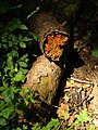 Woodland Logs - geograph.org.uk - 1380023.jpg 480 × 640; 137 KB
-
 Woodland Path at the Head of Welton Dale - geograph.org.uk - 788673.jpg 480 × 640; 196 KB
-
 Woodland Path to Welton Dale - geograph.org.uk - 565118.jpg 480 × 640; 151 KB
-
 Yorkshire Wolds Way in Dale Plantation (geograph 5254255).jpg 1,200 × 799; 514 KB
.jpg)
.jpg)


.jpg)


.jpg)


.jpg)


.jpg)
.jpg)


_(25603340550).jpg)
.jpg)


.jpg)
.jpg)
.jpg)


.jpg)