Category:Welney
Jump to navigation
Jump to search
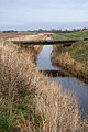
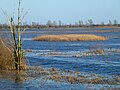
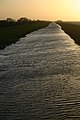
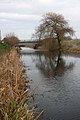
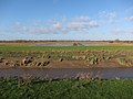
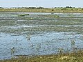
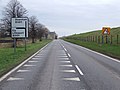
English: Welney is a village and civil parish in the the Fens of England, and the county of Norfolk. The village is situated immediately to the west of parallel Old Bedford River, River Delph and New Bedford River, which are here crossed by the A1101 road. The village is some to the south.
Magyar: Welney angliai falu Norfolk megyében az Old Bedford a Delph és a New Bedford folyók által körbezárt terület nyugati szélén, az A1101 út mentén. Downham Markettől 15 kilométerre dél-nyugatra, King's Lynntől 30 kilométerre délre, Norwichtől 70 kilométerre nyugatra, Cambridgetől 40 kilométerre északra található a Cambridgeshire megyével alkotott határhoz közel.
Nederlands: Welney is een dorp en een civil parish, gelegen in The Fens, in Engeland. Het dorp is gelegen, zo'n 15 km ten zuid-westen van Downham Market, 30 km ten zuiden van King's Lynn en 70 km westelijk van Norwich. Cambridge ligt 40 km naar het zuiden. De Old Croft Rivier stroomt vlak langs het dorp.
village and civil parish in Norfolk, UK  | |||||
| Upload media | |||||
| Instance of | |||||
|---|---|---|---|---|---|
| Location | King's Lynn and West Norfolk, Norfolk, East of England, England | ||||
| Area |
| ||||
 | |||||
Subcategories
This category has the following 2 subcategories, out of 2 total.
M
T
Media in category "Welney"
The following 200 files are in this category, out of 387 total.
(previous page) (next page)-

-
 24-2-04 Welney 022.jpg 2,816 × 2,120; 811 KB
-
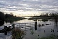
 A frosty view from Delph Bridge, Welney - geograph.org.uk - 3299648.jpg 4,320 × 3,240; 5.26 MB
-
 A little corner of Norfolk near Burgess Farm - geograph.org.uk - 3266957.jpg 4,320 × 3,240; 5.49 MB
-
 A thicket of trees - The Ouse Washes near Welney - geograph.org.uk - 4772303.jpg 4,320 × 3,240; 5.65 MB
-
 A very green ditch - geograph.org.uk - 575974.jpg 640 × 465; 94 KB
-
 A very green ditch - geograph.org.uk - 758739.jpg 640 × 480; 97 KB
-
 A1101 along the New Bedford River - geograph.org.uk - 3562139.jpg 1,926 × 1,173; 1.69 MB
-
 A1101 approaching Welney - geograph.org.uk - 3546036.jpg 2,256 × 1,504; 1.33 MB
-
 A1101 by Hundred Foot Bank - geograph.org.uk - 3125672.jpg 1,600 × 1,200; 850 KB
-
 A1101 entering Cambridgeshire near New Bedford River - geograph.org.uk - 3562144.jpg 2,061 × 1,215; 1.8 MB
-
 A1101 near Bank Farm - geograph.org.uk - 4715327.jpg 640 × 480; 54 KB
-
 A1101 near Welney House Farm - geograph.org.uk - 3546027.jpg 1,953 × 1,257; 1.74 MB
-
 A1101 southbound - geograph.org.uk - 5586362.jpg 640 × 510; 42 KB
-
 A1101 southbound - geograph.org.uk - 5586364.jpg 640 × 480; 47 KB
-
 A1101 southbound - geograph.org.uk - 5586385.jpg 640 × 480; 40 KB
-
 A1101 Wash Road - geograph.org.uk - 3562133.jpg 2,145 × 1,322; 2.49 MB
-
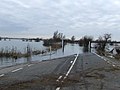
 A1101 Wash Road, Welney - flooded and closed - geograph.org.uk - 3873734.jpg 2,560 × 1,920; 2.13 MB
-

-
 Allport Hide, Welney WWT - geograph.org.uk - 4811958.jpg 1,600 × 1,200; 901 KB
-
 Alongside Wash Road - geograph.org.uk - 688588.jpg 427 × 640; 107 KB
-
 An open gate - The Ouse Washes near Welney - geograph.org.uk - 4773865.jpg 4,320 × 3,240; 6.01 MB
-

-
 B1100, Welney - geograph.org.uk - 4715362.jpg 640 × 480; 67 KB
-
 Beet and swans - geograph.org.uk - 1021892.jpg 640 × 480; 128 KB
-
 Bend in Wisbech Road, Tipps End - geograph.org.uk - 4715392.jpg 640 × 480; 72 KB
-

-
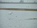
 Bewick Swans in Flight - geograph.org.uk - 4345462.jpg 640 × 445; 70 KB
-
 Bird feeders at WWT Welney Wetland Centre - geograph.org.uk - 5982988.jpg 1,600 × 1,200; 825 KB
-
 Bird scarer on farmland near Welney - geograph.org.uk - 1120515.jpg 640 × 427; 97 KB
-
 Boundary Post - geograph.org.uk - 1714502.jpg 1,200 × 1,600; 812 KB
-
 Boundary Post - geograph.org.uk - 1714508.jpg 1,600 × 1,200; 701 KB
-
 Bridge at Suspension Bridge - geograph.org.uk - 1021850.jpg 640 × 480; 127 KB
-
 Bridge Farm - geograph.org.uk - 2731804.jpg 1,600 × 1,200; 532 KB
-

-
 Bridge over Parting Drain - geograph.org.uk - 1120505.jpg 427 × 640; 107 KB
-
 Bridge to Welney reserve - geograph.org.uk - 3124737.jpg 1,200 × 1,600; 420 KB
-
 Bridleway along Ouse Washes - geograph.org.uk - 2727979.jpg 1,600 × 1,200; 707 KB
-
 Bridleway along Ouse Washes - geograph.org.uk - 2731830.jpg 1,600 × 1,200; 843 KB
-
 Bridleway along Ouse Washes - geograph.org.uk - 2731841.jpg 1,600 × 1,200; 853 KB
-
 Bridleway along Ouse Washes - geograph.org.uk - 2731939.jpg 1,600 × 1,200; 730 KB
-
 Bridleway along Ouse Washes - geograph.org.uk - 2731978.jpg 1,600 × 1,200; 689 KB
-
 Bridleway along Ouse Washes - geograph.org.uk - 2731981.jpg 1,600 × 1,200; 861 KB
-
 Bungalows in New Road, Welney - geograph.org.uk - 1859057.jpg 640 × 480; 105 KB
-
 Bungalows on the B1100, Welney - geograph.org.uk - 4715358.jpg 640 × 480; 64 KB
-

-
 Caravan park in Welney, Norfolk - geograph.org.uk - 4772281.jpg 4,320 × 3,240; 5.58 MB
-
 Cattle corral and flooding - The Ouse Washes near Welney - geograph.org.uk - 4264762.jpg 4,320 × 3,240; 5.41 MB
-
 Cattle on Hundred Foot Bank - geograph.org.uk - 3464333.jpg 4,320 × 3,240; 5.87 MB
-

-
 Christchurch, Pumpkin field - geograph.org.uk - 62895.jpg 640 × 379; 126 KB
-

-
 Concrete bridge at Welney. (since replaced) may 1993.jpg 2,399 × 1,599; 177 KB
-
 Copes Hill Farm, mixed identity - geograph.org.uk - 3159189.jpg 640 × 427; 97 KB
-
 Derelict house at Welney Fifties - geograph.org.uk - 1120499.jpg 640 × 427; 85 KB
-
 Derelict house at Welney Fifties - geograph.org.uk - 1120502.jpg 640 × 427; 94 KB
-
 Derelict house near Welney - geograph.org.uk - 4774707.jpg 4,320 × 3,240; 5.98 MB
-
 Dike near the reservoir on Lady Fen - geograph.org.uk - 3464338.jpg 4,320 × 3,240; 5.83 MB
-
 Ditch across Lady Fen - geograph.org.uk - 4812037.jpg 1,600 × 1,200; 1,019 KB
-

-
 Drainage ditch on Lady Fen - geograph.org.uk - 5983734.jpg 1,600 × 1,067; 931 KB
-
 Early winter flooding - The Ouse Washes near Welney - geograph.org.uk - 4264739.jpg 4,320 × 3,240; 5.58 MB
-
 Educational pool, WWT Welney Wetland Centre - geograph.org.uk - 5982990.jpg 1,600 × 1,200; 951 KB
-
 Entering Norfolk - geograph.org.uk - 4714838.jpg 640 × 480; 57 KB
-
 Entering Welney - geograph.org.uk - 4715344.jpg 640 × 480; 57 KB
-
 Entrance to Welney - geograph.org.uk - 5586366.jpg 640 × 428; 36 KB
-
 Farm building, Old Croft Farm - geograph.org.uk - 4715377.jpg 640 × 480; 69 KB
-
 Farm reservoir at Welney Fifties - geograph.org.uk - 1120508.jpg 640 × 427; 92 KB
-
 Farmland off March Road (B1100) - geograph.org.uk - 4715370.jpg 640 × 480; 65 KB
-
 Farmland, Hundred Foot Washes - geograph.org.uk - 4715336.jpg 640 × 480; 69 KB
-
 Fenland off the A1101 - geograph.org.uk - 4714843.jpg 640 × 480; 46 KB
-

-
 Flood Depth Varies - geograph.org.uk - 1177571.jpg 640 × 480; 63 KB
-

-
 Flooded and frozen - The Ouse Washes near Welney - geograph.org.uk - 3299754.jpg 4,320 × 3,240; 5.8 MB
-
 Flooded farmland near Burgess Farm, Fifty Road - geograph.org.uk - 3266945.jpg 4,320 × 3,240; 5.38 MB
-
 Flooded Gate - geograph.org.uk - 1177550.jpg 640 × 480; 55 KB
-
 Flooded gateway - geograph.org.uk - 688601.jpg 640 × 427; 76 KB
-
 Flooded gateway, near Welney - geograph.org.uk - 1046150.jpg 640 × 427; 67 KB
-
 Flooded Ouse Washes at Welney - geograph.org.uk - 688611.jpg 640 × 427; 101 KB
-
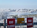
 Flooded Road - geograph.org.uk - 1177543.jpg 640 × 480; 66 KB
-
 Flooded Road Road Closed - geograph.org.uk - 1170158.jpg 640 × 480; 59 KB
-
 Footbridge at Welney Wetland Centre - geograph.org.uk - 3464259.jpg 4,320 × 3,240; 5.93 MB
-
 Footbridge by the Welney Wetland Centre - geograph.org.uk - 1894780.jpg 540 × 640; 104 KB
-
 Footbridge over the New Bedford River - geograph.org.uk - 5987249.jpg 3,024 × 4,032; 1.74 MB
-
 Footpath from Gold Hill - geograph.org.uk - 2731808.jpg 1,600 × 1,200; 963 KB
-
 Former hotel near Welney, Norfolk - geograph.org.uk - 4774708.jpg 4,320 × 3,240; 5.94 MB
-

-
 Friends Hide, Welney WWT - geograph.org.uk - 4812033.jpg 1,600 × 1,200; 952 KB
-

-
 Frozen and snow covered dike near Welney - geograph.org.uk - 3302262.jpg 4,320 × 3,240; 5.66 MB
-
 Frozen bank between the rivers at Welney - geograph.org.uk - 3300996.jpg 4,320 × 3,240; 5.93 MB
-
 Frozen washland - The Ouse Washes near Welney - geograph.org.uk - 3304484.jpg 4,320 × 3,240; 5.85 MB
-
 Frozen washlands - geograph.org.uk - 2211040.jpg 640 × 285; 57 KB
-
 Frozen washlands - geograph.org.uk - 2211371.jpg 640 × 432; 72 KB
-
 Garage, Gold Hill - geograph.org.uk - 4714856.jpg 640 × 445; 61 KB
-
 Gate to the washes near Suspension Bridge - The Ouse Washes - geograph.org.uk - 5764947.jpg 4,032 × 3,024; 4.33 MB
-
 Gateway to St. Mary's church, Welney - geograph.org.uk - 5982975.jpg 1,600 × 1,066; 936 KB
-
 Gold Hill, near Welney - geograph.org.uk - 309775.jpg 640 × 427; 51 KB
-
 Good job I wasn't on a horse - geograph.org.uk - 2731835.jpg 1,600 × 1,200; 923 KB
-
 Grazing cattle on Hundred Foot Bank - geograph.org.uk - 3464329.jpg 4,320 × 3,240; 5.68 MB
-
 Grazing on Ouse Washes - geograph.org.uk - 4810102.jpg 1,600 × 1,200; 998 KB
-
 Grazing on the Hundred Foot Washes - geograph.org.uk - 4714845.jpg 640 × 480; 63 KB
-
 Hale Drove,Welney - geograph.org.uk - 4261826.jpg 4,320 × 3,240; 5.5 MB
-
 Hides at Welney Wetland Centre - geograph.org.uk - 4673291.jpg 1,600 × 1,064; 444 KB
-
 Hoar frost and cattle pens - The Ouse Washes near Welney - geograph.org.uk - 3304717.jpg 4,320 × 3,240; 5.48 MB
-
 Hoar frost and The River Delph - The Ouse Washes near Welney - geograph.org.uk - 3301031.jpg 4,320 × 3,240; 5.33 MB
-
 House off Wisbech Road, Tipps End - geograph.org.uk - 4715389.jpg 640 × 480; 61 KB
-
 House on March Road (B1100) - geograph.org.uk - 4715384.jpg 640 × 480; 81 KB
-
 House Toll House Corner - geograph.org.uk - 4714831.jpg 640 × 458; 48 KB
-
 Houses in Main Street, Welney - geograph.org.uk - 1859065.jpg 640 × 480; 101 KB
-

-
 Houses on March Road (B1100), Welney - geograph.org.uk - 4715363.jpg 640 × 480; 53 KB
-
-
 Hundred Foot bank - geograph.org.uk - 2731968.jpg 1,600 × 1,200; 700 KB
-
 Hundred Foot Bank - geograph.org.uk - 3124711.jpg 1,600 × 1,200; 762 KB
-
 Hundred Foot Bank - geograph.org.uk - 3464204.jpg 4,320 × 3,240; 5.87 MB
-

-
 Ice blue - The Ouse Washes near Welney - geograph.org.uk - 3305420.jpg 4,320 × 3,240; 4.75 MB
-
 Island of reeds - The Ouse Washes near Welney - geograph.org.uk - 4777236.jpg 4,320 × 3,240; 5.45 MB
-
 Lady Fen Farm - geograph.org.uk - 3464299.jpg 4,320 × 3,240; 6.07 MB
-
 Lady Fen, Welney WWT - geograph.org.uk - 4810989.jpg 1,600 × 1,200; 916 KB
-
 Ladyfen Drain - geograph.org.uk - 1142154.jpg 640 × 480; 118 KB
-
 Ladyfen Drain - geograph.org.uk - 4812014.jpg 1,600 × 1,200; 702 KB
-
 Lamb and Flag, Welney - geograph.org.uk - 757651.jpg 640 × 480; 66 KB
-
 Leaving Welney - geograph.org.uk - 4715365.jpg 640 × 480; 50 KB
-
 Long straight river - geograph.org.uk - 483359.jpg 640 × 426; 62 KB
-

-
 Looking up the water tower in Welney - geograph.org.uk - 1859070.jpg 466 × 640; 107 KB
-
 Lyle Hide - geograph.org.uk - 1021897.jpg 640 × 480; 111 KB
-
 Main observatory, Welney WWT - geograph.org.uk - 4810998.jpg 1,600 × 1,190; 909 KB
-
 Main Street (A1101), Welney - geograph.org.uk - 4715360.jpg 640 × 480; 55 KB
-
 March Road (B1100) - geograph.org.uk - 4715373.jpg 640 × 480; 45 KB
-
 March Road (B1100), Tipps End - geograph.org.uk - 4715382.jpg 640 × 480; 79 KB
-
 March Road (B1100), Tipps End - geograph.org.uk - 4715397.jpg 640 × 480; 47 KB
-
 Minor road across Lady Fen - geograph.org.uk - 4812051.jpg 1,600 × 1,200; 736 KB
-
 Minor road to the Ouse Washes - geograph.org.uk - 4812057.jpg 1,600 × 1,200; 731 KB
-
 Mole near Welney Wetlands Visitors Centre - geograph.org.uk - 3464282.jpg 2,880 × 2,160; 3.58 MB
-
 Mute Swans on the Ouse Washes - geograph.org.uk - 4810111.jpg 1,600 × 1,199; 1,024 KB
-
 My feet are cold^ - geograph.org.uk - 2777572.jpg 2,592 × 3,888; 2.59 MB
-
 National Cycle Route 11 - geograph.org.uk - 4714834.jpg 640 × 480; 38 KB
-
 National Cycle Route 11 - geograph.org.uk - 4714853.jpg 640 × 480; 80 KB
-
 National Grid Pylons - geograph.org.uk - 438954.jpg 640 × 480; 174 KB
-
 Near Suspension Bridge - The Ouse Washes, Welney - geograph.org.uk - 4264758.jpg 4,320 × 3,240; 5.2 MB
-
 Nelson-Lyle Hide, Welney WWT - geograph.org.uk - 4811968.jpg 1,600 × 1,200; 1.01 MB
-
 New Bedford River - geograph.org.uk - 309781.jpg 427 × 640; 68 KB
-
 New Bedford River - geograph.org.uk - 3125663.jpg 1,600 × 1,200; 681 KB
-
 New Bedford River and Ouse Washes - geograph.org.uk - 2727984.jpg 1,200 × 1,600; 778 KB
-
 New house by Bank Farm - geograph.org.uk - 4810995.jpg 1,600 × 1,200; 826 KB
-
 New Road, Welney - geograph.org.uk - 2186475.jpg 1,600 × 1,200; 939 KB
-
 New wetland area, Welney WWT - geograph.org.uk - 3124731.jpg 1,600 × 1,200; 691 KB
-
 No flood water on Wash Road - The Ouse Washes near Welney - geograph.org.uk - 3299741.jpg 4,320 × 3,240; 5.73 MB
-
 Not a suspension bridge - geograph.org.uk - 4810088.jpg 1,600 × 1,200; 1.03 MB
-
 Old Bedford River - geograph.org.uk - 2777542.jpg 3,888 × 2,592; 3.5 MB
-
 Old Bedford River at Welney - geograph.org.uk - 3546043.jpg 2,256 × 1,504; 2.2 MB
-
 Old Bedford River near Welney - geograph.org.uk - 1120537.jpg 640 × 427; 102 KB
-
 Old Bedford River near Welney - geograph.org.uk - 1120540.jpg 640 × 427; 110 KB
-
 Old Bedford River near Welney - geograph.org.uk - 1120542.jpg 427 × 640; 92 KB
-
 Old Milepost - geograph.org.uk - 2868430.jpg 1,024 × 768; 240 KB
-
 Ouse Washes - geograph.org.uk - 2186465.jpg 1,600 × 1,200; 1.2 MB
-
 Ouse Washes - geograph.org.uk - 2728043.jpg 1,600 × 1,200; 752 KB
-
 Ouse Washes - geograph.org.uk - 2731818.jpg 1,600 × 1,200; 826 KB
-
 Ouse Washes - geograph.org.uk - 2731845.jpg 1,600 × 1,200; 729 KB
-
 Ouse Washes - geograph.org.uk - 2731926.jpg 1,600 × 1,200; 746 KB
-
 Ouse Washes - geograph.org.uk - 2731931.jpg 1,600 × 1,200; 656 KB
-
 Ouse Washes - geograph.org.uk - 2731945.jpg 1,600 × 1,200; 622 KB
-
 Ouse Washes at Suspension Bridge - geograph.org.uk - 688623.jpg 640 × 424; 70 KB
-
 Ouse Washes at Welney - geograph.org.uk - 688580.jpg 640 × 427; 76 KB
-
 Partially flooded - The Ouse Washes near Welney - geograph.org.uk - 4777242.jpg 4,320 × 3,240; 5.71 MB
-

-
 Pedestrian bridge at Welney Wetland Centre - geograph.org.uk - 5982985.jpg 1,600 × 1,200; 944 KB
-
 Picnic area, WWT Welney Wetland Centre - geograph.org.uk - 5982997.jpg 1,600 × 1,200; 1.03 MB
-
 Pink waters - The Ouse Washes near Welney - geograph.org.uk - 4264752.jpg 4,320 × 3,240; 5.2 MB
-
 Pisces Country Park - geograph.org.uk - 1120527.jpg 640 × 427; 79 KB
-
 Pollarded trees near Welney - geograph.org.uk - 1120524.jpg 640 × 427; 83 KB
-
 Power lines across the Ouse Washes - geograph.org.uk - 2727995.jpg 1,600 × 1,200; 644 KB
-
 Primitive Methodist Chapel, Suspension Bridge - geograph.org.uk - 2731825.jpg 1,600 × 1,200; 733 KB
-

-
 Pylon by Ouse Washes - geograph.org.uk - 2728002.jpg 1,600 × 1,200; 597 KB
-
 Receding flood water - The Ouse Washes - geograph.org.uk - 5764985.jpg 4,032 × 3,024; 3.64 MB
-
 Reedbed Hide, Welney WWT - geograph.org.uk - 4810980.jpg 1,600 × 1,200; 1.16 MB
-
 Reeds and flood water - The Ouse Washes near Welney - geograph.org.uk - 4772495.jpg 4,320 × 3,240; 5.65 MB
-
 River Delph - geograph.org.uk - 1714468.jpg 1,600 × 1,200; 155 KB
-
 River Delph at Welney - geograph.org.uk - 4531761.jpg 1,600 × 1,200; 432 KB
-
 River Delph from Delph Bridge - geograph.org.uk - 6421011.jpg 4,032 × 3,024; 2.1 MB
-

-
 Road beside the Hundred Foot Bank, near Welney - geograph.org.uk - 5982979.jpg 1,600 × 800; 541 KB
-
 ROAD CLOSED, ROAD FLOODED - The Ouse Washes near Welney - geograph.org.uk - 3304706.jpg 4,320 × 3,240; 5.39 MB
-
 Road junction - geograph.org.uk - 5586384.jpg 640 × 480; 71 KB
-
 Road north from Suspension Bridge - geograph.org.uk - 757629.jpg 640 × 480; 59 KB
-
 Rushes along a field boundary - geograph.org.uk - 757659.jpg 640 × 480; 69 KB
-
 Secured farm near Tipps End - geograph.org.uk - 3302249.jpg 4,320 × 3,240; 5.82 MB
-
 Setting sun - The Ouse Washes near Welney - geograph.org.uk - 4272830.jpg 4,320 × 3,240; 5.36 MB
-
 Shallow flood water - The Ouse Washes - geograph.org.uk - 5764992.jpg 3,924 × 2,943; 1.48 MB
-
 Sharp Left - geograph.org.uk - 1170162.jpg 640 × 480; 73 KB
-
 Sign for the Lamb ^ Flag in Welney - geograph.org.uk - 4715347.jpg 492 × 603; 101 KB
-
 Sign on the Lamb ^ Flag in Welney - geograph.org.uk - 4715348.jpg 527 × 627; 93 KB
-
 Skating swans on the Old Bedford River - geograph.org.uk - 2777554.jpg 3,888 × 2,592; 3.17 MB
-

-
 Sluice on Old Bedford River - geograph.org.uk - 688605.jpg 462 × 640; 43 KB


_-_geograph.org.uk_-_4715374.jpg)


,_Tipps_End_-_geograph.org.uk_-_4715386.jpg)


_may_1993.jpg)


_-_geograph.org.uk_-_4715368.jpg)


_-_geograph.org.uk_-_4715370.jpg)


_-_geograph.org.uk_-_4715384.jpg)


,_Tipps_End_-_geograph.org.uk_-_4715395.jpg)
,_Welney_-_geograph.org.uk_-_4715363.jpg)
,_Tipps_End_-_geograph.org.uk_-_4715399.jpg)


,_Welney_-_geograph.org.uk_-_4715360.jpg)
_-_geograph.org.uk_-_4715373.jpg)
,_Tipps_End_-_geograph.org.uk_-_4715382.jpg)
,_Tipps_End_-_geograph.org.uk_-_4715397.jpg)


