Category:Wellington Heath
Jump to navigation
Jump to search
village and civil parish in Herefordshire, England  | |||||
| Upload media | |||||
| Instance of | |||||
|---|---|---|---|---|---|
| Location | Herefordshire, West Midlands, England | ||||
| Population |
| ||||
 | |||||
English: Wellington Heath is a small village and civil parish in Herefordshire, England, approximately north of Ledbury. The population was recorded by the 2011 census at 440. (→Wellington Heath)
Polski: Wellington Heath – wieś i civil parish w Anglii, w hrabstwie Herefordshire. W 2011 civil parish liczyła 440 mieszkańców. (→Wellington Heath)

Subcategories
This category has the following 2 subcategories, out of 2 total.
O
- Oasts in Wellington Heath (3 F)
W
Media in category "Wellington Heath"
The following 66 files are in this category, out of 66 total.
-
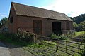 Barn at Petty France - geograph.org.uk - 965725.jpg 640 × 426; 80 KB
-
 Bend in the road - geograph.org.uk - 948100.jpg 640 × 480; 119 KB
-
 Bromyard Road crossing River Leadon near Staplow - geograph.org.uk - 5596868.jpg 1,600 × 1,199; 704 KB
-
 Cattle in a field at Wellington Heath - geograph.org.uk - 965707.jpg 640 × 426; 114 KB
-
 Crop of oats - geograph.org.uk - 895281.jpg 640 × 480; 96 KB
-
 Crops off Hollow Lane - geograph.org.uk - 948110.jpg 640 × 480; 82 KB
-
 Dwelling on Ledbury Road - geograph.org.uk - 6576333.jpg 800 × 533; 235 KB
-
 Entering Wellington Heath - geograph.org.uk - 636558.jpg 640 × 480; 80 KB
-
 Farm access off Hollow Lane - geograph.org.uk - 948111.jpg 640 × 480; 97 KB
-
 Farmers Arms - geograph.org.uk - 3620599.jpg 427 × 640; 74 KB
-
 Farmland at Wellington Heath - geograph.org.uk - 965127.jpg 640 × 426; 89 KB
-
 Farmland at Wellington Heath - geograph.org.uk - 965715.jpg 640 × 426; 90 KB
-
 Farmland near Peg's Farm - geograph.org.uk - 6556322.jpg 1,024 × 768; 306 KB
-
 Field of maize, Wellington Heath - geograph.org.uk - 964444.jpg 640 × 426; 65 KB
-
 Footpath off Ledbury Road - geograph.org.uk - 6576343.jpg 800 × 533; 129 KB
-
 Frith Farm orchard - geograph.org.uk - 948103.jpg 640 × 480; 106 KB
-
 Frith Wood and Frith Farm - geograph.org.uk - 965702.jpg 426 × 640; 93 KB
-
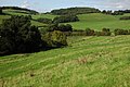
 Grassland at Wellington Heath - geograph.org.uk - 5999210.jpg 1,024 × 683; 198 KB
-
 Grassland at Wellington Heath - geograph.org.uk - 6673107.jpg 1,024 × 768; 258 KB
-
 Grassland with a view - geograph.org.uk - 895310.jpg 640 × 336; 59 KB
-
 Harvested maize field - geograph.org.uk - 3329360.jpg 1,024 × 680; 236 KB
-
 Hay bales in the field - geograph.org.uk - 895314.jpg 640 × 337; 53 KB
-
 Hillside by the B4220 - geograph.org.uk - 948091.jpg 640 × 480; 73 KB
-
 Hollow Lane crossroads - geograph.org.uk - 4248194.jpg 800 × 451; 262 KB
-
 Hollow Lane, Wellington Heath - geograph.org.uk - 964470.jpg 640 × 426; 81 KB
-
 Hop field - geograph.org.uk - 6673109.jpg 1,024 × 768; 259 KB
-
 Hope End Farm - geograph.org.uk - 895305.jpg 640 × 345; 65 KB
-
 Hope End School House, Wellington Heath - geograph.org.uk - 4592252.jpg 4,926 × 3,284; 4.11 MB
-
 House at Wellington Heath - geograph.org.uk - 965690.jpg 640 × 426; 85 KB
-
 Houses at the junction - geograph.org.uk - 947630.jpg 640 × 480; 91 KB
-
 Line of a footpath - geograph.org.uk - 4076561.jpg 800 × 451; 228 KB
-
 Lodge to Hope End Park - geograph.org.uk - 6000092.jpg 1,024 × 683; 247 KB
-
 Maize crop, Wellington Heath - geograph.org.uk - 964454.jpg 640 × 426; 87 KB
-
 Old orchard land - geograph.org.uk - 4076617.jpg 800 × 451; 195 KB
-
 Ordnance Survey flush bracket - geograph.org.uk - 4347476.jpg 2,560 × 1,920; 1.04 MB
-
 Ordnance Survey Sheet SO 74 Great Malvern, Published 1954.jpg 7,148 × 7,819; 5.9 MB
-
 Paddock in Wellington Heath - geograph.org.uk - 948102.jpg 640 × 480; 105 KB
-
 Paddocks at Swallow Farm - geograph.org.uk - 636592.jpg 480 × 640; 86 KB
-
 Peg's Farm - geograph.org.uk - 6576348.jpg 800 × 533; 126 KB
-
 Peg's Farmhouse, Wellington Heath - geograph.org.uk - 6673100.jpg 1,024 × 768; 249 KB
-
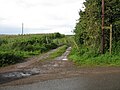
 Petty France - Lane to Wellington Heath - geograph.org.uk - 947641.jpg 640 × 480; 127 KB
-
 Petty France junction - geograph.org.uk - 947650.jpg 640 × 480; 126 KB
-
 Phone box on The Common - geograph.org.uk - 3620604.jpg 640 × 427; 112 KB
-
 Raycomb Lane - geograph.org.uk - 947538.jpg 480 × 640; 126 KB
-
 Road junction on Bromyard Road - geograph.org.uk - 5265620.jpg 800 × 600; 160 KB
-
 Road junction, Wellington Heath - geograph.org.uk - 964489.jpg 640 × 426; 124 KB
-
 Stores Brook - geograph.org.uk - 895257.jpg 640 × 480; 113 KB
-
 The Farmers Arms, Wellington Heath - geograph.org.uk - 1738212.jpg 1,024 × 679; 232 KB
-
 Toward Frith Wood - geograph.org.uk - 948104.jpg 640 × 480; 100 KB
-
 Unsuitable for HGVs - geograph.org.uk - 948093.jpg 640 × 480; 106 KB
-
 Valley east of Wellington Heath - geograph.org.uk - 947624.jpg 640 × 480; 102 KB
-
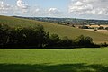
 View to Coddington and the Malvern Hills - geograph.org.uk - 3329359.jpg 1,024 × 680; 221 KB
-
 View to Wellington Heath - geograph.org.uk - 3329364.jpg 1,024 × 680; 191 KB
-
 Wellington Heath - Beggars Ash - geograph.org.uk - 948108.jpg 640 × 480; 106 KB
-
 Wellington Heath - Horse Lane - geograph.org.uk - 948109.jpg 640 × 480; 122 KB
-

-
 Wellington Heath cemetery - geograph.org.uk - 895285.jpg 640 × 480; 85 KB
-
 Ye Olde Cider House, Swallow Farm, Wellington Heath - geograph.org.uk - 4592231.jpg 4,412 × 2,789; 3.67 MB
-
 Young cattle at Storesbrook - geograph.org.uk - 895248.jpg 640 × 332; 82 KB
-
 Entrance and Gate House to Hope End - geograph.org.uk - 636622.jpg 640 × 480; 78 KB
-
 Farmland north of Wellington Heath - geograph.org.uk - 1438048.jpg 640 × 433; 88 KB
-
 Fields opposite Uplands Farm - geograph.org.uk - 513763.jpg 640 × 427; 279 KB
-
 Maize Field near Peg's Farm - geograph.org.uk - 513775.jpg 640 × 427; 248 KB
-
 Petty France Farm, near Ledbury - geograph.org.uk - 29122.jpg 640 × 479; 133 KB
-

-
 Road junction at Wellington Heath - geograph.org.uk - 636582.jpg 640 × 480; 70 KB


