Category:Wellesley, Massachusetts
Jump to navigation
Jump to search
town in Norfolk County, Massachusetts, United States    | |||||
| Upload media | |||||
| Instance of | |||||
|---|---|---|---|---|---|
| Part of |
| ||||
| Location | Norfolk County, Massachusetts | ||||
| Inception |
| ||||
| Population |
| ||||
| Area |
| ||||
| Elevation above sea level |
| ||||
| official website | |||||
 | |||||
Subcategories
This category has the following 27 subcategories, out of 27 total.
B
C
D
- Dana Hall School (14 F)
E
- Eaton-Moulton Mill (2 F)
- Elm Bank Reservation (10 F)
G
- Gulf Oil LP (8 F)
H
L
M
- Morses Pond (101 F)
N
P
- Paintshop Pond (65 F)
R
- Ridge Hill Farms (4 F)
S
W
- Waban Arch Bridge (12 F)
- William H. Winn House (7 F)
Media in category "Wellesley, Massachusetts"
The following 92 files are in this category, out of 92 total.
-
 Wellesley ma highlight.png 788 × 466; 54 KB
-

-

-
 2004-12-19 - Wellesley (1).jpg 768 × 1,024; 214 KB
-
 American homes and gardens (1908) (17537250023).jpg 3,127 × 1,444; 1.55 MB
-
 Attractive home grounds (1894) (20340462822).jpg 3,072 × 2,388; 2.23 MB
-
 Bus shelter on Route 9 at Cedar Street, May 2017.JPG 3,550 × 2,662; 2.25 MB
-
 Bus shelter on Route 9 at Weston Road, May 2017.JPG 3,774 × 2,827; 2.25 MB
-
 Central Block, Wellesley MA.jpg 4,032 × 3,024; 3.34 MB
-
 Central Street, Wellesley MA.jpg 3,195 × 2,130; 1.13 MB
-
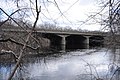
 Charles River Reservation bridge over the Charles River entering Wellesley MA.jpg 4,032 × 3,024; 4.79 MB
-
 CharlesRiver Route9Bridge.jpg 1,024 × 680; 340 KB
-
 CochituateAqueduct 1848BenchCedarStreetWellesley.jpg 1,024 × 680; 268 KB
-
 CochituateAqueduct CharlesRiverSiphonHouseSiteWellesley.jpg 1,024 × 680; 335 KB
-
 CochituateAqueduct HunnewellFieldWellesley.jpg 1,024 × 680; 250 KB
-
 CochituateAqueduct MarkerCedarStreetWellesley.jpg 2,048 × 1,360; 787 KB
-
 CochituateAqueduct MorsePondWeirHouse1.jpg 1,024 × 680; 340 KB
-
 CochituateAqueduct MorsePondWeirHouse2.jpg 1,024 × 680; 309 KB
-
 CochituateAqueduct MorsePondWeirHouse3.jpg 680 × 1,024; 308 KB
-
 CochituateAqueduct MorsePondWellesley.jpg 1,024 × 680; 329 KB
-
 CochituateAqueduct NearWellesleyCollege.jpg 1,024 × 680; 344 KB
-
 Cordingly Dam and Falls, Wellesley MA.jpg 3,264 × 2,448; 2.92 MB
-

-
 DoverMA ElmBank CheneyRoadBridge1.jpg 1,024 × 680; 319 KB
-
 DoverMA ElmBank CheneyRoadBridge2.jpg 1,024 × 680; 329 KB
-
 Eagle Main Entrance.jpg 3,400 × 2,550; 1.99 MB
-
 Elm Bank canoe launch 213345 929.jpg 5,344 × 3,006; 5.42 MB
-
 Elm Park and Sprague Memorial Tower.jpg 3,992 × 2,242; 8.51 MB
-
 Entering Wellesley westbound on MA Route 16, MA.jpg 3,260 × 2,170; 1.73 MB
-
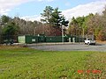
 Field Hockey Field (4036529285).jpg 2,048 × 1,536; 562 KB
-
 Field Hockey Field (4037280972).jpg 2,048 × 1,536; 730 KB
-
 Finlay Dam Wellesley 2011.jpg 3,264 × 2,448; 2.39 MB
-
 Fuller Brook Park.jpg 3,264 × 2,448; 3.91 MB
-

-
-

-

-
 Historic Hotel Wellesley.jpg 398 × 194; 20 KB
-
 Ware&VanBrunt Walter Hunnewell House.JPG 448 × 203; 42 KB
-
 Intermediate Building Wellesley MA 01.jpg 1,200 × 1,211; 973 KB
-
 Intermediate Building Wellesley MA 02.jpg 1,600 × 1,142; 1.81 MB
-
 Interstate95 CharlesRiverBridgeNewtonWellesley.jpg 1,024 × 680; 277 KB
-
 Isaac Sprague Memorial Tower Wellesley MA 01.jpg 1,200 × 1,177; 1.29 MB
-
 Isaac Sprague Memorial Tower Wellesley MA 02.jpg 1,200 × 1,193; 1,019 KB
-
 Isaac Sprague Memorial Tower Wellesley MA 03.jpg 1,200 × 1,245; 1.02 MB
-
 Lineman.JPG 320 × 240; 13 KB
-
 Linemenflags.JPG 1,024 × 768; 204 KB
-
 Little Free Library, Wellesley MA.jpg 4,032 × 3,024; 4.48 MB
-
 Map of Ridge Hill Farms (Baker Estate).jpg 595 × 800; 104 KB
-

-
 Mary Hunnewell Fyffe Footbridge, Wellesley MA.jpg 3,264 × 2,448; 2.2 MB
-

-
 NewXMFR.JPG 1,024 × 768; 379 KB
-

-
 Old378substation.JPG 1,024 × 768; 127 KB
-
 P1090001 (4037250270).jpg 2,048 × 1,536; 107 KB
-
 P1090007 (4036499427).jpg 2,048 × 1,536; 71 KB
-
 P1090008 (4037250312).jpg 2,048 × 1,536; 119 KB
-
 P1140001 (4037253204).jpg 2,048 × 1,536; 658 KB
-
 P1140002 (4037253038).jpg 2,048 × 1,536; 755 KB
-
 P1140003 (4036502383).jpg 2,048 × 1,536; 631 KB
-
 P1140004 (4036502449).jpg 2,048 × 1,536; 668 KB
-
 P1140005 (4036502475).jpg 2,048 × 1,536; 645 KB
-
 P1140006 (4036502267).jpg 2,048 × 1,536; 518 KB
-
 P1140007 (4037253056).jpg 2,048 × 1,536; 528 KB
-
 P1140008 (4037253348).jpg 2,048 × 1,536; 645 KB
-
 P1140009 (4036502241).jpg 2,048 × 1,536; 854 KB
-
 P1140010 (4037253386).jpg 2,048 × 1,536; 690 KB
-
 P1140011 (4036502323).jpg 2,048 × 1,536; 596 KB
-
 P1140012 (4037253426).jpg 2,048 × 1,536; 652 KB
-
 P1140013 (4037253082).jpg 2,048 × 1,536; 666 KB
-
 Paintshop Pond Dredging Project (4036519047).jpg 2,048 × 1,536; 669 KB
-
 PIC00020a (4037234596).jpg 1,280 × 1,024; 289 KB
-
 Pond Road and Washington Street Wellesley MA.jpg 1,600 × 833; 733 KB
-
 Pullingcable.jpg 300 × 225; 27 KB
-
 Reconstructing378.jpg 300 × 225; 20 KB
-
 Residence, Wellesley, Massachusetts (3678140081).jpg 1,536 × 1,183; 221 KB
-
 Seal of Wellesley, Massachusetts.png 280 × 280; 124 KB
-
 Sister Agnes Berchmans.png 264 × 404; 206 KB
-
 TN PIC00020 (4036484261).jpg 120 × 96; 3 KB
-
 Wales Street Walnut Street bridge, Wellesley MA.jpg 3,264 × 2,448; 2.07 MB
-
 Wellesley Center, MA.jpg 1,896 × 1,266; 345 KB
-
 Wellesley Free Library Fells Branch, May 2017.JPG 3,876 × 2,907; 2.39 MB
-

-
 Wellesley, Rockland Street Bridge, August 14, 2012 (7782780980).jpg 1,024 × 768; 159 KB
-
 WellesleyMA RosemaryBrookWestSiphonHouse.jpg 1,024 × 680; 235 KB
-
 WellesleyMA SudburyAqueduct SiphonHouse.jpg 1,024 × 680; 335 KB
-
 WellesleyMA SudburyAqueductRosemaryBrookCut.jpg 1,024 × 680; 264 KB
-
 WellesleyMA SudburyAqueductRosemaryBrookEmbankment.jpg 680 × 1,024; 225 KB
-
 WMLPvehicles.JPG 2,048 × 1,536; 834 KB
-
 Worcester Line from Kingsbury Street, Wellesley, March 2013.JPG 4,320 × 3,240; 4.98 MB
-
 WWW2007.JPG 1,024 × 768; 126 KB

_Map_showing_drives_from_the_Walker-Gordon_Laboratory,_203_Claredon_St.,_Boston,_to_the_Laboratory_Farm_in_Wellesley,_Massachusetts,_by_Geo._H._Walker_%26_Co,_from_the_Digital_Commonwealth_-_commonwealth_wd376694j.jpg)
.jpg)
_(17537250023).jpg)
_(20340462822).jpg)


_(20363934958).jpg)


.jpg)
.jpg)


.jpg)
.jpg)


.jpg)
.jpg)
.jpg)
.jpg)
.jpg)
.jpg)
.jpg)
.jpg)
.jpg)
.jpg)
.jpg)
.jpg)
.jpg)
.jpg)
.jpg)
.jpg)
.jpg)
.jpg)


.jpg)

.jpg)


.jpg)


