Category:Well Creek
Jump to navigation
Jump to search
Well Creek is a small tributary of the River Great Ouse in Norfolk. It formerly connected the River Nene to the Ouse via the now disused Wisbech Canal.
River in Norfolk, England | |||||
| Upload media | |||||
| Instance of | |||||
|---|---|---|---|---|---|
| Location |
| ||||
 | |||||
Media in category "Well Creek"
The following 60 files are in this category, out of 60 total.
-

-
 Bridge No 35 - geograph.org.uk - 1240985.jpg 640 × 480; 96 KB
-
 Bridge over Well Creek - geograph.org.uk - 1261828.jpg 640 × 489; 102 KB
-
 Cemetery Lane - geograph.org.uk - 1261928.jpg 640 × 480; 82 KB
-
 Cygnets on Well Creek east of Nordelph. - geograph.org.uk - 72235.jpg 640 × 599; 158 KB
-

-
 Dandelions growing by Well Creek - geograph.org.uk - 1261959.jpg 480 × 640; 97 KB
-

-
 Farm bridge over the Well Creek - geograph.org.uk - 3409914.jpg 640 × 427; 289 KB
-
 Glimpse through trees - geograph.org.uk - 1261950.jpg 640 × 511; 164 KB
-
 Grape hyacinths and daffodils - geograph.org.uk - 1261997.jpg 640 × 517; 109 KB
-
 House on the A1122 - geograph.org.uk - 1261970.jpg 640 × 480; 86 KB
-
 House on Town Street (B1412) - geograph.org.uk - 1241059.jpg 640 × 541; 97 KB
-
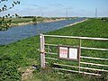
 Information boards by Well Creek - geograph.org.uk - 1261831.jpg 640 × 480; 103 KB
-
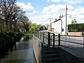
 Marmont Priory lock - geograph.org.uk - 265662.jpg 640 × 430; 76 KB
-

-
 Mullicourt Aqueduct - geograph.org.uk - 710356.jpg 3,008 × 2,000; 2.6 MB
-
 Mullicourt Aqueduct Cambridgeshire.jpg 640 × 480; 92 KB
-
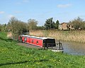 Narrowboat on Well Creek - geograph.org.uk - 1261978.jpg 640 × 511; 99 KB
-
 Pollarded willows - geograph.org.uk - 1261919.jpg 640 × 480; 77 KB
-
 Reflections in the River Nene - geograph.org.uk - 1241070.jpg 640 × 548; 124 KB
-
 Reflections in Well Creek - geograph.org.uk - 1261985.jpg 533 × 640; 160 KB
-

-
 Safely moored - geograph.org.uk - 1261975.jpg 640 × 528; 97 KB
-
 Sandy Cottage - geograph.org.uk - 1261953.jpg 600 × 562; 129 KB
-
 Sheds with blue doors - geograph.org.uk - 1261967.jpg 640 × 510; 116 KB
-
 Spar shop on Town Street (N1412) - geograph.org.uk - 1241079.jpg 640 × 480; 85 KB
-
 Sunset on Well Creek - geograph.org.uk - 755890.jpg 640 × 409; 57 KB
-
 Taking a rest - geograph.org.uk - 1261994.jpg 640 × 517; 155 KB
-

-
 The Crown - geograph.org.uk - 1241582.jpg 640 × 480; 94 KB
-
 The old course of the River Nene - geograph.org.uk - 1241057.jpg 640 × 525; 93 KB
-
 Town Street (B1412) - geograph.org.uk - 1241005.jpg 640 × 480; 94 KB
-
 Track along Main Drain - geograph.org.uk - 1261754.jpg 640 × 480; 108 KB
-
 Triangulation pillar by Well Creek - geograph.org.uk - 1262117.jpg 640 × 553; 100 KB
-

-
 Upwell Post Office - geograph.org.uk - 1241001.jpg 473 × 640; 99 KB
-
 View across Well Creek - geograph.org.uk - 1240997.jpg 640 × 480; 102 KB
-
 View across Well Creek - geograph.org.uk - 1241735.jpg 640 × 480; 84 KB
-
 View across Well Creek - geograph.org.uk - 1261933.jpg 640 × 480; 106 KB
-
 View across Well Creek - geograph.org.uk - 1820383.jpg 640 × 480; 97 KB
-
 View along Well Creek - geograph.org.uk - 1261944.jpg 640 × 480; 96 KB
-
 View along Well Creek - geograph.org.uk - 1262101.jpg 640 × 480; 94 KB
-
 View past the Goch - geograph.org.uk - 1261984.jpg 640 × 480; 104 KB
-
 Well Creek - geograph.org.uk - 1240990.jpg 480 × 640; 133 KB
-
 Well Creek - geograph.org.uk - 1241051.jpg 640 × 480; 92 KB
-
 Well Creek - geograph.org.uk - 1241730.jpg 640 × 480; 92 KB
-
 Well Creek - geograph.org.uk - 1261780.jpg 640 × 480; 98 KB
-
 Well Creek - geograph.org.uk - 1261824.jpg 640 × 480; 98 KB
-
 Well Creek - geograph.org.uk - 1262111.jpg 640 × 480; 112 KB
-
 Well Creek - geograph.org.uk - 685679.jpg 640 × 427; 90 KB
-

-
 Well Creek east from Nordelph. - geograph.org.uk - 72233.jpg 480 × 640; 71 KB
-

-
 Well Creek near Hall Bridge, Upwell - geograph.org.uk - 68361.jpg 640 × 480; 114 KB
-
 Well Creek, at Creek Farm. - geograph.org.uk - 73084.jpg 640 × 480; 68 KB
-
 Willow on bank of Well Creek. - geograph.org.uk - 72227.jpg 480 × 640; 109 KB
-
 Willow tree on Cemetery Lane - geograph.org.uk - 1261836.jpg 640 × 480; 92 KB
-
 Willows on the bank of the creek - geograph.org.uk - 1261962.jpg 640 × 512; 168 KB
-


_-_geograph.org.uk_-_1241059.jpg)


_-_geograph.org.uk_-_1241054.jpg)


,_aka_Well_Creek._-_geograph.org.uk_-_70355.jpg)


_-_geograph.org.uk_-_1241079.jpg)


_-_geograph.org.uk_-_1241005.jpg)


