Category:Welham, Leicestershire
Jump to navigation
Jump to search
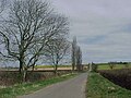
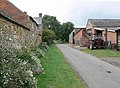
English: Welham is a small village and civil parish in the Harborough district of Leicestershire, England, north-east of Market Harborough. The village is situated on the north bank of the River Welland, which forms the border with the neighbouring county of Northamptonshire.
village and civil parish in Leicestershire, United Kingdom  | |||||
| Upload media | |||||
| Instance of | |||||
|---|---|---|---|---|---|
| Location | Harborough, Leicestershire, East Midlands, England | ||||
| Population |
| ||||
 | |||||
Subcategories
This category has only the following subcategory.
W
Media in category "Welham, Leicestershire"
The following 110 files are in this category, out of 110 total.
-

-
 Bend in Thorpe Langton Road - geograph.org.uk - 3390904.jpg 4,000 × 3,000; 4.6 MB
-
 Bowden Lane - geograph.org.uk - 5023311.jpg 640 × 444; 103 KB
-
 Bowden Lane in Welham, Leicestershire - geograph.org.uk - 570149.jpg 640 × 371; 118 KB
-
 Bowden Lane-Weston Road junction - geograph.org.uk - 5023312.jpg 640 × 430; 103 KB
-
 Bridge along Welham Road - geograph.org.uk - 3391220.jpg 3,005 × 2,065; 1.56 MB
-
 Bridleway to Bowden Road - geograph.org.uk - 3390764.jpg 3,129 × 2,206; 2.27 MB
-
 Bridleway to Langton Caudle - geograph.org.uk - 3390921.jpg 4,000 × 3,000; 3.5 MB
-
 Cattle in the Welland Valley - geograph.org.uk - 3390868.jpg 2,926 × 2,658; 2.29 MB
-
 Cockerel on the tower - geograph.org.uk - 5023313.jpg 640 × 468; 59 KB
-
 Dusting of snow on Leverton road - geograph.org.uk - 1703230.jpg 640 × 454; 77 KB
-
 Electricity pylon and field near Welham Lodge - geograph.org.uk - 3394513.jpg 2,822 × 2,228; 1.91 MB
-
 Entrance to Blackwell's Lodge - geograph.org.uk - 3394525.jpg 2,817 × 2,432; 2.45 MB
-
 Farm buildings along Welham Lane - geograph.org.uk - 3394517.jpg 3,948 × 2,742; 3.28 MB
-
 Farm buildings along Welham Lane - geograph.org.uk - 3394518.jpg 4,000 × 3,000; 3.78 MB
-
 Farmland along Great Bowden Lane - geograph.org.uk - 3390872.jpg 3,247 × 2,213; 2.5 MB
-
 Farmland in the flat Welland Valley - geograph.org.uk - 3390893.jpg 3,613 × 2,642; 3.2 MB
-
 Farmland in the Welland Valley - geograph.org.uk - 3390972.jpg 3,813 × 2,851; 3.74 MB
-
 Farmland in the Welland Valley - geograph.org.uk - 3391198.jpg 1,935 × 1,248; 731 KB
-
 Farmland near Welham Lodge - geograph.org.uk - 3394497.jpg 3,983 × 2,862; 3.52 MB
-
 Farmland north of Thorpe Langton Road - geograph.org.uk - 3391114.jpg 3,492 × 2,813; 3.27 MB
-
 Field and hedge along Welham Lane - geograph.org.uk - 3394486.jpg 2,859 × 2,226; 1.73 MB
-
 Field by the River Welland, Welham - geograph.org.uk - 6224176.jpg 1,920 × 1,280; 1.41 MB
-
 Field west of Slawston Road at Welham - geograph.org.uk - 5023314.jpg 640 × 449; 124 KB
-
 Fields along Welham Road - geograph.org.uk - 3391211.jpg 4,000 × 3,000; 3.5 MB
-
 Fields near Welham Lodge - geograph.org.uk - 3394508.jpg 3,061 × 2,247; 2.24 MB
-
 Fields to the west of Welham Lane - geograph.org.uk - 5023308.jpg 640 × 389; 78 KB
-
 Fingerpost along Slawston Lane - geograph.org.uk - 3391128.jpg 3,497 × 2,707; 2.83 MB
-
 Footpath by the River Welland - geograph.org.uk - 6379626.jpg 3,776 × 2,520; 2.07 MB
-
 Former railway bridge - geograph.org.uk - 230266.jpg 640 × 480; 78 KB
-
 Gate at Welham Fishing Lake - geograph.org.uk - 3390790.jpg 3,093 × 2,455; 2.49 MB
-
 Grange Farm Cottage, Welham.jpg 4,000 × 3,000; 3.76 MB
-
 Great Bowden Lane - geograph.org.uk - 3390881.jpg 3,973 × 2,875; 3.41 MB
-
-
 Great Bowden Lane approaching the Gate House - geograph.org.uk - 3390750.jpg 2,100 × 1,656; 1,016 KB
-
 Heading north along Great Bowden Lane - geograph.org.uk - 3390778.jpg 4,000 × 3,000; 4 MB
-
 Heading west along Thorpe Langton Road - geograph.org.uk - 3390960.jpg 3,986 × 2,808; 3.64 MB
-
 Hedge and ditch along Slawston Road - geograph.org.uk - 3391177.jpg 4,000 × 3,000; 3.82 MB
-

-
 K6 telephone kiosk, Welham.jpg 4,000 × 3,000; 5.08 MB
-
 Leicestershire Round - geograph.org.uk - 5206988.jpg 640 × 480; 50 KB
-
 Leicestershire Round footpath looking down Langton Caudle - geograph.org.uk - 4892283.jpg 5,344 × 3,006; 2.46 MB
-
 New entrance to farm off Welham Road, Welham - geograph.org.uk - 6394170.jpg 1,920 × 1,280; 1.91 MB
-
-
 On the road to Slawston - geograph.org.uk - 5544632.jpg 480 × 640; 83 KB
-

-

-
 Pylon and electricity pole by Welham Road - geograph.org.uk - 6224977.jpg 1,870 × 1,245; 1.56 MB
-
 Road junction and grass triangle - geograph.org.uk - 4892022.jpg 5,344 × 3,006; 2.18 MB
-
 Roller in a field - geograph.org.uk - 3391174.jpg 3,631 × 3,000; 3.87 MB
-
 Signpost at the Crossroads - geograph.org.uk - 781887.jpg 427 × 640; 108 KB
-
 Slawston Road - geograph.org.uk - 5234733.jpg 640 × 480; 37 KB
-
 Slawston Road coming out of Welham - geograph.org.uk - 6379581.jpg 3,776 × 2,520; 3.46 MB
-
 Slawston Road in Welham - geograph.org.uk - 3391124.jpg 3,071 × 1,927; 1.82 MB
-
 Slawston Road in Welham - geograph.org.uk - 6411636.jpg 800 × 471; 139 KB
-
 Slawston Road leaving Welham - geograph.org.uk - 6379580.jpg 3,776 × 2,520; 3.06 MB
-

-

-
 Slawston Road, Welham - geograph.org.uk - 6224834.jpg 1,832 × 1,130; 1.57 MB
-
 South door into St Andrew Welham - geograph.org.uk - 5023321.jpg 640 × 622; 178 KB
-
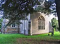
 St Andrew Welham - geograph.org.uk - 5023322.jpg 640 × 518; 104 KB
-
 St Andrew Welham main churchyard gate - geograph.org.uk - 5023323.jpg 640 × 479; 153 KB
-
 St Andrew Welham north end - geograph.org.uk - 5023324.jpg 640 × 473; 150 KB
-
 St Andrew Welham tower - geograph.org.uk - 5023325.jpg 566 × 640; 172 KB
-

-
 The Grange, Welham.jpg 4,000 × 3,000; 4.98 MB
-
 The Old Rectory, Welham.jpg 4,000 × 3,000; 3.85 MB
-
 The Old Red Lion - geograph.org.uk - 5234727.jpg 640 × 480; 54 KB
-
 The Old red Lion, Welham - geograph.org.uk - 6379593.jpg 3,776 × 2,520; 3.13 MB
-
 The Old Red Lion, Welham 01.jpg 4,000 × 3,000; 4.09 MB
-
 The Old Red Lion, Welham 02.jpg 4,000 × 3,000; 3.17 MB
-
 The River Welland near Welham - geograph.org.uk - 6379608.jpg 3,776 × 2,520; 3.24 MB
-
 Thorpe Langton Road - geograph.org.uk - 6301362.jpg 1,600 × 1,200; 512 KB
-
 Thorpe Langton Road at Birch Tree Farm - geograph.org.uk - 3394529.jpg 1,327 × 1,074; 318 KB
-
 Thorpe Langton Road into Welham - geograph.org.uk - 5023328.jpg 640 × 437; 80 KB
-

-
 Thorpe Langton Road west of Welham - geograph.org.uk - 6249968.jpg 1,920 × 1,280; 1.24 MB
-
 Thorpe Langton Road, Welham - geograph.org.uk - 6249963.jpg 1,824 × 1,114; 1.19 MB
-

-
 Top of the railway embankment - geograph.org.uk - 230270.jpg 640 × 480; 61 KB
-
 Track at Birch Tree Farm - geograph.org.uk - 3394528.jpg 2,722 × 2,036; 1.6 MB
-

-
 Tributary of the River Welland - geograph.org.uk - 3390834.jpg 3,887 × 2,955; 3.41 MB
-
 View of the village of Thorpe Langton - geograph.org.uk - 3351615.jpg 3,400 × 2,135; 2.18 MB
-
 Welham Churchyard - geograph.org.uk - 6298989.jpg 1,600 × 1,200; 712 KB
-

-

-
 Welham Lane towards Cranoe - geograph.org.uk - 5023309.jpg 640 × 486; 89 KB
-
 Welham Lane towards Cranoe - geograph.org.uk - 5023330.jpg 640 × 434; 65 KB
-
 Welham Lane towards Welham - geograph.org.uk - 5023310.jpg 640 × 483; 95 KB
-
 Welham Lane towards Welham - geograph.org.uk - 5023331.jpg 640 × 444; 75 KB
-
 Welham Lane towards Welham - geograph.org.uk - 5023334.jpg 640 × 470; 101 KB
-
 Welham Manor House and barns 01.jpg 4,000 × 3,000; 3.48 MB
-
 Welham Manor House and barns 02.jpg 4,000 × 3,000; 3.18 MB
-
 Welham Manor House and barns 03.jpg 4,000 × 3,000; 4.33 MB
-
-
 Welham Road descending into the Welland Valley - geograph.org.uk - 3391354.jpg 4,000 × 3,000; 3.52 MB
-
 Welham Road eastwards - geograph.org.uk - 5023305.jpg 640 × 426; 66 KB
-
 Welham Road heading towards Slawston - geograph.org.uk - 3391238.jpg 4,000 × 3,000; 3.33 MB
-
 Welham Road leading down to the Welland Valley - geograph.org.uk - 6379572.jpg 3,776 × 2,520; 3.27 MB
-
 Welham Road passes Birch Tree Farm - geograph.org.uk - 5023306.jpg 640 × 447; 64 KB
-
 Welham Road westwards - geograph.org.uk - 5023307.jpg 640 × 467; 88 KB
-
 Welham, Leicestershire - geograph.org.uk - 232584.jpg 640 × 480; 108 KB
-
 Welham-Bridge over the River Welland.jpg 4,000 × 2,678; 6.3 MB
-
 Winter snow on the fields - geograph.org.uk - 1151539.jpg 640 × 427; 60 KB
-
 A sharp bend in the road - geograph.org.uk - 572663.jpg 640 × 467; 131 KB
-
 Approaching Welham - geograph.org.uk - 572668.jpg 640 × 445; 116 KB
-
 Junction north of Welham, Leicestershire - geograph.org.uk - 572683.jpg 640 × 410; 109 KB
-
 Manor Farm in Welham, Leicestershire - geograph.org.uk - 570157.jpg 640 × 472; 119 KB
-
 The River Welland - geograph.org.uk - 570143.jpg 640 × 458; 126 KB


