Category:Weinstraße 29 (Forst an der Weinstraße)
Jump to navigation
Jump to search
| Object location | | View all coordinates using: OpenStreetMap |
|---|

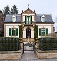
Weinstraße 29 villa
- Single storey neo-baroque villa with hipped mansard roof, 1880.
Media in category "Weinstraße 29 (Forst an der Weinstraße)"
The following 2 files are in this category, out of 2 total.
-
 029 2015 03 25 Kulturdenkmaeler Forst.jpg 2,172 × 2,301; 4.17 MB
-
 Forst an der Weinstr 03.jpg 1,600 × 1,200; 975 KB

