Category:Wednesbury
Jump to navigation
Jump to search
town in West Midlands, England  | |||||
| Upload media | |||||
| Instance of | |||||
|---|---|---|---|---|---|
| Location | Sandwell, West Midlands, England | ||||
 | |||||
English: Wednesbury is a market town in England's Black Country, part of the Sandwell metropolitan borough in the West Midlands, near the source of the River Tame. At the 2011 Census the town has a population of 37,817.(→Wednesbury)
Français : Wednesbury est une ville anglaise, située dans le district métropolitain de Sandwell, dans les Midlands de l'Ouest. Au moment du recensement de 2001, elle comptait habitants. (→Wednesbury)
Nederlands: Wednesbury is een plaats in het bestuurlijke gebied Sandwell, in het Engelse graafschap West Midlands. De plaats telt 24.337 inwoners en ligt in de streek Black Country. (→Wednesbury)
Norsk nynorsk: Wednesbury er ein marknadsby i grevskapet West Midlands i England. Han har kring 24 500 innbyggjarar og ligg i Black Country nær elva Tame. (→Wednesbury)
Polski: Wednesbury - miasto w Wielkiej Brytanii, w Anglii, w hrabstwie West Midlands. W 2001r. miasto to zamieszkiwało 24 337 osób. (→Wednesbury)
Română: Wednesbury este un oraș în comitatul West Midlands, regiunea omonimă, Anglia. Orașul se află în districtul metropolitan Sandwell. (→Wednesbury)
اردو: چرچ ہل، ویسٹ مڈلینڈز ( انگریزی: Wednesbury) انگلستان کا ایک رہائشی علاقہ جو West Midlands میں واقع ہے۔ (→چرچ ہل، ویسٹ مڈلینڈز)

Subcategories
This category has the following 20 subcategories, out of 20 total.
B
- Brunswick Park, Wednesbury (3 F)
C
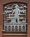
- Caryatid Gateway, Wednesbury (8 F)
I
- IKEA Birmingham (3 F)
K
- John Ashley Kilvert (6 F)
P
R
- Russell House, Wednesbury (2 F)
W
- Wednesbury enamels (10 F)
- Wednesbury Old Post Office (7 F)
- Wednesbury Parkway windmill (4 F)
- Wednesbury Police Station (4 F)
- Wednesbury reliefs (17 F)
- Wednesbury Town Hall (8 F)
- Wednesbury Town railway station (12 F)
- St Paul's Church, Wood Green (3 F)
Media in category "Wednesbury"
The following 199 files are in this category, out of 199 total.
-
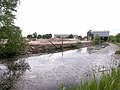
 Access to the Tame Valley Canal - geograph.org.uk - 1037829.jpg 480 × 640; 328 KB
-
 Aer Lingus plane seen from Albert Street in Wednesbury (26772359099).jpg 4,608 × 3,456; 5.46 MB
-

-
 Amazon - Patent Drive, Wednesbury (24656162428).jpg 4,608 × 3,456; 6.04 MB
-
 Amazon - Patent Drive, Wednesbury - sign (37813020024).jpg 4,608 × 3,456; 5.69 MB
-
 Amazon - Patent Drive, Wednesbury - signs - HGV Only - Staff & Visitors (24656112508).jpg 3,456 × 4,608; 5.65 MB
-
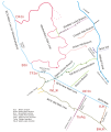 BCN canal map Wednesbury Oak.svg 330 × 390; 75 KB
-
 Bescot Walsall - Wednesbury freight geograph-2784752-by-Ben-Brooksbank.jpg 2,102 × 1,448; 1.18 MB
-
 Bill and Ben, waste transfer men - geograph.org.uk - 863969.jpg 640 × 480; 164 KB
-

-
 Bradley Branch Lock 1 beneath Midland Metro bridge QF.jpg 3,648 × 2,736; 2.99 MB
-
 Bradley Branch Lock 2 QF.jpg 3,648 × 2,736; 3.41 MB
-
 Crankhall Lane Bridge - geograph.org.uk - 2670.jpg 640 × 480; 62 KB
-
 Darlaston - The Black Horse pub - geograph.org.uk - 1853865.jpg 640 × 480; 167 KB
-
 Derelict industrial building near Darlaston - geograph.org.uk - 3264470.jpg 1,024 × 768; 188 KB
-
 Diamond Buses Wright Streetlite DF 32316.jpg 5,184 × 3,456; 4.45 MB
-
 Duright Engineering Ltd - Portway Road, Wednesbury (26773957799).jpg 4,608 × 3,456; 1.98 MB
-
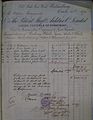 Facrtura 01.JPG 1,812 × 2,340; 2.51 MB
-
 Factura 02.JPG 2,052 × 2,508; 2.93 MB
-

-
-

-
 Gospel Oak PH at Gospel Oak - geograph.org.uk - 254898.jpg 640 × 480; 243 KB
-
 Guns Village Metro Station - geograph.org.uk - 1423113.jpg 640 × 426; 315 KB
-
 Guns Village Station - geograph.org.uk - 369672.jpg 640 × 480; 155 KB
-
 Hall End Methodist Church - geograph.org.uk - 198720.jpg 640 × 480; 56 KB
-
 Hall End Tavern - geograph.org.uk - 198688.jpg 640 × 480; 50 KB
-
 Hallens Drive, Wednesbury - MECCA (24656299908).jpg 4,608 × 3,456; 5.76 MB
-
 Hallens Drive, Wednesbury - road sign (37813055554).jpg 4,608 × 3,456; 6.29 MB
-

-
 Hallens Drive, Wednesbury - Wanted HGV Drivers (37641362435).jpg 4,608 × 3,456; 5.46 MB
-
 Heath Lane Hospital - geograph.org.uk - 198690.jpg 640 × 480; 54 KB
-
 High School (27172108451).jpg 3,116 × 4,674; 11.17 MB
-
 Holyhead Primary Academy - Holyhead Road, Wednesbury (24675097068).jpg 4,608 × 3,456; 6.33 MB
-
 Holyhead Primary Academy - Holyhead Road, Wednesbury (37659614565).jpg 4,608 × 3,456; 6.4 MB
-
 Holyhead Primary Academy - Holyhead Road, Wednesbury (38491144666).jpg 4,608 × 3,456; 6.44 MB
-
 Holyhead Primary Academy - Holyhead Road, Wednesbury - school sign (37831320424).jpg 4,608 × 3,456; 6.33 MB
-
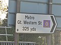 Holyhead Road, Wednesbury - sign - Metro Gt. Western St 325 yds (37653747885).jpg 4,608 × 3,456; 5.89 MB
-
 Horse and Jockey.jpg 6,000 × 4,000; 6.11 MB
-

-
 King's Hill - Old Park Road - geograph.org.uk - 1853866.jpg 640 × 480; 185 KB
-
 Lea Brook Methodist Church, Wednesbury - geograph.org.uk - 254860.jpg 640 × 480; 260 KB
-
 Lower Ocker Branch - geograph.org.uk - 2685.jpg 640 × 480; 71 KB
-
 Map of Staffordshire OS Map name 063-SW, Ordnance Survey, 1883-1894.jpg 5,339 × 3,593; 5.78 MB
-
 Map of Staffordshire OS Map name 063-SW, Ordnance Survey, 1883-1894.tiff 5,339 × 3,593; 54.88 MB
-
 Midland Metro in a snowstorm.jpg 1,632 × 1,224; 329 KB
-
 Morrisons Wednesbury Cafe - Noel (24646711248).jpg 3,968 × 2,240; 2.66 MB
-
 Morrisons, Wednesbury - geograph.org.uk - 863535.jpg 640 × 480; 190 KB
-
 NewMetroLivery.jpg 800 × 600; 113 KB
-
 No through road under the Midland Metro - geograph.org.uk - 255388.jpg 550 × 437; 185 KB
-
 Oakeswell, Wednesbury - geograph.org.uk - 41573.jpg 610 × 385; 46 KB
-
 Old Blue Ball Public House.jpg 6,000 × 4,000; 9.24 MB
-
 Open ground, Wednesbury Oak - geograph.org.uk - 1483621.jpg 640 × 480; 127 KB
-
 Patent Drive, Wednesbury - Esso petrol station (37641192365).jpg 4,608 × 3,456; 5.87 MB
-
 Patent Drive, Wednesbury - mouse (38472848776).jpg 4,608 × 3,456; 6.04 MB
-
 Patent Drive, Wednesbury - road sign (37813089364).jpg 4,608 × 3,456; 6.03 MB
-
 Patent Drive, Wednesbury - roundabout near Hallens Drive (38528497581).jpg 4,608 × 3,456; 6.06 MB
-
 Patent Drive, Wednesbury - Trident Drive - Britannia Park - Folkes (38472700586).jpg 4,608 × 3,456; 3.26 MB
-

-

-
 Pro Clean - Victoria Street and Stafford Street, Wednesbury (38516322822).jpg 4,608 × 3,456; 2.68 MB
-
 Pro Clean - Victoria Street and Stafford Street, Wednesbury - tankers (26772111959).jpg 4,608 × 3,456; 6.46 MB
-
 Pro Clean - Victoria Street and Stafford Street, Wednesbury - tankers (37660170195).jpg 4,608 × 3,456; 6.17 MB
-
 Pro Clean - Victoria Street and Stafford Street, Wednesbury - tankers (38491679646).jpg 4,608 × 3,456; 6.06 MB
-
 Queen Anne - Holyhead Road, Wednesbury (24675036818).jpg 4,608 × 3,456; 6.11 MB
-
 Ricardo tank.jpg 427 × 193; 8 KB
-
 Ridgeacre Branch Canal - geograph.org.uk - 39400.jpg 640 × 480; 152 KB
-
 Rocket Pool - geograph.org.uk - 589727.jpg 640 × 480; 124 KB
-
 Rocket Pool Bradley - geograph.org.uk - 589736.jpg 480 × 640; 154 KB
-

-

-

-
 Shockers Wines - Holyhead Road, Wednesbury (38515743662).jpg 4,608 × 3,456; 6.01 MB
-

-
 St Luke, Mesty Croft, Wednesbury - geograph.org.uk - 1608592.jpg 640 × 473; 64 KB
-
 St Mary on the Hill - geograph.org.uk - 589802.jpg 640 × 480; 107 KB
-
 St Mary's Wednesbury.JPG 2,272 × 3,200; 1.37 MB
-

-
 Swanpool Medical Centre - geograph.org.uk - 299968.jpg 629 × 478; 90 KB
-
 T.H. Cooper, Wednesbury - record sleeve.jpg 2,648 × 2,547; 2.15 MB
-
 Tame near Hill Top Wednesbury.JPG 1,715 × 1,286; 446 KB
-
 The beginnings of Wednesbury - geograph.org.uk - 864957.jpg 480 × 585; 235 KB
-

-
 The former St James Schools - St James Street, Wednesbury (37671592225).jpg 4,608 × 3,456; 6.31 MB
-
 The former St James Schools - St James Street, Wednesbury (37671621145).jpg 4,608 × 3,456; 6.11 MB
-
 The former St James Schools - St James Street, Wednesbury (37671638535).jpg 4,608 × 3,456; 1.77 MB
-
 The former St James Schools - St James Street, Wednesbury (37842733234).jpg 4,608 × 3,456; 2.89 MB
-
 The former St James Schools - St James Street, Wednesbury (38503045346).jpg 4,608 × 3,456; 6.28 MB
-

-
 The Parish Church of St. James the Great - St James Street, Wednesbury (37842909144).jpg 4,608 × 3,456; 6.47 MB
-
 The Parish Church of St. James the Great - St James Street, Wednesbury (37842947614).jpg 4,608 × 3,456; 5.94 MB
-

-

-

-
 The Patent Shaft Gates - roundabout on Dudley Street, Wednesbury (44616635204) (cropped).jpg 3,408 × 1,917; 3.09 MB
-
 The Patent Shaft Gates - roundabout on Dudley Street, Wednesbury (44616635204).jpg 4,608 × 3,456; 6.06 MB
-
 The Vintage Life Gift Shop - Holyhead Road, Wednesbury (38473569626).jpg 3,456 × 4,608; 6.34 MB
-
 The Vintage Life Gift Shop - Holyhead Road, Wednesbury (38497588112).jpg 4,608 × 3,456; 6.35 MB
-
 The world is not enough. - geograph.org.uk - 999760.jpg 640 × 480; 69 KB
-
 Vicarage Road, Hall End - geograph.org.uk - 198721.jpg 640 × 480; 51 KB
-
 Walsall Canal - Wednesbury (26768943179).jpg 4,608 × 3,456; 2.94 MB
-
 Walsall Canal - Wednesbury (37657308895).jpg 4,608 × 3,456; 6.42 MB
-
 Walsall Canal - Wednesbury - Canada geese (26768908119).jpg 4,608 × 3,456; 5.74 MB
-
 Walsall Canal - Wednesbury - gate (37657338935).jpg 4,608 × 3,456; 6.02 MB
-
 Walsall Canal - Wednesbury - gate to Hallens Drive (38513254512).jpg 4,608 × 3,456; 6.04 MB
-
 Walsall Canal - Wednesbury - Midland Metro bridge (26768953139).jpg 4,608 × 3,456; 2.78 MB
-
 Walsall Canal - Wednesbury - Monway Bridge (26769580359).jpg 4,608 × 3,456; 6.41 MB
-
 Walsall Canal - Wednesbury - Monway Bridge (37657877715).jpg 4,608 × 3,456; 6.37 MB
-
 Walsall Canal - Wednesbury - Monway Bridge (38488972386).jpg 4,608 × 3,456; 5.81 MB
-
 Walsall Canal - Wednesbury - Monway Bridge - electricity pylon (38545263021).jpg 4,608 × 3,456; 6.08 MB
-
 Walsall Canal - Wednesbury - Monway Bridge - sign (37657848065).jpg 4,608 × 3,456; 6.21 MB
-
 Walsall Canal - Wednesbury - Monway Bridge - steps (38513820822).jpg 4,608 × 3,456; 2.29 MB
-
 Walsall Canal - Wednesbury - sign (38513377902).jpg 4,608 × 3,456; 6.27 MB
-
 Walsall Canal - Wednesbury - sign - Private Fishing - No fishing (38544730791).jpg 3,456 × 4,608; 6.23 MB
-
 Walsall Canal - Wednesbury - Willingsworth Hall Bridge (24673212648).jpg 4,608 × 3,456; 6.23 MB
-
 Walsall Canal - Wednesbury - Willingsworth Hall Bridge (37658104755).jpg 4,608 × 3,456; 6.14 MB
-
 Walsall Canal - Wednesbury - Willingsworth Hall Bridge (37829725744).jpg 4,608 × 3,456; 6 MB
-
 Walsall Canal - Wednesbury - Willingsworth Hall Bridge (38489517616).jpg 4,608 × 3,456; 6.18 MB
-
 Walsall Canal - Wednesbury - Willingsworth Hall Bridge (38545655301).jpg 4,608 × 3,456; 5.96 MB
-

-

-
 Walsall Canal - Wednesbury - Willingsworth Hall Bridge - sign (37829648934).jpg 4,608 × 3,456; 6.3 MB
-

-
 Walsall Canal - Wednesbury - Willingsworth Hall Bridge - steps (26769801889).jpg 4,608 × 3,456; 6.49 MB
-
 Warburtons, Wednesbury - Big Spring Clean 2010 (4763849530).jpg 733 × 463; 145 KB
-
 Wednesbury - the High Street.jpg 640 × 426; 82 KB
-
 Wednesbury 2010..jpg 1,781 × 1,063; 168 KB
-
 Wednesbury as a manufacturing and commercial centre (1918) (14586560228).jpg 2,752 × 1,752; 679 KB
-
 Wednesbury as a manufacturing and commercial centre (1918) (14770851254).jpg 1,536 × 2,324; 481 KB
-
 Wednesbury as a manufacturing and commercial centre (1918) (14772879572).jpg 1,896 × 3,428; 480 KB
-
 Wednesbury Bus Station - geograph.org.uk - 863432.jpg 640 × 480; 227 KB
-
 Wednesbury Bus Station Clock.jpg 2,600 × 4,448; 3.93 MB
-
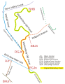 Wednesbury Canal Map SO99SE.svg 700 × 900; 130 KB
-

-
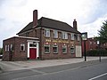
 Wednesbury Fire Station - geograph.org.uk - 589830.jpg 640 × 480; 107 KB
-
 Wednesbury Great Western Street Tram Stop - sign (38540921771).jpg 4,608 × 3,456; 5.38 MB
-

-
 Wednesbury Herald advertising.jpg 760 × 309; 293 KB
-
 Wednesbury industry - geograph.org.uk - 864986.jpg 480 × 596; 248 KB
-
 Wednesbury Market - geograph.org.uk - 589754.jpg 640 × 480; 145 KB
-
 Wednesbury Museum - 2016-11-30 - Andy Mabbett - 10.jpg 3,872 × 2,592; 4.7 MB
-
 Wednesbury Museum - 2016-11-30 - Andy Mabbett - 11.jpg 3,872 × 2,592; 4.68 MB
-
 Wednesbury Museum - 2016-11-30 - Andy Mabbett - 12.jpg 3,872 × 2,592; 4.87 MB
-
 Wednesbury Museum - 2016-11-30 - Andy Mabbett - 13.jpg 3,872 × 2,592; 4.82 MB
-
 Wednesbury Museum - 2016-11-30 - Andy Mabbett - 14.jpg 3,872 × 2,592; 4.85 MB
-
 Wednesbury Museum - 2016-11-30 - Andy Mabbett - 15.jpg 3,872 × 2,592; 4.76 MB
-
 Wednesbury Museum - 2016-11-30 - Andy Mabbett - 16.jpg 3,872 × 2,592; 4.81 MB
-
 Wednesbury Museum - 2016-11-30 - Andy Mabbett - 18.jpg 3,872 × 2,592; 4.79 MB
-
 Wednesbury Museum - 2016-11-30 - Andy Mabbett - 40.jpg 3,872 × 2,592; 4.87 MB
-
 Wednesbury Oak Canal demolished GKN works.jpg 3,648 × 2,736; 3.65 MB
-
 Wednesbury Oak Canal Loxdale Sidings.jpg 3,648 × 2,736; 3.72 MB
-
 Wednesbury Oak Canal rural.jpg 3,648 × 2,736; 3.63 MB
-
 Wednesbury Old Canal narrow.jpg 2,736 × 3,648; 3.58 MB
-
 Wednesbury Old Canal wide.jpg 3,648 × 2,736; 3.46 MB
-
 Wednesbury Parkway Tram Stop - path (24669382658).jpg 4,608 × 3,456; 6.51 MB
-
 Wednesbury Parkway Tram Stop - sign (38541573381).jpg 4,608 × 3,456; 5.91 MB
-

-
 Wednesbury Parkway Tram Stop - sign - Leabrook Road (26765747219).jpg 4,608 × 3,456; 6.19 MB
-
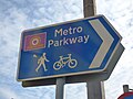 Wednesbury Parkway Tram Stop - sign - Metro Parkway (24669317578).jpg 4,608 × 3,456; 5.85 MB
-
 Wednesbury Parkway tram stop in 2006.jpg 640 × 480; 282 KB
-
 Wednesbury Parkway, Park and Ride - geograph.org.uk - 255390.jpg 407 × 640; 188 KB
-
 Wednesbury railway geograph-2168617.jpg 1,024 × 630; 287 KB
-
 Wednesbury Stores - geograph.org.uk - 1265739.jpg 640 × 480; 94 KB
-
 Wednesbury Town Centre Clock - geograph.org.uk - 991935.jpg 480 × 640; 86 KB
-
 Wednesbury town centre.jpg 5,504 × 3,096; 9.9 MB
-
 Wednesbury Windmill - geograph.org.uk - 717936.jpg 640 × 506; 94 KB
-
 Wednesfield Cenotaph - geograph.org.uk - 803661.jpg 640 × 480; 115 KB
-
 Wendsbury- 2014-04-19 15-00.jpg 640 × 426; 105 KB
-

-
 WS10 - Holyhead Road, Wednesbury (37659580645).jpg 4,608 × 3,456; 2 MB
-
 'Each footprint marks a step in time' - geograph.org.uk - 863475.jpg 640 × 480; 307 KB
-
 Approaching Hallens Lane roundabout - geograph.org.uk - 999823.jpg 640 × 480; 74 KB
-
 Aqueduct View - geograph.org.uk - 369711.jpg 640 × 480; 95 KB
-
 Black Lake - geograph.org.uk - 13614.jpg 640 × 426; 90 KB
-
 Bridge on the West Mids tramline - geograph.org.uk - 1483226.jpg 640 × 480; 138 KB
-
 Canal and Station at Dudley Port - geograph.org.uk - 361470.jpg 600 × 450; 184 KB
-
 Canal at Moxley - geograph.org.uk - 1483196.jpg 640 × 480; 149 KB
-
 Charlemont Cemetery - geograph.org.uk - 1424344.jpg 640 × 426; 379 KB
-
 Crossing the Metro Line - geograph.org.uk - 1423104.jpg 640 × 426; 340 KB
-
 Footpath at Gospel Oak - geograph.org.uk - 1439238.jpg 640 × 426; 453 KB
-
 Footpath to Sheepwash Urban Park - geograph.org.uk - 361564.jpg 600 × 450; 354 KB
-
 Heath Lane Cemetery - geograph.org.uk - 198727.jpg 640 × 480; 70 KB
-

-

-
 Ryland Aqueduct - geograph.org.uk - 361456.jpg 640 × 480; 233 KB
-
-
 Shops and Library, St Marks Road - geograph.org.uk - 299964.jpg 640 × 480; 87 KB
-
 Skewbald showjumper - geograph.org.uk - 361578.jpg 600 × 450; 276 KB
-
 Stone Cross - geograph.org.uk - 20056.jpg 610 × 458; 50 KB
-
 Stonemasons - geograph.org.uk - 198731.jpg 640 × 480; 53 KB
-
 Storm Clouds Over Tame Valley - geograph.org.uk - 369623.jpg 640 × 480; 105 KB
-
 Tame Valley Aqueduct - geograph.org.uk - 369700.jpg 640 × 480; 117 KB
-
 Tame Valley Canal - geograph.org.uk - 369739.jpg 640 × 480; 102 KB
-
 The Gough Arms, Hateley Heath - geograph.org.uk - 41603.jpg 610 × 458; 52 KB
-
 The Miners Arms - geograph.org.uk - 274635.jpg 600 × 450; 182 KB
-
 The View from Lidl - geograph.org.uk - 41568.jpg 609 × 387; 41 KB
-
 Tipton Sports Academy - geograph.org.uk - 254877.jpg 640 × 480; 196 KB
-
 Wellington Bridge, Great Bridge - geograph.org.uk - 410536.jpg 640 × 427; 114 KB
-
 Wood Green Pumping Station - geograph.org.uk - 206926.jpg 640 × 427; 84 KB

.jpg)
.jpg)
.jpg)
.jpg)
.jpg)


.jpg)


.jpg)
.jpg)
.jpg)


.jpg)
.jpg)
.jpg)
.jpg)

.jpg)
.jpg)
.jpg)
.jpg)
.jpg)
.jpg)


.jpg)


.jpg)
.jpg)
.jpg)
.jpg)
.jpg)
.jpg)

.jpg)
.jpg)
.jpg)
.jpg)
.jpg)


.jpg)
.jpg)
.jpg)
.jpg)
.jpg)


.jpg)


.jpg)
.jpg)
.jpg)
.jpg)
.jpg)
.jpg)
.jpg)
.jpg)
.jpg)
.jpg)
.jpg)
_(cropped).jpg)
.jpg)
.jpg)
.jpg)


.jpg)
.jpg)
.jpg)
.jpg)
.jpg)
.jpg)
.jpg)
.jpg)
.jpg)
.jpg)
.jpg)
.jpg)
.jpg)
.jpg)
.jpg)
.jpg)
.jpg)
.jpg)
.jpg)
.jpg)
.jpg)
.jpg)
.jpg)
.jpg)
.jpg)

_(14586560228).jpg)
_(14770851254).jpg)
_(14772879572).jpg)


.jpg)

.jpg)
.jpg)


.jpg)
.jpg)
.jpg)
.jpg)
.jpg)


.jpg)


