Category:Weatherboards in Oxfordshire
Jump to navigation
Jump to search
Ceremonial counties of England: Berkshire · Buckinghamshire · Cambridgeshire · Cheshire · Devon · Dorset · East Sussex · Essex · Gloucestershire · Greater London · Greater Manchester · Hampshire · Herefordshire · Hertfordshire · Isle of Wight · Kent · Lincolnshire · Norfolk · Northamptonshire · Oxfordshire · Shropshire · Somerset · Staffordshire · Suffolk · Surrey · Warwickshire · West Midlands · West Sussex · West Yorkshire · Worcestershire
City-counties:
Former historic counties:
Other former counties:
City-counties:
Former historic counties:
Other former counties:
Media in category "Weatherboards in Oxfordshire"
The following 48 files are in this category, out of 48 total.
-
 Clock on the top - geograph.org.uk - 1560507.jpg 640 × 427; 86 KB
-
 Church Hall, Bladon - geograph.org.uk - 1407978.jpg 480 × 640; 62 KB
-
 All finished - geograph.org.uk - 1546676.jpg 640 × 480; 74 KB
-
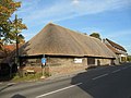
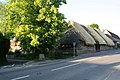
 Barn across the road - geograph.org.uk - 1377858.jpg 640 × 480; 77 KB
-
 Barn the other way - geograph.org.uk - 1359203.jpg 640 × 426; 65 KB
-
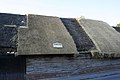
 Eaves on the barn - geograph.org.uk - 1368791.jpg 640 × 480; 76 KB
-
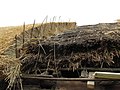
 Getting on with the work - geograph.org.uk - 1359195.jpg 640 × 426; 80 KB
-
 Nottingham Fee, Blewbury - geograph.org.uk - 1155704.jpg 640 × 426; 197 KB
-
 Old barn, Blewbury - geograph.org.uk - 1155776.jpg 426 × 640; 191 KB
-
 Pegged up the roof - geograph.org.uk - 1368796.jpg 640 × 480; 94 KB
-
 Thatching a barn - geograph.org.uk - 1359169.jpg 640 × 480; 60 KB
-
 Tree in the road - geograph.org.uk - 1359178.jpg 640 × 426; 95 KB
-
 Blewbury GreatTreeFarm barn SSE.jpg 1,280 × 647; 400 KB
-
 Blewbury GreatTreeFarm barn SSW.jpg 1,280 × 622; 382 KB
-
 Blewbury TurnpikeHouse SSE.jpg 1,280 × 598; 394 KB
-
 BrightwellBaldwin OldForge SE.jpg 1,280 × 847; 770 KB
-
 Chinnor 2010.jpg 1,024 × 683; 186 KB
-
 KnightonFarm barn.jpg 1,024 × 614; 315 KB
-
 Sitting on Mushrooms - geograph.org.uk - 1180622.jpg 640 × 426; 76 KB
-
 Thatched cottage, East Hagbourne - geograph.org.uk - 1779354.jpg 2,837 × 1,596; 1.92 MB
-
 East Hendred Village Pump - geograph.org.uk - 1308809.jpg 640 × 489; 74 KB
-

-
 Coombe End Farm - geograph.org.uk - 1386432.jpg 640 × 426; 201 KB
-
 GreatCoxwell ChapelHouse SW.jpg 1,280 × 1,280; 842 KB
-
 Ornate barn - geograph.org.uk - 722225.jpg 639 × 479; 214 KB
-
 Henley-on-Thames ReadingRd 273–281.jpg 1,280 × 1,215; 565 KB
-
 Project Timescape - geograph.org.uk - 1243207.jpg 640 × 427; 56 KB
-
 Old Granary - geograph.org.uk - 1670858.jpg 873 × 1,024; 319 KB
-
 Barn at Lilley Farm - geograph.org.uk - 856908.jpg 640 × 416; 97 KB
-
 Barns at English Farm - geograph.org.uk - 595110.jpg 640 × 477; 68 KB
-
 Barns at English Farm - geograph.org.uk - 595125.jpg 640 × 477; 81 KB
-
 Converted barn at English Farm - geograph.org.uk - 595118.jpg 640 × 477; 67 KB
-
 English Farm and its outbuildings - geograph.org.uk - 595121.jpg 640 × 477; 83 KB
-
 Nuffield EnglishFarm EastRange SSW.jpg 1,280 × 641; 357 KB
-
 Nuffield EnglishFarm EastRange WSW.jpg 1,280 × 720; 394 KB
-
 Nuffield EnglishFarm WestBarn west.jpg 1,275 × 1,280; 705 KB
-
 Nuffield HolyTrinity north.jpg 1,280 × 1,279; 703 KB
-
 River-Rowing-Museum-Henley.jpg 2,898 × 2,334; 3.79 MB
-
 Grey's Green Cricket Club - geograph.org.uk - 556639.jpg 640 × 477; 94 KB
-
 Plough cottage - geograph.org.uk - 1325049.jpg 640 × 426; 69 KB
-
 Thatched barn on Pound Lane - geograph.org.uk - 1709366.jpg 1,500 × 1,000; 165 KB
-
 Scot's Farm - geograph.org.uk - 1005666.jpg 640 × 427; 172 KB
-
 SuttonCourtenay HighSt LongBarn.jpg 1,280 × 1,280; 712 KB
-
 Barn at Manor Farm, Sydenham - geograph.org.uk - 39197.jpg 640 × 480; 122 KB
-
 Sydenham CrotonFarm BarnRuin.jpg 2,990 × 1,495; 1.58 MB
-
 Sydenham RydersFarmBarn.jpg 3,000 × 2,000; 2.37 MB
-
 A bus shelter in West Hendred - geograph.org.uk - 1743663.jpg 1,500 × 1,000; 167 KB
-
 Wytham YewTreeCottage.jpg 3,000 × 1,800; 1.92 MB


