Category:Wayside shrine Augstenweg, Koglhof
Jump to navigation
Jump to search
| Object location | | View all coordinates using: OpenStreetMap |
|---|
Media in category "Wayside shrine Augstenweg, Koglhof"
The following 7 files are in this category, out of 7 total.
-
 Wayside shrine Augstenweg, Koglhof 01.jpg 3,000 × 4,896; 6.49 MB
-
 Wayside shrine Augstenweg, Koglhof 02.jpg 2,864 × 4,824; 5.29 MB
-
 Wayside shrine Augstenweg, Koglhof 03.jpg 2,896 × 4,704; 5.92 MB
-
 Wayside shrine Augstenweg, Koglhof 04.jpg 2,760 × 4,880; 5.2 MB
-
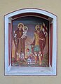 Wayside shrine Augstenweg, Koglhof 05 - Saints Florian and Anthony.jpg 2,920 × 4,032; 4.81 MB
-
 Wayside shrine Augstenweg, Koglhof 06 - Saint George.jpg 3,056 × 4,184; 5.18 MB
-
 Wayside shrine Augstenweg, Koglhof 07.jpg 2,827 × 2,782; 3.06 MB


