Category:Watkin Path
Jump to navigation
Jump to search

English: The Watkin path is route up Snowdon from the south side.
Media in category "Watkin Path"
The following 98 files are in this category, out of 98 total.
-
 Afon Cwm Llan from the Watkin Path - geograph.org.uk - 4087004.jpg 1,600 × 901; 513 KB
-
 Approach to Snowdon on Watkin Path - geograph.org.uk - 3931508.jpg 800 × 605; 111 KB
-
 Bethania toilets - geograph.org.uk - 1045423.jpg 640 × 480; 130 KB
-
 Bridge carrying the Watkin Path over the Afon Cwm Llan - geograph.org.uk - 6192533.jpg 5,110 × 3,832; 6.49 MB
-
 Bridge on the Watkin Path in Nantgwynant - geograph.org.uk - 6192465.jpg 4,000 × 3,000; 6.89 MB
-
 Bwlch y Saethau - geograph.org.uk - 1702236.jpg 1,600 × 1,200; 420 KB
-
 Bwlch y saethau and the Watkin Path - geograph.org.uk - 6193240.jpg 5,184 × 3,888; 7.01 MB
-
 Cow on the Watkin Path - geograph.org.uk - 1542843.jpg 640 × 427; 84 KB
-
 Crib Goch from Watkin Path - geograph.org.uk - 1449718.jpg 640 × 380; 57 KB
-
 Derelict remains on lower Watkin Path - geograph.org.uk - 4827794.jpg 640 × 428; 117 KB
-
 Fenced enclosure beside Watkin Path - geograph.org.uk - 3184058.jpg 1,500 × 1,125; 1.92 MB
-
 Feral Goats on the Watkins Path - geograph.org.uk - 1888887.jpg 2,288 × 1,712; 893 KB
-
 Foxgloves next to the Watkin Path - geograph.org.uk - 4301984.jpg 4,608 × 3,456; 5.02 MB
-
 Gate on the Watkin Path - geograph.org.uk - 1543026.jpg 640 × 427; 118 KB
-
 Gate on the Watkin Path in Cwm Llan - geograph.org.uk - 6192505.jpg 4,819 × 3,614; 6.67 MB
-
 Hafod-y-llan from the Watkin Path - geograph.org.uk - 4014703.jpg 2,560 × 1,593; 1.67 MB
-
 Hairy caterpillar on the Watkin Path - geograph.org.uk - 6192492.jpg 4,473 × 3,354; 4.59 MB
-
 Last stretch of the Watkin Path to Snowdon's summit - geograph.org.uk - 6193246.jpg 3,888 × 5,184; 6.19 MB
-
 Looking along the Watkin Path to Y Lliwedd - geograph.org.uk - 4167877.jpg 4,000 × 3,000; 3.2 MB
-
 Looking back to Snowdon from the Watkin Path - geograph.org.uk - 4167882.jpg 4,000 × 3,000; 3.54 MB
-
 Looking back up the Watkin Path - geograph.org.uk - 4167874.jpg 4,000 × 3,000; 4.17 MB
-
 Looking down the Watkin Path - geograph.org.uk - 4167879.jpg 4,000 × 3,000; 4.21 MB
-
 Looking down the Watkin Path towards Y Lliwedd - geograph.org.uk - 4167872.jpg 4,000 × 3,000; 3.12 MB
-
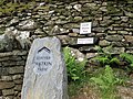
 Marker Stone on the Watkin Path - geograph.org.uk - 5414232.jpg 3,215 × 2,220; 2.06 MB
-
 Obelisk on the Watkin Path - geograph.org.uk - 1543169.jpg 640 × 427; 90 KB
-

-

-
 On the Watkin Path - geograph.org.uk - 2431904.jpg 3,968 × 2,976; 3.29 MB
-
 On the Watkin Path - geograph.org.uk - 3747940.jpg 640 × 480; 83 KB
-
 On the Watkin Path - geograph.org.uk - 4301980.jpg 4,608 × 3,456; 5.35 MB
-
 On the Watkin Path beside Plascwmllan - geograph.org.uk - 6192535.jpg 5,055 × 3,791; 5.55 MB
-
 On the Watkin Path in Cwm Llan - geograph.org.uk - 6192507.jpg 4,544 × 3,408; 5.36 MB
-
 On the Watkin Path in Nantgwynant - geograph.org.uk - 6192460.jpg 4,500 × 3,375; 7.7 MB
-
 On the Watkin Path in Nantgwynant - geograph.org.uk - 6192462.jpg 2,531 × 3,375; 5.02 MB
-
 Part of the Watkin Path - geograph.org.uk - 3747928.jpg 640 × 480; 83 KB
-
 Part of the Watkin Path in Cwm Llan - geograph.org.uk - 2086735.jpg 640 × 480; 102 KB
-
 Part of the Watkin Path in Cwm Llan - geograph.org.uk - 2086747.jpg 640 × 480; 125 KB
-

-
 Part of the Watkin Path up Snowdon - geograph.org.uk - 3747881.jpg 640 × 480; 77 KB
-
 Path along Watkin Road in Leicester - geograph.org.uk - 5540022.jpg 800 × 520; 113 KB
-
 Ruins from the Watkin Path - geograph.org.uk - 4015540.jpg 1,600 × 901; 396 KB
-
 Slab by the Watkin Path - geograph.org.uk - 4960360.jpg 600 × 800; 683 KB
-
 Snowdon from the Watkin Path - geograph.org.uk - 4282002.jpg 4,608 × 3,456; 4.94 MB
-
 Snowdon from the Watkin Path - geograph.org.uk - 4960287.jpg 800 × 600; 650 KB
-
 Snowdon from the Watkin Path - geograph.org.uk - 6192568.jpg 4,970 × 3,727; 6.35 MB
-
 Start of the Watkin Path - geograph.org.uk - 4282024.jpg 4,608 × 3,456; 5.56 MB
-
 Starting point of the Watkin Path - geograph.org.uk - 4018002.jpg 1,920 × 2,560; 2.23 MB
-
 Steep section on the Watkin Path - geograph.org.uk - 4020446.jpg 800 × 507; 152 KB
-
 Summit of Yr Wyddfa - geograph.org.uk - 1499504.jpg 640 × 406; 48 KB
-
 The path from the River Lostock to Watkin Road - geograph.org.uk - 3391847.jpg 2,560 × 1,920; 1.68 MB
-
 The start of the Watkin Path - geograph.org.uk - 5992143.jpg 4,032 × 3,024; 2.84 MB
-
 The Watkin Path - geograph.org.uk - 1543032.jpg 640 × 427; 125 KB
-
 The Watkin Path - geograph.org.uk - 1543037.jpg 640 × 427; 110 KB
-
 The Watkin Path - geograph.org.uk - 4596542.jpg 1,024 × 680; 280 KB
-
 The Watkin Path - geograph.org.uk - 5414144.jpg 3,424 × 2,256; 2.35 MB
-
 The Watkin Path about to enter Cwm Llan - geograph.org.uk - 4015677.jpg 4,320 × 2,432; 4.95 MB
-
 The Watkin Path and Y Lliwedd - geograph.org.uk - 82626.jpg 640 × 480; 82 KB
-
 The Watkin Path at Plascwmllan - geograph.org.uk - 5408359.jpg 3,416 × 2,256; 2.48 MB
-
 The Watkin Path at Plascwmllan - geograph.org.uk - 5408517.jpg 3,408 × 2,256; 2.23 MB
-
 The Watkin Path going up Cwm Llan - geograph.org.uk - 2431910.jpg 3,968 × 2,976; 2.7 MB
-
 Upgrades to the Watkin Path - geograph.org.uk - 6193253.jpg 5,184 × 3,888; 6.68 MB
-
 Upper Cwm Llan from the Watkin path - geograph.org.uk - 4087048.jpg 1,600 × 1,200; 334 KB
-
 Upper section of the Watkin Path approaching the bwlch - geograph.org.uk - 4281992.jpg 4,608 × 3,456; 6.4 MB
-
 View back down the Watkin Path towards Nantgwynant - geograph.org.uk - 6192479.jpg 5,184 × 3,888; 6.9 MB
-
 View back down the Watkin Path towards Y Lliwedd - geograph.org.uk - 6193255.jpg 4,953 × 3,715; 6.11 MB
-
 View from the Watkin Path - geograph.org.uk - 1543063.jpg 640 × 427; 57 KB
-
 View from the Watkin Path - geograph.org.uk - 1543081.jpg 640 × 427; 44 KB
-
 View from the Watkin Path - geograph.org.uk - 5414167.jpg 3,408 × 2,256; 1.79 MB
-
 View from the Watkin Path to Y Lliwedd - geograph.org.uk - 6193250.jpg 3,796 × 5,061; 6.68 MB
-
 View south from the Watkin Path towards Yr Aran - geograph.org.uk - 6192575.jpg 5,184 × 3,888; 6.27 MB
-

-
 View towards Y Lliwedd from the Watkin Path - geograph.org.uk - 5414182.jpg 3,416 × 2,248; 2.81 MB
-

-

-
 Waterfall to one side of the Watkin Path - geograph.org.uk - 2431900.jpg 3,968 × 2,976; 2.93 MB
-
 Waterfalls near the Watkin Path - geograph.org.uk - 2431906.jpg 3,968 × 2,976; 3.23 MB
-
 Watkin Path - geograph.org.uk - 4015939.jpg 4,320 × 2,432; 4.74 MB
-
 Watkin Path - geograph.org.uk - 4087009.jpg 1,600 × 901; 506 KB
-
 Watkin Path - geograph.org.uk - 4087042.jpg 1,600 × 901; 438 KB
-
 Watkin Path - Snowdon - geograph.org.uk - 1721.jpg 640 × 481; 51 KB
-
 Watkin Path above Nantgwynant - geograph.org.uk - 6192476.jpg 4,250 × 3,188; 7.05 MB
-
 Watkin Path and gate - geograph.org.uk - 4086995.jpg 1,600 × 901; 448 KB
-
 Watkin Path and quarries, Yr Wyddfa.jpg 4,320 × 2,432; 4.45 MB
-
 Watkin Path approaching The Gladstone Rock - geograph.org.uk - 4015749.jpg 4,320 × 2,432; 4.62 MB
-
 Watkin Path crossing Afon Cwm Llan - geograph.org.uk - 4015734.jpg 4,320 × 2,432; 4.71 MB
-
 Watkin Path in Cwm Llan - geograph.org.uk - 4301992.jpg 4,608 × 3,456; 5.45 MB
-
 Watkin Path marker - geograph.org.uk - 4596544.jpg 800 × 531; 120 KB
-

-
 Watkin Path to Bwlch y Saethau - geograph.org.uk - 6193249.jpg 3,630 × 4,841; 6.52 MB
-
 Watkin Path up Snowdon - geograph.org.uk - 4281941.jpg 4,608 × 3,456; 5.64 MB
-
 Watkin path up Snowdon - geograph.org.uk - 4281998.jpg 4,608 × 3,456; 5.13 MB
-
 Watkin Path up Snowdon from Bwlch y Saethau - geograph.org.uk - 4282004.jpg 4,608 × 3,456; 5.17 MB
-
 Watkin Path with valley, Yr Wyddfa.jpg 4,320 × 2,432; 4.49 MB
-
 Watkin Path, Yr Wyddfa.jpg 4,320 × 2,432; 4.54 MB
-
 Y Lliwedd from the Watkin Path - geograph.org.uk - 4281985.jpg 4,608 × 3,456; 5.57 MB
-
 Y Lliwedd from Watkin path.jpg 2,592 × 1,944; 997 KB
-
 Yr Aran from the Watkin Path - geograph.org.uk - 1938124.jpg 800 × 600; 181 KB
-
 Yr Aran from the Watkin Path. - geograph.org.uk - 4281971.jpg 4,608 × 3,456; 4.89 MB


