Category:Waterperry with Thomley
Jump to navigation
Jump to search
English: Waterperry with Thomley is a civil parish in South Oxfordshire. It includes the village of Waterperry (Ordnance Survey grid reference SP626066) and the abandoned former village of Thomley (OS Grid ref. SP629091). Thomley and Wateperry were separate civil parishes in 1957. The current single civil parish was formed at some time therafter.
civil parish in South Oxfordshire district, Oxfordshire, England | |||||
| Upload media | |||||
| Instance of | |||||
|---|---|---|---|---|---|
| Location | South Oxfordshire, Oxfordshire, South East England, England | ||||
| Population |
| ||||
 | |||||
Media in category "Waterperry with Thomley"
The following 164 files are in this category, out of 164 total.
-
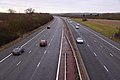
 1 mile to J8a, M40 - geograph.org.uk - 5648553.jpg 640 × 426; 62 KB
-
 A Barn Full of Bales - geograph.org.uk - 3218471.jpg 800 × 597; 123 KB
-
 A deer hide on the edge of Waterperry Wood - geograph.org.uk - 3731689.jpg 1,500 × 999; 266 KB
-
 A shady pool in Waterperry Garden covered in duck weed - geograph.org.uk - 3627049.jpg 3,648 × 2,736; 3.69 MB
-
 A stile on the Oxfordshire Way - geograph.org.uk - 3731686.jpg 1,500 × 999; 292 KB
-

-
 Baker Farm Bridge, M40 - geograph.org.uk - 2458438.jpg 640 × 324; 37 KB
-
 Bakers Farm Bridge, M40 - geograph.org.uk - 2690169.jpg 640 × 364; 39 KB
-
 Beside the M40 - geograph.org.uk - 3224533.jpg 2,560 × 1,920; 1.5 MB
-
 Bridge over the M40 at Waterperry - geograph.org.uk - 3719632.jpg 4,012 × 1,925; 1.66 MB
-

-
 Bridge over the M40 northbound - geograph.org.uk - 2900490.jpg 640 × 480; 54 KB
-
 Bridge over the M40 to Waterperry - geograph.org.uk - 3721401.jpg 1,500 × 999; 240 KB
-
 Bridge over the M40 Waterperry - geograph.org.uk - 2521876.jpg 1,597 × 1,094; 437 KB
-
 Bridleway around Waterperry Wood - geograph.org.uk - 6534790.jpg 3,024 × 4,032; 6.74 MB
-
 Bridleway by Waterperry Wood - geograph.org.uk - 1288906.jpg 640 × 480; 116 KB
-
 Car park at Waterperry garden centre - geograph.org.uk - 2521439.jpg 1,600 × 1,200; 599 KB
-
 Cows in the Meadow - geograph.org.uk - 4541171.jpg 1,024 × 656; 170 KB
-
 Dry maize stalks in a field near Worminghall - geograph.org.uk - 1721725.jpg 1,500 × 1,000; 218 KB
-
 Electricity Pylons near Waterperry - geograph.org.uk - 1724832.jpg 1,500 × 1,000; 110 KB
-
 Entering Worminghall - geograph.org.uk - 6274374.jpg 800 × 498; 80 KB
-
 Entrance to Townsend Farm - geograph.org.uk - 6274362.jpg 800 × 600; 124 KB
-
 Family tree - geograph.org.uk - 3482055.jpg 2,048 × 1,536; 536 KB
-
 Field and Pylons - geograph.org.uk - 3218452.jpg 1,024 × 683; 155 KB
-
 Field edge by Ledall Cottage - geograph.org.uk - 3721427.jpg 1,500 × 999; 206 KB
-
 Field west of Waterperry Road - geograph.org.uk - 3857637.jpg 640 × 480; 126 KB
-
 Fields by the M40 - geograph.org.uk - 3224528.jpg 1,600 × 1,202; 446 KB
-
 Flat countryside north of Holton - geograph.org.uk - 1911533.jpg 640 × 427; 74 KB
-
 Flooded Fields - geograph.org.uk - 3218429.jpg 2,219 × 1,758; 1.21 MB
-
 Footbridge in Waterperry Gardens - geograph.org.uk - 4989574.jpg 1,500 × 1,125; 247 KB
-
 Footbridge near Park Farm - geograph.org.uk - 5953334.jpg 5,152 × 3,864; 4.83 MB
-
 Footbridge over M40 - geograph.org.uk - 5648545.jpg 640 × 375; 41 KB
-
 Footbridge over the M40 - geograph.org.uk - 3731668.jpg 1,500 × 999; 211 KB
-
 Footbridge over the M40 - geograph.org.uk - 3731671.jpg 1,500 × 999; 220 KB
-
 Footbridge over the M40 - geograph.org.uk - 4521565.jpg 640 × 427; 205 KB
-

-
 Footbridge, M40 near Park Farm - geograph.org.uk - 2690161.jpg 640 × 430; 52 KB
-
 Footpath across a drain - geograph.org.uk - 3731663.jpg 999 × 1,500; 487 KB
-
 Footpath by Park Farm - geograph.org.uk - 3731683.jpg 1,500 × 999; 420 KB
-
 Footpath by Park Farm - geograph.org.uk - 3731685.jpg 1,500 × 999; 262 KB
-
 Footpath by the edge of a field - geograph.org.uk - 3731666.jpg 1,500 × 999; 369 KB
-
 Footpath to Park Farm - geograph.org.uk - 3731678.jpg 1,500 × 999; 234 KB
-
 Footpath to Waterperry Common - geograph.org.uk - 3721420.jpg 1,500 × 999; 433 KB
-
 Formal garden at Waterperry - geograph.org.uk - 3482060.jpg 2,048 × 1,536; 524 KB
-
 Gates form stock pens, near Holton - geograph.org.uk - 1172105.jpg 640 × 480; 103 KB
-
 Gravelled track, Waterperry Wood - geograph.org.uk - 1288895.jpg 640 × 480; 316 KB
-
 Half mile from J8a, M40 - geograph.org.uk - 5648555.jpg 640 × 426; 47 KB
-
 Hay rolls by Park Farm - geograph.org.uk - 3731657.jpg 1,500 × 999; 225 KB
-
 Hay rolls in a barn - geograph.org.uk - 3731662.jpg 1,500 × 999; 213 KB
-
 Hedgerow in a field near Waterperry - geograph.org.uk - 1723370.jpg 1,000 × 1,500; 243 KB
-
 Herbaceous border at Waterperry - geograph.org.uk - 2332573.jpg 3,072 × 2,048; 1.89 MB
-
 Horse Jumps near Ledalls Cottage - geograph.org.uk - 3224540.jpg 2,276 × 1,665; 1.12 MB
-
 House View - geograph.org.uk - 3515612.jpg 800 × 600; 81 KB
-
 Junction of road from Waterperry village - geograph.org.uk - 2521431.jpg 1,600 × 1,200; 588 KB
-
 M40 crossed by Menmarsh Road - geograph.org.uk - 3445689.jpg 3,529 × 2,659; 1.04 MB
-
 M40 east of Park Farm - geograph.org.uk - 3444182.jpg 3,648 × 2,645; 1.01 MB
-
 M40 motorway - Baker's Farm bridge - geograph.org.uk - 3021469.jpg 640 × 480; 53 KB
-
 M40 motorway - Menmarsh Road bridge - geograph.org.uk - 3021475.jpg 640 × 480; 48 KB
-
 M40 motorway - Park Farm footbridge - geograph.org.uk - 3021471.jpg 640 × 480; 53 KB
-
 M40 Motorway, North of Waterperry - geograph.org.uk - 4521338.jpg 640 × 427; 214 KB
-
 M40 near Waterperry - geograph.org.uk - 2458424.jpg 640 × 406; 37 KB
-
 M40 Northbound - geograph.org.uk - 4521357.jpg 640 × 427; 221 KB
-
 M40 northbound - geograph.org.uk - 6191355.jpg 1,024 × 684; 282 KB
-
 M40 northbound - geograph.org.uk - 6191364.jpg 1,024 × 684; 188 KB
-
 M40 northbound - geograph.org.uk - 6191371.jpg 1,024 × 684; 200 KB
-
 M40 northbound towards Bicester - geograph.org.uk - 2900488.jpg 640 × 480; 42 KB
-
 M40 south near Junction 8A - geograph.org.uk - 2831089.jpg 640 × 481; 37 KB
-
 M40 south near Townsend Farm - geograph.org.uk - 2831084.jpg 640 × 481; 46 KB
-
 M40 south passing under footbridge - geograph.org.uk - 2831061.jpg 640 × 480; 41 KB
-
 M40 southbound near Bakers Farm - geograph.org.uk - 2831076.jpg 640 × 481; 48 KB
-
 M40 southbound nearing junction 8A (3) - geograph.org.uk - 2213051.jpg 640 × 480; 326 KB
-
 M40 southbound, near Junction 8A - geograph.org.uk - 3067768.jpg 3,008 × 2,000; 4.1 MB
-
 M40 view North - geograph.org.uk - 1175382.jpg 640 × 480; 57 KB
-
 M40 west of Baker's Farm - geograph.org.uk - 3444175.jpg 3,648 × 2,736; 1.89 MB
-
 M40 west of Waterperry - geograph.org.uk - 3125925.jpg 3,545 × 2,732; 1.67 MB
-
 M40, North of Oxford Services - geograph.org.uk - 4521315.jpg 640 × 427; 227 KB
-
 M40, overbridge near Field Farm - geograph.org.uk - 2458452.jpg 640 × 300; 23 KB
-
 M40, southbound - geograph.org.uk - 5648550.jpg 640 × 391; 53 KB
-
 M40, southbound - geograph.org.uk - 5648551.jpg 640 × 378; 52 KB
-
 M40, southbound - geograph.org.uk - 5648554.jpg 640 × 414; 58 KB
-
 Menmarsh Road Bridge, M40 - geograph.org.uk - 5648543.jpg 640 × 404; 48 KB
-
 Minor road overbridge, M40 motorway - geograph.org.uk - 3021466.jpg 640 × 480; 65 KB
-
 National Cycle Route 57 - geograph.org.uk - 6274366.jpg 800 × 600; 181 KB
-
 National Cycle Route 57 - geograph.org.uk - 6274369.jpg 800 × 600; 166 KB
-
 New Barn, Waterperry - geograph.org.uk - 3216208.jpg 2,178 × 1,539; 1,018 KB
-
 Northbound M40 - geograph.org.uk - 4521348.jpg 640 × 427; 204 KB
-
 Northbound M40 near Waterperry - geograph.org.uk - 4521329.jpg 640 × 427; 212 KB
-

-
 Northbound M40, Menmarsh Road Bridge - geograph.org.uk - 4521568.jpg 640 × 427; 218 KB
-
 Northbound M40, Oxfordshire - geograph.org.uk - 3610468.jpg 640 × 480; 209 KB
-
 Northbound M40, Waterperry Road Bridge - geograph.org.uk - 3610463.jpg 640 × 480; 241 KB
-
 Obelisk in Waterperry Gardens - geograph.org.uk - 3481769.jpg 1,536 × 2,048; 525 KB
-

-
 Overbridge, M40 near Waterperry - geograph.org.uk - 2690180.jpg 640 × 430; 54 KB
-
 Oxfordshire Junction - geograph.org.uk - 3529485.jpg 800 × 600; 158 KB
-

-
 Park Farm House - geograph.org.uk - 3218464.jpg 2,328 × 1,749; 1.38 MB
-
 Parson's Farm near Waterperry - geograph.org.uk - 1175388.jpg 640 × 480; 68 KB
-
 Path in Waterperry Gardens - geograph.org.uk - 4992459.jpg 1,500 × 1,125; 386 KB
-
 Path into the Hedge - geograph.org.uk - 5953293.jpg 4,339 × 3,470; 4.29 MB
-

-
 Ploughed field by Park Farm - geograph.org.uk - 3721433.jpg 4,000 × 2,664; 1.32 MB
-
 Ploughed field by Park Farm - geograph.org.uk - 3731655.jpg 1,500 × 999; 367 KB
-
 Power line near Waterperry - geograph.org.uk - 3857605.jpg 640 × 480; 101 KB
-
 River Thame at Waterstock - geograph.org.uk - 1911406.jpg 640 × 427; 91 KB
-
 River Thame near Waterstock - geograph.org.uk - 5655272.jpg 3,888 × 2,592; 3.22 MB
-

-
 Ruin and old houses, Waterperry - geograph.org.uk - 3864744.jpg 640 × 480; 166 KB
-
 Shut That Door - geograph.org.uk - 3216196.jpg 1,600 × 1,316; 568 KB
-
 Small Monument in the Orchard - geograph.org.uk - 4541177.jpg 640 × 427; 92 KB
-
 Smith's Lane, Waterperry Common - geograph.org.uk - 5953319.jpg 4,443 × 3,199; 5.24 MB
-
 Snowdrops in Waterperry Gardens - geograph.org.uk - 4992457.jpg 1,500 × 1,125; 385 KB
-
 Southbound carriageway of the M40 - geograph.org.uk - 2900485.jpg 640 × 471; 60 KB
-

-
 Stubble field near Town Farm - geograph.org.uk - 6274372.jpg 800 × 600; 121 KB
-

-
 The entrance to Waterperry Gardens - geograph.org.uk - 2521463.jpg 1,600 × 1,200; 579 KB
-
 The M40 heading southbound - geograph.org.uk - 4978555.jpg 1,500 × 1,125; 139 KB
-
 The M40 heading southbound - geograph.org.uk - 4978562.jpg 1,500 × 1,125; 124 KB
-
 The M40 looking northbound - geograph.org.uk - 3721396.jpg 1,500 × 999; 152 KB
-
 The M40 looking northbound - geograph.org.uk - 3731675.jpg 1,500 × 999; 183 KB
-
 The M40 looking southbound - geograph.org.uk - 3721394.jpg 1,500 × 999; 148 KB
-
 The M40 looking southbound - geograph.org.uk - 3731673.jpg 1,500 × 999; 151 KB
-
 The M40 Motorway near Waterperry - geograph.org.uk - 6274359.jpg 800 × 578; 98 KB
-
 The M40 runs under a road near Waterperry - geograph.org.uk - 4978565.jpg 1,500 × 1,125; 118 KB
-
 The M40 to London - geograph.org.uk - 1714978.jpg 1,500 × 1,000; 124 KB
-
 The northbound M40 by Waterperry - geograph.org.uk - 1724825.jpg 1,500 × 1,000; 132 KB
-
 The Oxfordshire Way by Waterperry - geograph.org.uk - 3731687.jpg 1,500 × 999; 204 KB
-

-
 The River Thame by Waterperry - geograph.org.uk - 4989577.jpg 1,500 × 1,125; 214 KB
-
 The River Thame by Waterperry Gardens - geograph.org.uk - 4992454.jpg 1,500 × 1,125; 301 KB
-
 The River Thame by Waterperry Gardens - geograph.org.uk - 4992456.jpg 1,500 × 1,125; 340 KB
-
 The River Thame in Waterperry Gardens - geograph.org.uk - 4989576.jpg 1,500 × 1,125; 303 KB
-
 The road to Waterperry - geograph.org.uk - 1723375.jpg 1,500 × 1,000; 142 KB
-
 The southbound M40 by Waterperry - geograph.org.uk - 1724827.jpg 1,500 × 1,000; 119 KB
-
 The teashop and gardens at Waterperry House - geograph.org.uk - 2521444.jpg 1,600 × 1,200; 551 KB
-
 The teashop at Waterperry - geograph.org.uk - 2521451.jpg 1,600 × 1,200; 407 KB
-
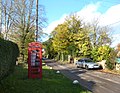 The Village Phone Box - geograph.org.uk - 3216127.jpg 2,253 × 1,746; 1.64 MB
-
 Townsend Farm House - geograph.org.uk - 2830640.jpg 3,648 × 2,736; 2.9 MB
-
 Townsend Farm, Waterperry - geograph.org.uk - 3216217.jpg 2,560 × 1,458; 1.08 MB
-
 Track to Park Farm House - geograph.org.uk - 3721423.jpg 1,500 × 999; 253 KB
-
 Trees at Waterperry Common - geograph.org.uk - 5953288.jpg 4,588 × 3,273; 2.46 MB
-
 View across the River Thame - geograph.org.uk - 2667320.jpg 3,872 × 2,592; 3.47 MB
-
 Virgin's Walk in Waterperry Gardens - geograph.org.uk - 4992460.jpg 1,500 × 1,125; 266 KB
-
 Water Gate - geograph.org.uk - 3218442.jpg 2,436 × 1,797; 1.57 MB
-
 Waterperry Area - geograph.org.uk - 3529462.jpg 800 × 600; 115 KB
-
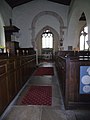 Waterperry Church Interior - geograph.org.uk - 3529481.jpg 600 × 800; 76 KB
-
 Waterperry Church View - geograph.org.uk - 3515619.jpg 591 × 800; 103 KB
-
 Waterperry Garden Centre - geograph.org.uk - 2830737.jpg 3,648 × 2,736; 1.98 MB
-
 Waterperry Gardens - geograph.org.uk - 3529454.jpg 800 × 600; 85 KB
-
 Waterperry House - geograph.org.uk - 2830719.jpg 3,648 × 2,736; 2.02 MB
-
 Waterperry House - geograph.org.uk - 3481755.jpg 2,048 × 1,536; 839 KB
-
 Waterperry House, Waterperry - geograph.org.uk - 3431700.jpg 640 × 459; 207 KB
-
 Waterperry Road - geograph.org.uk - 3857623.jpg 640 × 480; 116 KB
-
 Waterperry Road at stream bridge - geograph.org.uk - 3864756.jpg 640 × 480; 210 KB
-
 Waterperry Road Bridge, Northbound M40 - geograph.org.uk - 4521333.jpg 640 × 427; 209 KB
-
 Waterperry Road, Townsend - geograph.org.uk - 6274363.jpg 800 × 600; 142 KB
-
 Waterperry village at exit from the gardens. - geograph.org.uk - 2521471.jpg 1,600 × 1,200; 601 KB
-
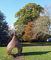 Wicker Pear Again - geograph.org.uk - 3216183.jpg 1,428 × 1,698; 1.2 MB
-
 Wicker Pear, Waterperry - geograph.org.uk - 3216177.jpg 2,031 × 1,632; 1.15 MB
-
 Willow trees near Waterperry - geograph.org.uk - 1723374.jpg 1,500 × 1,000; 286 KB
-
 Woodland drive in Waterperry Wood - geograph.org.uk - 1288875.jpg 640 × 480; 340 KB
-
 Yard at Waterperry Gardens - geograph.org.uk - 3857615.jpg 640 × 480; 111 KB
-
 Meadow near Bernwood Forest - geograph.org.uk - 223228.jpg 640 × 427; 117 KB


_-_geograph.org.uk_-_2213051.jpg)


