Category:Watermills in Nottinghamshire
Jump to navigation
Jump to search
Subcategories
This category has the following 8 subcategories, out of 8 total.
B
- Bath Mill, Mansfield (19 F)
C
- Caythorpe Mill (3 F)
M
- Hoveringham Mill (4 F)
P
- Pleasley Mills (32 F)
S
- Caudwell's Mill, Southwell (7 F)
T
- Town Mill Pub, Mansfield (5 F)
U
W
- Warsop Mill (14 F)
Media in category "Watermills in Nottinghamshire"
The following 32 files are in this category, out of 32 total.
-
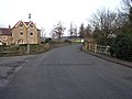 Carlton Mill - geograph.org.uk - 125617.jpg 640 × 480; 88 KB
-
 Carlton Mill - geograph.org.uk - 4492576.jpg 1,280 × 960; 1,008 KB
-
 Carlton Mill and the stream - geograph.org.uk - 2058058.jpg 800 × 551; 111 KB
-
 Dam And Sluices 5 Metres South West Of Pleasley Bridge (at sunset) (1).jpg 3,036 × 4,048; 4.41 MB
-
 Dam And Sluices 5 Metres South West Of Pleasley Bridge (at sunset) (3).jpg 4,048 × 3,036; 4.55 MB
-
 Dam And Sluices 5 Metres South West Of Pleasley Bridge (at sunset) (4).jpg 4,048 × 3,036; 4.02 MB
-

-

-
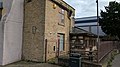
 Field Mill House, Grade II Listed Building (1).jpg 3,840 × 2,160; 3.74 MB
-
 Field Mill House, Grade II Listed Building (2).jpg 3,840 × 2,160; 2.71 MB
-
 Field Mill House, Grade II Listed Building (3).jpg 3,840 × 2,160; 2.77 MB
-
 Field Mill House, Grade II Listed Building (4).jpg 3,840 × 2,160; 3.92 MB
-
 Field Mill House, Grade II Listed Building (5).jpg 3,840 × 2,160; 3.05 MB
-
 Field Mill House, Grade II Listed Building (6).jpg 2,160 × 3,840; 3.22 MB
-
 Field Mill House, Grade II Listed Building (7).jpg 3,840 × 2,160; 3.12 MB
-
 Field Mill House, Grade II Listed Building (8).jpg 2,160 × 3,840; 3.87 MB
-
 Field Mill House, Grade II Listed Building (9).jpg 3,840 × 2,160; 3.27 MB
-
 Fiskerton Mill - geograph.org.uk - 641979.jpg 640 × 480; 98 KB
-
 Fiskerton Mill - geograph.org.uk - 647104.jpg 640 × 480; 108 KB
-
 Fiskerton Mill - geograph.org.uk - 647109.jpg 640 × 480; 109 KB
-
 Halam Mill - geograph.org.uk - 42018.jpg 640 × 480; 130 KB
-
 Halam Mill.jpg 1,280 × 960; 547 KB
-
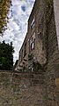
 Haughton Watermill - geograph.org.uk - 560145.jpg 427 × 640; 142 KB
-
 Hoveringham Mill and House.jpg 1,280 × 960; 588 KB
-
 Mill Bridge And Adjoining Weir, Warsop (4).jpg 3,840 × 2,160; 4.11 MB
-
 Monk's Mill, Scrooby - geograph.org.uk - 4259618.jpg 1,280 × 960; 578 KB
-
 Rolleston Mill.jpg 1,280 × 960; 462 KB
-
 Rufford Mill - geograph.org.uk - 109927.jpg 640 × 480; 106 KB
-
 Rufford Park Mill - geograph.org.uk - 561269.jpg 640 × 480; 76 KB
-
 Stanton's Mill And Adjoining Outbuildings, Bath Lane, Mansfield (1).jpg 3,805 × 2,550; 1.59 MB
-
 Stanton's Mill And Adjoining Outbuildings, Bath Lane, Mansfield (2).jpg 4,048 × 3,036; 2.57 MB
-
 Stanton's Mill And Adjoining Outbuildings, Bath Lane, Mansfield. Side View (3).jpg 4,048 × 3,036; 2.47 MB


_(1).jpg)
_(3).jpg)
_(4).jpg)
,_Grade_II_listed_building,_Pleasley,_Mansfield.jpg)

.jpg)
.jpg)
.jpg)
.jpg)
.jpg)
.jpg)
.jpg)
.jpg)
.jpg)


.jpg)


.jpg)
.jpg)
.jpg)