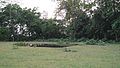
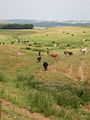
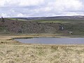
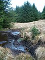
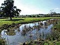
Category:Watering holes
Jump to navigation
Jump to search
small body of water  | |||||
| Upload media | |||||
| Subclass of | |||||
|---|---|---|---|---|---|
| Different from | |||||
| Said to be the same as | artificial pond | ||||
| |||||
Subcategories
This category has the following 5 subcategories, out of 5 total.
B
~
Media in category "Watering holes"
The following 139 files are in this category, out of 139 total.
-
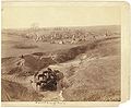
 A Lodge at the Mole National Park in Northern Ghana.jpg 4,928 × 3,264; 7.11 MB
-
 A watering place (2430718656).jpg 1,024 × 766; 482 KB
-
 A Watering Place (4903278175).jpg 1,024 × 775; 193 KB
-
 Aepyceros melampus petersi female 8014.jpg 5,616 × 3,744; 9.54 MB
-
 Ahaggar Mountains 1981 62.jpg 2,099 × 1,499; 672 KB
-
 American Bison with friends.jpg 2,816 × 2,112; 1.39 MB
-

-
 Augrabies-windpump-001.jpg 2,448 × 3,264; 1.87 MB
-
Augrabies-windpump-001.ogv 13 s, 360 × 430; 3.44 MB
-
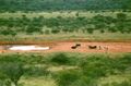 BotswanaSeroweWaterhole.jpg 800 × 528; 73 KB
-
 Cattle Watering Hole - geograph.org.uk - 92522.jpg 640 × 479; 156 KB
-
-

-
-
 Dehesa de Arcones 03.jpg 3,777 × 2,446; 6.43 MB
-
 Dehesa de Arcones.jpg 3,872 × 2,592; 6.44 MB
-
 Devil's Waterhole.jpg 1,984 × 1,488; 643 KB
-
 Down the water hole.jpg 1,172 × 786; 875 KB
-
 Dutchmans hole - geograph.org.uk - 1524065.jpg 640 × 480; 59 KB
-
-

-
 Endless Stations 115 - Budgie Tornado.jpg 4,400 × 2,940; 19.82 MB
-
 Grabill - Villa of Brule-1.jpg 5,113 × 3,771; 2.16 MB
-
 Grabill - Villa of Brule-2.jpg 4,920 × 4,044; 1.99 MB
-
 Green Pond, Fritham Plain, New Forest - geograph.org.uk - 69313.jpg 640 × 480; 95 KB
-
 HenryCo Waterhole.jpg 3,264 × 2,448; 2.31 MB
-
 Hooper's Spring - NARA - 516730.jpg 3,000 × 2,301; 1.44 MB
-
 Hot Watering Hole Action.jpg 640 × 480; 78 KB
-
 I'm bigger than you.jpg 5,184 × 3,456; 6.82 MB
-
 Koeien bij een plas water in New England, RP-F-2001-7-1036-9.jpg 8,258 × 3,528; 3.02 MB
-
 Lagunas y montañas del parque nacional general juan pablo peñaloza paramo batallon 14.jpg 4,608 × 3,456; 5.62 MB
-
 Loch am Torf, Barra.jpg 5,184 × 3,456; 10.76 MB
-
 Loxodonta africana group drinking in Tsavo East National Park (edited).jpg 1,398 × 1,049; 275 KB
-
 Lucas van Uden 002.jpg 1,266 × 875; 389 KB
-
 Medieval Cattle Watering Hole - geograph.org.uk - 1772525.jpg 2,560 × 1,900; 6.17 MB
-

-
 Milwaukee Public Museum February 2023 45 (Africa--Eastern Africa--Savanna Water Hole).jpg 6,000 × 4,000; 6.44 MB
-

-
 Milwaukee Public Museum November 2022 151 (Africa--Eastern Africa--Savanna Water Hole).jpg 6,000 × 4,000; 6.38 MB
-
 Milwaukee Public Museum November 2022 152 (Africa--Eastern Africa--Savanna Water Hole).jpg 6,000 × 4,000; 7.34 MB
-
 Milwaukee Public Museum November 2022 153 (Africa--Eastern Africa--Savanna Water Hole).jpg 6,000 × 4,000; 6.41 MB
-
 Mole National Park from the viewing platform.jpg 960 × 720; 175 KB
-
 Mole National Park Ghana.jpg 2,523 × 1,869; 2.83 MB
-
 Mole National Park, West Gonja (P1100356).jpg 4,608 × 3,456; 11.04 MB
-
 Mole National Park, West Gonja (P1100358).jpg 4,472 × 2,981; 9.62 MB
-
 Mole National Park, West Gonja (P1100359).jpg 4,608 × 3,456; 8.95 MB
-
 Montépilloy (60), abreuvoir.jpg 3,664 × 2,748; 2.4 MB
-
 Moorland pond - geograph.org.uk - 1009020.jpg 640 × 480; 144 KB
-
 Museum of Science, Boston, MA - IMG 3154.JPG 3,264 × 2,448; 2.61 MB
-
 Namib desert feral horses.jpg 3,456 × 1,584; 2.01 MB
-
 New Forest pond - geograph.org.uk - 1638909.jpg 640 × 480; 121 KB
-
 Nordiska taflor - no-nb digibok 2014031428009-117.jpg 4,203 × 3,244; 3.42 MB
-
 Oasis dans le sahara.jpg 1,080 × 1,440; 271 KB
-
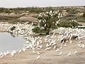
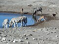
 Oryx at a Watering Hole.jpg 640 × 480; 73 KB
-
 Oryx gazella male 8054 b.jpg 5,484 × 3,656; 7.03 MB
-
 Oryx gazella male 8054.jpg 5,484 × 3,656; 6.66 MB
-
 Ottringham Ings - geograph.org.uk - 263421.jpg 640 × 496; 115 KB
-
 P 20170604 091803 SRES.jpg 8,192 × 6,144; 11.89 MB
-
 Parklands Stables, Walliswood - geograph.org.uk - 162910.jpg 640 × 435; 134 KB
-
 Peacocks (India. 2016).jpg 4,320 × 3,240; 6.05 MB
-
 Peck Pond on Hunshelf Hall Lane - geograph.org.uk - 1777104.jpg 3,296 × 2,472; 1.04 MB
-
 Pirineo Oscense, ganado 1993 04.jpg 1,026 × 657; 209 KB
-
 Pirineo Oscense, ganado 1993 05.jpg 1,068 × 707; 219 KB
-
 Pond near New House Farm - geograph.org.uk - 889797.jpg 640 × 427; 334 KB
-
 Pond near Railway Cottage - geograph.org.uk - 1248827.jpg 640 × 480; 97 KB
-

-
 Porcupine Creek, Porcupine Gorge National Park, North Queensland, Australia.jpg 4,160 × 3,120; 7.24 MB
-
 Pushkar watering hole.jpg 722 × 480; 92 KB
-
 Python sebae watering hole, Fathala Reserve, Karang, Senegal.jpg 2,816 × 2,112; 4.37 MB
-
 Robregordo (1988).jpg 1,048 × 700; 809 KB
-
 RSA Addo.jpg 900 × 589; 139 KB
-
 Sheep watering hole - geograph.org.uk - 395390.jpg 640 × 451; 150 KB
-
 Small pond on Aylestone Meadows - geograph.org.uk - 651284.jpg 640 × 419; 85 KB
-

-
 Small Water hole at Blakenhall Farm - geograph.org.uk - 395094.jpg 640 × 481; 170 KB
-
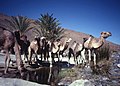
 Somali with camels.jpg 607 × 377; 92 KB
-
 Stagnant watering hole - geograph.org.uk - 402117.jpg 640 × 481; 154 KB
-
 StateLibQld 1 201923 Meadow water hole on the Barambah Estate, 1914.jpg 1,000 × 653; 119 KB
-
 Staying Still 22 - At Engine Hole.jpg 5,120 × 2,067; 10.67 MB
-
 Staying Still 23 - Silvery Bark.jpg 1,992 × 5,120; 9.85 MB
-
 Staying Still 26 - Dusky Blue.jpg 2,709 × 3,000; 5.17 MB
-
 Staying Still 27 - Last Light At Bough Shed Hole.jpg 4,854 × 3,000; 11.29 MB
-
 Staying Still 32 - At Combo Waterhole.jpg 5,120 × 2,852; 12.2 MB
-

-
 Texel - Hoge Berg - Zuid Haffel - ICE Photocompilation Viewing from ESE to WSW.jpg 5,485 × 2,030; 12.41 MB
-
 Texel - Hoge Berg - Zuid Haffel - View SE.jpg 6,048 × 4,032; 25.09 MB
-
 Texel - Hoge Berg - Zuid Haffel - View South.jpg 6,048 × 4,032; 23.28 MB
-
 Texel - Hoge Berg - Zuid Haffel - View SSE.jpg 6,048 × 4,032; 23.9 MB
-
 Texel - Hoge Berg - Zuid Haffel - View SSW.jpg 6,048 × 4,032; 23.57 MB
-
 Texel - Hoge Berg - Zuid Haffel - View SW.jpg 6,048 × 4,032; 25.05 MB
-

-
 The hole is full - geograph.org.uk - 738956.jpg 640 × 427; 62 KB
-
 The stream at Lonesome bridge - geograph.org.uk - 1654954.jpg 640 × 480; 102 KB
-
 Tigers at the water hole.jpg 480 × 606; 155 KB
-
 Tswana phrasebook banner Elephants.jpg 17,250 × 2,475; 12.42 MB
-
 TWed.jpg 3,072 × 2,304; 578 KB
-
 Urocolius indicus.jpg 1,024 × 637; 410 KB
-

-
 Val d'Aran 1999 68.jpg 1,024 × 676; 960 KB
-
 Valle de Arán, panorámicas (1999) 06.jpg 7,234 × 2,514; 9.86 MB
-
 Water body in Park.jpg 4,208 × 2,368; 4.19 MB
-
 Water body inside forest.jpg 4,208 × 2,368; 2.92 MB
-
 Water hole addo elephant park.jpg 2,048 × 1,536; 556 KB
-
 Water hole in Kaashidhoo kuruhinna tharaagandu dwelling.jpg 1,600 × 1,131; 802 KB
-
 Water Hole Windmill Kgalagadi Transfrontier Park.jpeg 1,600 × 1,200; 212 KB
-
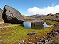
 Water Hole, Andes Mtns, Argentina (6279667963).jpg 1,504 × 1,023; 163 KB
-
 Water in rock cleft at Wadi Rum.jpg 3,388 × 2,372; 5.32 MB
-
 Watering Hole - geograph.org.uk - 1063607.jpg 640 × 480; 54 KB
-
 Watering hole - geograph.org.uk - 1334884.jpg 640 × 479; 112 KB
-
 Watering Hole - geograph.org.uk - 547216.jpg 640 × 426; 385 KB
-
 Watering hole view.jpg 1,920 × 1,080; 806 KB
-
 Watering Hole Viewing Place at Etosha Campsite.jpg 640 × 480; 93 KB
-
 Watering hole, Smithmoor Common - geograph.org.uk - 867300.jpg 640 × 427; 278 KB
-
 Watering Hole. - geograph.org.uk - 466054.jpg 640 × 480; 161 KB
-
 Watering hole.jpg 2,258 × 1,276; 738 KB
-
 Watering Hole^ - geograph.org.uk - 644019.jpg 640 × 480; 138 KB
-
 White rhino at watering hole in the morning.jpg 640 × 480; 77 KB
-
 Willy Pit Pond Warlingham - geograph.org.uk - 1215884.jpg 640 × 426; 124 KB
-
 Wéris abreuvoir.jpg 2,560 × 1,920; 2.47 MB
-
 A superior watering hole^ - geograph.org.uk - 257527.jpg 640 × 427; 130 KB
-
 Brook. - geograph.org.uk - 238314.jpg 480 × 640; 164 KB
-
 Cattle and spring, Dods - geograph.org.uk - 208867.jpg 480 × 640; 65 KB
-

-
 Dickey Pit, Croxton Heath - geograph.org.uk - 513002.jpg 640 × 427; 80 KB
-
 Locker Tarn - geograph.org.uk - 259592.jpg 640 × 479; 96 KB
-
 Ocknell Pond, New Forest - geograph.org.uk - 123661.jpg 640 × 480; 93 KB
-
 Old water hole - geograph.org.uk - 584191.jpg 640 × 480; 105 KB
-
 Peat pool in the forest. - geograph.org.uk - 113018.jpg 480 × 640; 200 KB
-
 Pond at Thorpe Farm, Skendleby - geograph.org.uk - 554415.jpg 640 × 480; 101 KB
-
 Pond at Thorpe Farm, Skendleby - geograph.org.uk - 554419.jpg 640 × 480; 87 KB
-
 Rushbush Pond, New Forest - geograph.org.uk - 203846.jpg 640 × 297; 76 KB
-
 Shepton Bridge, New Forest - geograph.org.uk - 35952.jpg 480 × 640; 203 KB
-
 Water Hole - geograph.org.uk - 118013.jpg 640 × 480; 146 KB
-
 Watering hole near Hickling - geograph.org.uk - 257448.jpg 640 × 427; 108 KB
-
 Wherwell - Watering Hole - geograph.org.uk - 695173.jpg 640 × 479; 103 KB
-
-

-
 السياحة بالاهواز.jpg 403 × 268; 27 KB
-
 تربية الجمال بالاهواز.jpg 403 × 316; 35 KB

.jpg)
.jpg)


.jpg)


.jpg)
.jpg)
.jpg)
.jpg)
.jpg)


.jpg)
.jpg)
.jpg)
,_abreuvoir.jpg)


.jpg)


.jpg)


_watch_African_elephants_drink_from_a_watering_hole_while_on_safari_in_Mombasa.jpg)


.jpg)


,_Elephant_Sands,_Botsuana,_2018-07-28,_DD_114-117_PAN.jpg)
_06.jpg)