Category:Water-cum-Jolly Dale
Jump to navigation
Jump to search
Media in category "Water-cum-Jolly Dale"
The following 44 files are in this category, out of 44 total.
-
 Below Cressbrook Hall - geograph.org.uk - 2911037.jpg 4,000 × 2,672; 2.53 MB
-
 Colourful climbers - geograph.org.uk - 569414.jpg 426 × 640; 66 KB
-
 Crag, path and river - geograph.org.uk - 2839121.jpg 1,024 × 768; 295 KB
-

-
 Cressbrook Dale - panoramio - PJMarriott.jpg 2,048 × 1,536; 916 KB
-
 Cressbrook Dale - panoramio.jpg 2,048 × 1,536; 1.18 MB
-
 Cressbrook, Water-cum-Jolly Dale, cliffs by the Wye.jpg 4,000 × 2,660; 1.75 MB
-
 Cressbrook, Water-cum-Jolly Dale, cliffs near the mill.jpg 4,000 × 2,660; 2.28 MB
-
 Cressbrook, Water-cum-Jolly Dale, climbers on cliffs by the Wye.jpg 2,002 × 3,000; 1.97 MB
-
 Cressbrook, Water-cum-Jolly Dale, Millpond 1.jpg 4,000 × 2,660; 3.01 MB
-
 Cressbrook, Water-cum-Jolly Dale, Millpond 2.jpg 4,000 × 2,245; 2.88 MB
-
 Cressbrook, Water-cum-Jolly Dale, view towards the mill.jpg 4,000 × 2,660; 3.03 MB
-
 From the Monsal trail - geograph.org.uk - 5094219.jpg 3,264 × 2,448; 3.02 MB
-
 Limestone crag by the River Wye - geograph.org.uk - 2839101.jpg 829 × 1,024; 291 KB
-
 Miller's Dale - geograph.org.uk - 4803067.jpg 640 × 426; 96 KB
-
 Millpond (30238911752).jpg 6,032 × 4,032; 16.57 MB
-
 Monsal Dale Water-come-Jolly Derbyshire England.jpg 1,073 × 843; 179 KB
-
 Monsal Dale, Water-come-Jolly, Derbyshire, England-LCCN2002696710.jpg 3,691 × 2,770; 3.64 MB
-
 Monsal Dale, Water-come-Jolly, Derbyshire, England-LCCN2002696710.tif 3,691 × 2,770; 29.25 MB
-
 River Wye - geograph.org.uk - 2422400.jpg 427 × 640; 272 KB
-
 River Wye - geograph.org.uk - 2855262.jpg 640 × 418; 236 KB
-
 River Wye - geograph.org.uk - 4068640.jpg 640 × 427; 405 KB
-
 River Wye above Cressbrook Mill - geograph.org.uk - 150325.jpg 640 × 490; 211 KB
-
 River Wye above Cressbrook Mill - geograph.org.uk - 2290822.jpg 768 × 1,024; 284 KB
-

-
 River Wye at Cressbrook - geograph.org.uk - 1081575.jpg 640 × 480; 77 KB
-
 River Wye gorge at Water cum Jolly - geograph.org.uk - 181664.jpg 640 × 480; 64 KB
-
 River Wye in Water-cum-Jollydale - geograph.org.uk - 3665551.jpg 2,560 × 1,920; 1.63 MB
-
 River Wye in winter - geograph.org.uk - 3296729.jpg 3,648 × 2,736; 4.95 MB
-
 River Wye near Cressbrook Mill - geograph.org.uk - 1704932.jpg 800 × 600; 178 KB
-
 River Wye near Cressbrook Mill - geograph.org.uk - 2856342.jpg 4,608 × 3,072; 3.51 MB
-
 River Wye near Cressbrook Mill - geograph.org.uk - 450140.jpg 640 × 480; 104 KB
-
 River Wye upstream of Cressbrook - geograph.org.uk - 2839114.jpg 1,024 × 768; 313 KB
-
 Swan on the River Wye (2) - geograph.org.uk - 1894530.jpg 480 × 640; 122 KB
-
 The Wye valley at Water-cum-Jolly - geograph.org.uk - 2845293.jpg 3,872 × 2,592; 5.63 MB
-
 Water cum Jolly on the River Wye - geograph.org.uk - 181654.jpg 640 × 480; 68 KB
-
 Water- cum- Jolly Dale - geograph.org.uk - 4279453.jpg 4,912 × 3,264; 2.16 MB
-
 Water-cum-Jolly Dale - geograph.org.uk - 1081584.jpg 640 × 480; 79 KB
-
 Water-cum-Jolly Dale from Monsal Trail, Peak District, Derbyshire (8120050970).jpg 2,592 × 1,944; 2.36 MB
-
 Water-cum-Jolly Dale from the Monsal Trail - geograph.org.uk - 6134258.jpg 1,024 × 683; 184 KB
-
 Water-cum-Jolly Dale, Monsal Trail, Peak District, Derbyshire (8120022347).jpg 2,592 × 1,944; 1.92 MB
-
 Weir at Water cum Jolly Dale - geograph.org.uk - 2833828.jpg 4,000 × 3,000; 2.59 MB
-
 Weir at Water cum Jolly Dale, River Wye - geograph.org.uk - 1366007.jpg 480 × 640; 142 KB
-
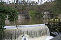 Weir by Cressbrook Mill - geograph.org.uk - 347699.jpg 640 × 427; 111 KB


.jpg)


_-_geograph.org.uk_-_1894530.jpg)


.jpg)

.jpg)


