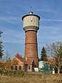
Category:Wasserturm Dahme/Mark
Jump to navigation
Jump to search
| Object location | | View all coordinates using: OpenStreetMap |
|---|
This is the category of the Brandenburger Baudenkmal (cultural heritage monument) with the ID 09105718 (Wikidata)
|
| Upload media | |||||
| Instance of | |||||
|---|---|---|---|---|---|
| Location | Dahme/Mark, Amt Dahme/Mark, Teltow-Fläming District, Brandenburg, Germany | ||||
| Heritage designation | |||||
 | |||||
Media in category "Wasserturm Dahme/Mark"
The following 4 files are in this category, out of 4 total.
-
 Dahme Mark Wasserturm.jpg 2,736 × 3,648; 2.89 MB
-
 DahmeMark Wasserturm.jpg 3,648 × 5,472; 1.53 MB
-
 DahmeMark Wasserturm1.jpg 4,000 × 3,200; 1.61 MB
-
 DahmeMark Wasserturm2.jpg 3,388 × 5,082; 2.75 MB


