Category:Washington State Route 520
Jump to navigation
Jump to search
freeway in Washington state   | |||||
| Upload media | |||||
| Instance of | |||||
|---|---|---|---|---|---|
| Location | King County, Washington, Pacific Northwest, Washington, Pacific States Region | ||||
| Transport network | |||||
| Owned by | |||||
| Maintained by | |||||
| Start time |
| ||||
| Inception |
| ||||
| Length |
| ||||
| Terminus | |||||
| |||||
| « First · 510 · 512 · 513 · 514 · 515 · 516 · 518 · 519 · 520 · 522 · 523 · 524 · 525 · 526 · 527 · 528 · 529 · 530 · Last » |
| I-5 · I-82 · I-90 · I-182 · I-205 · I-405 · I-605 · I-705 |
| US-2 · US-10 · US-12 · US-95 · US-97 · US-99 · US-101 · US-195 · US-197 · US-295 · US-395 · US-730 · US-830 |
English: This category should contain files related to Washington State Route 520.
Subcategories
This category has the following 2 subcategories, out of 2 total.
B
- Bill Dawson Trail (7 F)
E
Pages in category "Washington State Route 520"
This category contains only the following page.
Media in category "Washington State Route 520"
The following 45 files are in this category, out of 45 total.
-
 WA-520.svg 600 × 600; 9 KB
-
 Aerial of Montlake, 1962 (37726105824).jpg 1,200 × 948; 466 KB
-
 Aerial view of Portage Bay in Seattle.jpg 3,264 × 2,448; 3.16 MB
-
 Bridge disassembly site on SR 520 at Montlake.jpg 4,912 × 3,264; 6.39 MB
-
 Crane, Washington SR 520 construction, Foster Island.jpg 4,288 × 2,848; 6.64 MB
-
 Drawing of Portage Bay bridge, 1960 (53784467542).jpg 1,200 × 971; 558 KB
-
 End of the line (4439690297).jpg 4,272 × 2,848; 2.69 MB
-
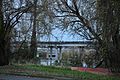
 Evergreen Point Floating Bridge (2016) from east end after opening, April 2016.jpg 4,744 × 3,156; 3.43 MB
-
 Fence (4440466724).jpg 4,272 × 2,848; 2.8 MB
-

-
 Husky Stadium from under Washington SR 520 during construction - Foster Island - 01.jpg 4,288 × 2,848; 4.54 MB
-
 I-405 southbound approaching SR 520.jpg 4,272 × 2,848; 4.26 MB
-
 Looking Down SR-520 Bridge Trail (25368734798).jpg 5,184 × 3,456; 4.66 MB
-
 Montlake Freeway Station (4334390234).jpg 3,264 × 2,448; 4.45 MB
-
 Proposed R.H. Thomson Freeway arboretum interchange, 1960.gif 1,200 × 978; 975 KB
-
 Ramp to Nowhere, Washington Park Arboretum, Seattle.jpg 4,288 × 2,848; 6.36 MB
-
 Ramp to Washington SR 520 during construction - Foster Island - 01.jpg 4,288 × 2,848; 4.56 MB
-
 Seattle - construction on Montlake Interchange, 1963.jpg 2,650 × 2,640; 2.81 MB
-
 Seattle - Evergreen Point bridge from Volunteer Park water tower.jpg 3,264 × 2,448; 2.07 MB
-
 Seattle - Proposed underwater tube crossing of Union Bay, 1960s.jpg 3,660 × 2,214; 1.34 MB
-
 Seattle - SR 520 from Queen City Yacht Club 01.jpg 6,000 × 4,000; 10 MB
-
 SR 520 Bike Trail in Bel-Red.jpg 4,744 × 3,156; 5.83 MB
-
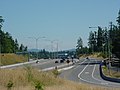
 SR 520 eastbound at SR 202, Redmond, Washington.jpg 4,700 × 3,088; 4.22 MB
-
 SR 520 eastbound from NE 36th Street in Redmond.jpg 4,676 × 3,048; 3.75 MB
-
 SR 520 eastbound from NE 60th Street in Redmond, WA.jpg 4,912 × 3,264; 5.3 MB
-
 SR 520 Ghost Ramp.jpg 3,456 × 2,304; 787 KB
-
 SR 520 under construction, 1963 (15980299986).jpg 1,074 × 1,200; 494 KB
-
 SR-520 from Volunteer Park.JPG 3,264 × 2,448; 3.12 MB
-
 SR-520 Lake Washington Boulevard Off Ramp (4440466530).jpg 4,272 × 2,848; 3.3 MB
-
 SR520 at 51st.JPG 1,024 × 768; 327 KB
-
 Terry Hall Demolition Webcams on Lander (13613911263).jpg 5,184 × 3,456; 6.31 MB
-
 Underside of Washington SR 520 during construction - Foster Island - 01.jpg 4,288 × 2,848; 5.83 MB
-
 Underside of Washington SR 520 during construction - Foster Island - 02.jpg 4,288 × 2,848; 4.83 MB
-
 Viewing platform on Washington Park Arboretum Waterfront Trail seen from Foster Island.jpg 4,288 × 2,848; 7.02 MB
-
 WA 520 West Roadside (27678012083).jpg 1,200 × 770; 657 KB
-
 WA 520 West WA 900 (28215039551).jpg 1,200 × 800; 576 KB
-
 WA-520 Dipping and Soaring.jpg 3,330 × 2,229; 1.84 MB
-
 WA-520 eastbound from 24th Avenue during closure.jpg 4,320 × 3,240; 2.92 MB
-
 WA-520 eastbound from Montlake Boulevard during closure.jpg 4,320 × 3,240; 3.53 MB
-
 WA-520 westbound from 24th Avenue during closure.jpg 4,320 × 3,240; 3.44 MB
-
 WA-520 westbound from Montlake Boulevard during closure.jpg 4,320 × 3,240; 3.44 MB
-
 WA520Junction.jpg 3,264 × 2,448; 1.5 MB
-
 Washington State Route 520 Map.svg 1,028 × 609; 4.46 MB
-

-
 Washington State Route 520.svg 1,152 × 640; 191 KB
.jpg)


.jpg)
.jpg)
_from_east_end_after_opening,_April_2016.jpg)
.jpg)


.jpg)
.jpg)


.jpg)

.jpg)

.jpg)


.jpg)
.jpg)


.jpg)
