Category:Washburn Point
Jump to navigation
Jump to search
   | |||||
| Upload media | |||||
| Instance of | |||||
|---|---|---|---|---|---|
| Located in protected area | |||||
| Location | Mariposa County, California, Pacific States Region | ||||
| Located on street | |||||
| Mountain range | |||||
| Elevation above sea level |
| ||||
 | |||||
Media in category "Washburn Point"
The following 6 files are in this category, out of 6 total.
-
 Mount Starr King kz01.jpg 3,216 × 2,025; 1.66 MB
-
 Washburn Point - Half Dome, Yosemite Valley, Vernal a Nevada Falls - panoramio.jpg 3,872 × 2,592; 2.82 MB
-
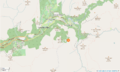 Washburn Point Carte OSM.png 957 × 576; 159 KB
-

-

-
 Yosemite National Park Washburn Point Panorama with Half Dome (altitude 7500ft).jpg 20,514 × 5,054; 43.9 MB


.jpg)