Category:Warslow
Jump to navigation
Jump to search
English: Warslow is a small village in Staffordshire, England. It is located in the Peak District National Park about 10 miles north of Ashbourne.
village in United Kingdom  | |||||
| Upload media | |||||
| Instance of | |||||
|---|---|---|---|---|---|
| Location | Staffordshire Moorlands, Staffordshire, West Midlands, England | ||||
 | |||||
Subcategories
This category has the following 3 subcategories, out of 3 total.
S
- Swainsley Tunnel (12 F)
W
- Warslow War Memorial (2 F)
Media in category "Warslow"
The following 33 files are in this category, out of 33 total.
-
 B5053 at Wigginstall - geograph.org.uk - 453704.jpg 480 × 640; 100 KB
-
 Beware Bull - geograph.org.uk - 464274.jpg 427 × 640; 158 KB
-
 Chapel at Reaps Moor - geograph.org.uk - 455726.jpg 640 × 427; 140 KB
-
 Cowlow Farm, Warslow - geograph.org.uk - 516186.jpg 640 × 422; 93 KB
-
 Dale Bridge, Manifold Valley.jpg 3,622 × 5,051; 6.04 MB
-
 Dead railway - geograph.org.uk - 224567.jpg 640 × 480; 117 KB
-
 Ex rail - new road tunnel - geograph.org.uk - 282272.jpg 640 × 480; 150 KB
-
 Former School, Warslow.jpg 4,000 × 2,248; 5.05 MB
-
 In the Staffordshire Moorlands - geograph.org.uk - 455699.jpg 640 × 427; 140 KB
-
 Manifold School - geograph.org.uk - 653482.jpg 640 × 480; 64 KB
-
 Manifold Trail just south of the tunnel - geograph.org.uk - 1417770.jpg 640 × 426; 444 KB
-
 Methodist Chapel, Warslow.jpg 4,792 × 3,307; 3.21 MB
-
 Near Moorlands Farm - geograph.org.uk - 455696.jpg 640 × 427; 113 KB
-
 Oddbull - geograph.org.uk - 452999.jpg 480 × 640; 92 KB
-
 Stock rearing at Reapsmoor - geograph.org.uk - 455706.jpg 640 × 427; 93 KB
-
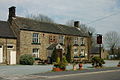
 The Greyhound Public House in Warslow - geograph.org.uk - 2650554.jpg 3,296 × 2,472; 1.03 MB
-

-
 Towards Ecton Bridge - geograph.org.uk - 1233559.jpg 640 × 480; 162 KB
-
 Valley above Wigginstall Farms - geograph.org.uk - 453714.jpg 640 × 480; 120 KB
-
 Visibility railings - geograph.org.uk - 455720.jpg 640 × 427; 102 KB
-
 Warslow Hall - geograph.org.uk - 2322716.jpg 3,648 × 2,736; 5.52 MB
-
 Warslow in 2006.jpg 640 × 426; 80 KB
-
 Warslow, entrance sign - geograph.org.uk - 2394888.jpg 640 × 446; 64 KB
-
 Wigginstall panorama - geograph.org.uk - 453740.jpg 640 × 206; 106 KB
-
 Dale Farm Wetton Mill - geograph.org.uk - 26672.jpg 640 × 480; 107 KB
-
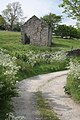 Derelict barn near Clough Head, Warslow - geograph.org.uk - 455716.jpg 427 × 640; 170 KB
-
 Hayes Farm - geograph.org.uk - 452863.jpg 640 × 480; 148 KB
-
 K6 Kiosk - geograph.org.uk - 224556.jpg 480 × 640; 102 KB
-
 Little Brownlow Farm near Warslow - geograph.org.uk - 649091.jpg 640 × 480; 99 KB
-
 Near Warslow Hall - geograph.org.uk - 223973.jpg 640 × 480; 98 KB
-
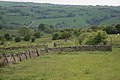
 Staffordshire Moorlands - geograph.org.uk - 181193.jpg 640 × 480; 113 KB
-
 The Greyhound Inn - geograph.org.uk - 224937.jpg 640 × 480; 90 KB
-
 Warslow Hall feeder reservoir - geograph.org.uk - 452859.jpg 480 × 640; 259 KB


