Category:Warscheneck
Jump to navigation
Jump to search
Deutsch: Das Warscheneck (2388 m) befindet sich in östlichen Teil des Toten Gebirges auf dem Gebiet der Gemeinden Vorderstoder und Spital am Pyhrn.
English: Warscheneck (2388 m) is located in the eastern part of the mountain ridge Totes Gebirge in the local authority areas of Vorderstoder and Spital am Pyhrn.
mountain in Austria  | |||||
| Upload media | |||||
| Instance of | |||||
|---|---|---|---|---|---|
| Part of | |||||
| Location | Upper Austria, Austria | ||||
| Mountain range | |||||
| Topographic prominence |
| ||||
| Topographic isolation |
| ||||
| Elevation above sea level |
| ||||
 | |||||
Subcategories
This category has the following 2 subcategories, out of 2 total.
T
W
- Warscheneck-Südostgrat (6 F)
Media in category "Warscheneck"
The following 35 files are in this category, out of 35 total.
-
 Armeria alpina.jpg 1,704 × 2,272; 342 KB
-
 Brunnsteinerkar Ramesch Warscheneck.JPG 4,288 × 2,848; 5.03 MB
-
 Carex firma Inflorescence.jpg 2,272 × 1,704; 3.25 MB
-
 Draba stellata.jpg 2,272 × 1,704; 1,024 KB
-
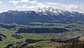 Garstner Eck against Warscheneck.jpg 2,508 × 1,448; 1.86 MB
-
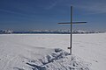
 Gipfenkreuz Warscheneck.jpg 1,440 × 2,560; 690 KB
-
 Kirchdorf an der Krems Micheldorf-7891.jpg 6,048 × 4,024; 20.85 MB
-
 Kremstal Kirchdorf Micheldorf von der Weinbergstraße Schlierbach-4831.jpg 5,000 × 2,812; 8.51 MB
-
 LiezenerSummitCross.jpg 3,872 × 2,592; 853 KB
-
 MayralmSengsengengebirgeWinter20110225.jpg 3,872 × 2,592; 1.94 MB
-
 Minuartia gerardii.jpg 2,272 × 1,704; 784 KB
-
 Naturschutzgebiet Warscheneck-Süd-Wurzeralm, Teichlboden.JPG 2,048 × 1,536; 1.64 MB
-
 Sedum atratum.jpg 1,393 × 1,117; 253 KB
-
 Snow-covered trees near Stubwieswipfel, Totes Gebirge, (5).jpg 3,648 × 2,736; 4.89 MB
-
 Spital am Pyhrn Wurzeralm Teichlboden.jpg 5,905 × 3,968; 5.88 MB
-
 Spital am Pyhrn Wurzeralm Warscheneck Brunnsteinerkar.jpg 6,000 × 4,000; 6.99 MB
-
 Spital aP Hofalm Warscheneck.jpg 5,693 × 3,795; 6.6 MB
-
 Spital aP Oberweng 107 Warscheneck.jpg 5,707 × 3,805; 7.02 MB
-
 Spital aP Warscheneckgebiet Arlingsattel.jpg 6,000 × 4,000; 9.32 MB
-
 Torstein Warscheneck Totes Gebirge 20190915.jpg 3,872 × 2,592; 3.95 MB
-
 ValerianaCelticaWarscheneck.jpg 2,592 × 3,872; 1.4 MB
-
 Verrucaria01.jpg 1,374 × 984; 462 KB
-
 View from Wurbauerkogel in Windischgarsten 2022-08-04 03.jpg 8,384 × 5,612; 30.63 MB
-
 Village at Wurbauerkogel in Rosenau am Hengstpaß 2022-08-04 17.jpg 8,384 × 5,612; 32.31 MB
-
 Warscheneck 360° Gipfelpanorama.jpg 4,680 × 1,024; 5.02 MB
-
 Warscheneck Totes Gebirge 20050205a.jpg 2,272 × 1,375; 2.17 MB
-
 Warscheneck und Wurzeralm.jpg 349 × 196; 8 KB
-
 Warscheneck winter.jpg 3,648 × 2,048; 4.68 MB
-
 Warscheneck.jpg 1,024 × 630; 116 KB
-
 WarscheneckGipfelkreuz.jpg 1,704 × 2,272; 605 KB
-
 Widerlechnerstein-Warscheneck 360° Panorama.jpg 3,670 × 1,024; 3.93 MB
-
 Windischgarstner Becken Pano 20150221.jpg 9,521 × 1,834; 9.7 MB
-
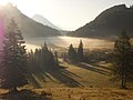
 Windischgarstner Becken Warscheneck.jpg 3,872 × 2,592; 3.93 MB
-
 WindischgarstnerBecken.jpg 3,872 × 2,592; 1.64 MB
-
 Wurzeralm Warscheneck 20060203a.jpg 2,272 × 1,704; 2.04 MB


.jpg)


