Category:Wardley, Rutland
Jump to navigation
Jump to search
village and civil parish in Rutland, United Kingdom  | |||||
| Upload media | |||||
| Instance of | |||||
|---|---|---|---|---|---|
| Location | Rutland, East Midlands, England | ||||
| Population |
| ||||
| Area |
| ||||
 | |||||
Main Wikipedia article: Wardley, Rutland.
Subcategories
This category has only the following subcategory.
B
- St Botolph's Church, Wardley (3 F)
Media in category "Wardley, Rutland"
The following 102 files are in this category, out of 102 total.
-
 A 47 towards Leicester 2012 - geograph.org.uk - 2904422.jpg 640 × 468; 77 KB
-
 A view down the disused former A47 - geograph.org.uk - 3891969.jpg 1,600 × 1,200; 771 KB
-
 A what is it type picture - geograph.org.uk - 3412114.jpg 3,648 × 2,736; 2.49 MB
-
 A47 curving west of Wardley - geograph.org.uk - 3586453.jpg 640 × 480; 69 KB
-
 A47 from Peterborough - geograph.org.uk - 2904420.jpg 640 × 468; 90 KB
-
 A47 Leicester Road in Rutland - geograph.org.uk - 3887535.jpg 1,600 × 1,319; 645 KB
-
 A47 Leicester Road near Wardley - geograph.org.uk - 3361577.jpg 3,441 × 2,377; 1.82 MB
-
 A47 Leicester Road towards Uppingham - geograph.org.uk - 3894527.jpg 1,600 × 1,177; 416 KB
-
 A47 towards Leicester - geograph.org.uk - 2904421.jpg 640 × 479; 72 KB
-
 A47 towards Leicester - geograph.org.uk - 317931.jpg 640 × 370; 42 KB
-
 A47 Wardley bypass cutting - geograph.org.uk - 3586451.jpg 640 × 480; 67 KB
-
 Autumn along the disused former A47 - geograph.org.uk - 4713412.jpg 800 × 600; 228 KB
-
 Barrier across the old A47 - geograph.org.uk - 3887294.jpg 1,600 × 1,346; 796 KB
-
 Benchmark on Wardley Church - geograph.org.uk - 3411846.jpg 3,648 × 2,736; 2.6 MB
-
 Bridleway between fields and hedge - geograph.org.uk - 2904428.jpg 640 × 484; 110 KB
-
 Bridleway leading down to the A47 - geograph.org.uk - 5883385.jpg 3,776 × 2,520; 3.96 MB
-
 Bridleway to Ridlington - geograph.org.uk - 2904424.jpg 640 × 483; 80 KB
-
 Bridleway to Ridlington - geograph.org.uk - 2904429.jpg 640 × 476; 85 KB
-
 Church of St Botolph, Wardley - geograph.org.uk - 5883445.jpg 3,776 × 2,520; 4.19 MB
-
 Church yard steps at Wardley - geograph.org.uk - 3412100.jpg 3,648 × 2,736; 2.66 MB
-
 Climbing the disused and former A47 - geograph.org.uk - 3891984.jpg 1,200 × 1,600; 699 KB
-
 Closed church dedicated to St Botolph - geograph.org.uk - 4931267.jpg 640 × 494; 122 KB
-
 Cottage in Wardley - geograph.org.uk - 2238255.jpg 800 × 600; 343 KB
-
 Deere on the A47 - geograph.org.uk - 3411809.jpg 3,648 × 2,736; 2.78 MB
-
 Descending along the former A47 - geograph.org.uk - 3887435.jpg 1,600 × 1,200; 857 KB
-
 Disused road near Wardley - geograph.org.uk - 3894477.jpg 1,366 × 1,600; 1 MB
-
 Disused road near Wardley - geograph.org.uk - 3894483.jpg 1,600 × 1,200; 717 KB
-
-
 Farmland north of Wardley Hill - geograph.org.uk - 5556044.jpg 800 × 553; 126 KB
-

-
 Field near Wardley, Rutland - geograph.org.uk - 5021580.jpg 2,560 × 1,920; 2.3 MB
-
 Fields north of the A47 Leicester Road - geograph.org.uk - 3894545.jpg 1,600 × 1,200; 611 KB
-
 Fields south of A47 - geograph.org.uk - 2904425.jpg 640 × 474; 73 KB
-
 Flood water gullies - geograph.org.uk - 3411783.jpg 3,648 × 2,736; 2.69 MB
-
 Footpath bridge over the Eyebrook - geograph.org.uk - 3411710.jpg 3,648 × 2,736; 2.52 MB
-
 Foresters shed in Wardley Wood - geograph.org.uk - 3411666.jpg 3,648 × 2,736; 2.58 MB
-
 Gate along the old A47 - geograph.org.uk - 3894511.jpg 1,600 × 1,156; 556 KB
-
 Gate onto farmland along the A47 Leicester Road - geograph.org.uk - 3903304.jpg 1,600 × 1,180; 766 KB
-
 High ground north of Wardley - geograph.org.uk - 3361565.jpg 3,204 × 2,175; 2.09 MB
-
 In the middle of Wardley Wood - geograph.org.uk - 5883554.jpg 3,776 × 2,520; 3.9 MB
-
 Lay-by on the westbound A47 - geograph.org.uk - 3586448.jpg 640 × 480; 61 KB
-
 Layby along the A47 Leicester Road - geograph.org.uk - 3903295.jpg 1,600 × 1,157; 605 KB
-
 Leicester Road (A47) - geograph.org.uk - 4006372.jpg 640 × 480; 55 KB
-
 Leicester Road (A47) - geograph.org.uk - 4006381.jpg 640 × 480; 61 KB
-
 Lines of conifer trees near the old A47 - geograph.org.uk - 3894489.jpg 1,600 × 1,113; 684 KB
-
 Main Street through Wardley westwards. - geograph.org.uk - 4931269.jpg 640 × 475; 135 KB
-
 Main Street towards Uppingham - geograph.org.uk - 4931270.jpg 640 × 466; 127 KB
-
 New fencing near Wardley Wood - geograph.org.uk - 3411651.jpg 3,648 × 2,736; 2.59 MB
-

-
 Oilseed rape crop off the A47 - geograph.org.uk - 4006376.jpg 640 × 480; 66 KB
-
 Old A47 - Wardley Hill - geograph.org.uk - 1837034.jpg 650 × 488; 156 KB
-
 Old A47 - Wardley Hill - geograph.org.uk - 1837043.jpg 650 × 488; 166 KB
-
 Old Road system - geograph.org.uk - 5883418.jpg 3,776 × 2,520; 4.09 MB
-
 Quaker's Spinney and Park Farm - geograph.org.uk - 3894501.jpg 1,600 × 1,285; 385 KB
-
 Redundant cattle grid - geograph.org.uk - 3411766.jpg 3,648 × 2,736; 2.71 MB
-
 Rutland countryside north of Wardley - geograph.org.uk - 4697274.jpg 800 × 670; 136 KB
-
 Rutland countryside viewed from the A47 - geograph.org.uk - 3894532.jpg 1,600 × 1,119; 554 KB
-
 Rutland farmland near Wardley - geograph.org.uk - 4697295.jpg 800 × 655; 135 KB
-
 Rutland farmland north of Wardley - geograph.org.uk - 3891959.jpg 1,600 × 1,215; 594 KB
-
 Rutland farmland north of Wardley - geograph.org.uk - 5924131.jpg 640 × 358; 64 KB
-
 Rutland Round footpath - geograph.org.uk - 5556026.jpg 681 × 800; 158 KB
-
 Shallow valley north of Wardley - geograph.org.uk - 3892094.jpg 1,600 × 1,169; 434 KB
-
 Soil erosion - geograph.org.uk - 3411786.jpg 3,648 × 2,736; 2.65 MB
-
 South Western approach to Wardley Wood - geograph.org.uk - 3411686.jpg 3,648 × 2,736; 2.59 MB
-
 Southwest Rutland farmland - geograph.org.uk - 3891962.jpg 1,600 × 1,185; 720 KB
-
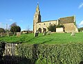
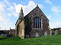
 St Botolph's Church, Wardley - geograph.org.uk - 2452278.jpg 4,000 × 3,000; 4.04 MB
-
 St. Botolph's church, Wardley - geograph.org.uk - 2238247.jpg 800 × 600; 297 KB
-
 Stopped up road, Wardley - geograph.org.uk - 3412099.jpg 3,648 × 2,736; 2.84 MB
-
 Sun Dial on Wardley Church - geograph.org.uk - 3411840.jpg 3,648 × 2,736; 2.77 MB
-
 Sweeping curve, A47 - geograph.org.uk - 4700885.jpg 640 × 396; 41 KB
-
 The A47 Leicester Road - geograph.org.uk - 3891931.jpg 1,600 × 1,419; 728 KB
-
 The disused former A47 - geograph.org.uk - 5556022.jpg 800 × 600; 166 KB
-
 The former A47 at Wardley Hill - geograph.org.uk - 5556034.jpg 800 × 600; 194 KB
-
 The former A47 at Wardley Hill - geograph.org.uk - 5924134.jpg 640 × 530; 102 KB
-
 The former A47 descending Wardley Hill - geograph.org.uk - 5556039.jpg 600 × 800; 203 KB
-
 The former A47 descending Wardley Hill - geograph.org.uk - 5924137.jpg 640 × 556; 114 KB
-
 The former and disused A47 - geograph.org.uk - 3894457.jpg 1,600 × 1,135; 697 KB
-
 The old Wardley Road - geograph.org.uk - 3887547.jpg 1,600 × 1,247; 683 KB
-
 The old Wardley road junction with the old A47 - geograph.org.uk - 3411826.jpg 3,648 × 2,736; 2.67 MB
-
 The overgrown and disused former A47 - geograph.org.uk - 3887412.jpg 1,600 × 1,200; 847 KB
-
 The route of the former A47 - geograph.org.uk - 3892042.jpg 1,600 × 1,083; 727 KB
-
 The route of the former A47 - geograph.org.uk - 3894514.jpg 1,600 × 1,191; 734 KB
-
 The Rutland Round entering Wardley from the south - geograph.org.uk - 5883451.jpg 3,776 × 2,520; 3.78 MB
-

-
 The Rutland Round footpath - geograph.org.uk - 3411836.jpg 3,648 × 2,736; 2.79 MB
-
 The Rutland Round south of Wardley - geograph.org.uk - 5883458.jpg 3,776 × 2,520; 3.89 MB
-
 The summit of the disused former A47 - geograph.org.uk - 3892032.jpg 1,600 × 1,147; 771 KB
-
 The sun is setting - geograph.org.uk - 317927.jpg 640 × 480; 23 KB
-

-
 Tractor and farmland near Ridlington - geograph.org.uk - 4697290.jpg 800 × 604; 120 KB
-

-
 Transmitter mast near Wardley - geograph.org.uk - 3894451.jpg 1,600 × 1,009; 277 KB
-
 View from the churchyard at Wardley - geograph.org.uk - 2452281.jpg 4,000 × 3,000; 4.35 MB
-
 View from Wardley, Rutland - geograph.org.uk - 209869.jpg 640 × 427; 70 KB
-
 View towards Belton-in-Rutland - geograph.org.uk - 3887489.jpg 1,600 × 1,314; 564 KB
-
 View towards the village of Belton-in-Rutland - geograph.org.uk - 3894495.jpg 1,600 × 1,206; 512 KB
-
 View towards the west - geograph.org.uk - 2904430.jpg 640 × 475; 75 KB
-
 View towards Wardley - geograph.org.uk - 539043.jpg 640 × 445; 108 KB
-
-
 Wardley, near Uppingham - geograph.org.uk - 209863.jpg 640 × 427; 80 KB
-
 Field track - geograph.org.uk - 317924.jpg 640 × 480; 92 KB
-
 Fields south of A47 - geograph.org.uk - 317933.jpg 640 × 480; 77 KB


_-_geograph.org.uk_-_4006370.jpg)


_-_geograph.org.uk_-_4006372.jpg)
_-_geograph.org.uk_-_4006381.jpg)


