Category:Wardens' Way
Jump to navigation
Jump to search
English: The Warden's Way is a 22km (14 miles) linear footpath connecting Bourton-on-the-Water in Gloucestershire with Winchcombe in Gloucestershire, England.
Media in category "Wardens' Way"
The following 9 files are in this category, out of 9 total.
-
 The Wardens Way and Diamond Way - geograph.org.uk - 67750.jpg 640 × 426; 144 KB
-
 The Wardens Way in Guiting Wood - geograph.org.uk - 67451.jpg 640 × 426; 188 KB
-
 The Wardens' Way - geograph.org.uk - 177993.jpg 640 × 426; 142 KB
-
 The Wardens' Way near Deadmanbury Gate - geograph.org.uk - 87930.jpg 640 × 426; 149 KB
-
 View from Wardens' Way - geograph.org.uk - 1702829.jpg 4,000 × 3,000; 2.11 MB
-
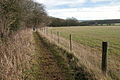
 Wardens way footpath - geograph.org.uk - 1556576.jpg 640 × 480; 159 KB
-
 Wardens' Way - geograph.org.uk - 1702831.jpg 4,000 × 3,000; 3.61 MB
-
 Wardens' Way - geograph.org.uk - 1703475.jpg 4,000 × 3,000; 4.03 MB
-
 Wardens' Way meets the Salt Way - geograph.org.uk - 1702827.jpg 640 × 480; 108 KB


