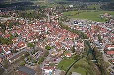
Category:Wangen im Allgäu
Jump to navigation
Jump to search
urban municipality in Baden-Württemberg, Germany | |||||
| Upload media | |||||
| Instance of |
| ||||
|---|---|---|---|---|---|
| Part of |
| ||||
| Named after |
| ||||
| Location |
| ||||
| Capital |
| ||||
| Head of government |
| ||||
| Inception |
| ||||
| Population |
| ||||
| Area |
| ||||
| Elevation above sea level |
| ||||
| official website | |||||
 | |||||
Subcategories
This category has the following 24 subcategories, out of 24 total.
Pages in category "Wangen im Allgäu"
This category contains only the following page.
Media in category "Wangen im Allgäu"
The following 37 files are in this category, out of 37 total.
-
Aerial view of Wangen im Allgäu.jpg 2,556 × 1,706; 711 KB
-
Ausgang - panoramio (3).jpg 2,816 × 2,120; 852 KB
-
Bauernhof in Wangen im Allgäu 4.jpg 3,264 × 2,448; 2.33 MB
-
Beutelsau in Wangen im Allgäu from south.jpg 3,840 × 2,160; 3.14 MB
-
Beutelsau in Wangen im Allgäu from west.jpg 3,840 × 2,160; 3.05 MB
-
BudS - Karbachtal Topo.jpg 3,960 × 5,980; 9.44 MB
-
BudS - Westallgäu Topo.jpg 5,710 × 8,380; 30.16 MB
-
Cow in Wangen im Allgäu.jpg 1,032 × 774; 227 KB
-
Elitz in Wangen im Allgäu from southeast.jpg 3,840 × 2,160; 3.23 MB
-
Elitzer See in Wangen im Allgäu from its eastern shore.jpg 3,840 × 2,160; 2.91 MB
-
Flagge Wangen im Allgäu.svg 600 × 1,500; 33 KB
-
Hergatz - Schwarzenberg, Wangen i A v S 02.jpg 4,371 × 2,304; 983 KB
-
Landappbw 1054565 1818 Burgruine Neuravensburg Neuravensburg.jpg 1,440 × 1,920; 728 KB
-
Landappbw 967306 1820 Kapelle St. Konrad Wangen-Hiltensweiler.jpg 1,922 × 2,600; 704 KB
-
Landappbw 967307 1820 Kapelle St. Konrad Wangen-Hiltensweiler.jpg 2,600 × 1,806; 689 KB
-
Landappbw 967308 1820 Kapelle St. Konrad Wangen-Hiltensweiler.jpg 2,600 × 1,518; 510 KB
-
Landappbw 967309 1820 Kapelle St. Konrad Wangen-Hiltensweiler.jpg 1,727 × 2,600; 423 KB
-
Landappbw 967311 1820 Kapelle St. Konrad Wangen-Hiltensweiler.jpg 1,605 × 2,600; 682 KB
-
Landappbw 967312 1820 Kapelle St. Konrad Wangen-Hiltensweiler.jpg 2,600 × 2,547; 1.41 MB
-
Landkreis Ravensburg Karte mit Ortsnamen.png 949 × 744; 165 KB
-
Landkreis Wangen GemeindenV1.svg 512 × 724; 91 KB
-
Large tree 2.jpg 3,096 × 4,128; 4.38 MB
-
Luftbild Elitz in Wangen im Allgäu.jpg 8,000 × 6,000; 19.87 MB
-
Mühlrad - panoramio.jpg 2,816 × 2,120; 1.19 MB
-
Ortsschild Wangen im Allgäu.JPG 4,224 × 2,376; 684 KB
-
Pfärrich - panoramio (1).jpg 2,694 × 2,438; 711 KB
-
Pfärrich - panoramio (2).jpg 3,264 × 2,448; 914 KB
-
Reichsstädte Wangen - Isny - Leutkirch, Pfeffel 1746.png 1,059 × 973; 2.13 MB
-
Schrottplatz - panoramio.jpg 2,816 × 2,120; 916 KB
-
Schwarzensee in Wangen im Allgäu from south.jpg 3,840 × 2,160; 2.77 MB
-
Sorreite in Wangen im Allgäu from southwest.jpg 3,840 × 2,160; 3.51 MB
-
Wangen - panoramio (3).jpg 2,816 × 2,120; 1.03 MB
-
Wangen im Allgäu 1.jpg 5,136 × 2,482; 4.08 MB
-
Wangen im Allgäu 2.jpg 5,776 × 2,408; 4.01 MB
-
Wangen im Allgäu 3.jpg 3,264 × 2,448; 1.19 MB
-
Wangen im Allgäu in RV.svg 718 × 550; 923 KB
-
Württembergische Flurkarte 1'2.500 Wangen.jpg 2,127 × 2,124; 3.04 MB


