Category:Wambolter Hof (Bensheim)
Jump to navigation
Jump to search
| Object location | | View all coordinates using: OpenStreetMap |
|---|
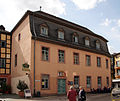
This is the category of the Hessian Kulturdenkmal (cultural monument) with the ID 525 (Wikidata)
|
national heritage site  | |||||
| Upload media | |||||
| Instance of | |||||
|---|---|---|---|---|---|
| Location | Bensheim, Landkreis Bergstraße, Darmstadt Government Region, Hesse, Germany | ||||
| Heritage designation | |||||
 | |||||
Media in category "Wambolter Hof (Bensheim)"
The following 6 files are in this category, out of 6 total.
-
 Bensheim Wambolter Hof 03.jpg 2,048 × 1,728; 509 KB
-
 Bensheim, Wambolter Hof, Rückseite (1).jpg 8,576 × 6,204; 35.34 MB
-
 Bensheim, Wambolter Hof, Rückseite (2).jpg 4,598 × 5,057; 17.71 MB
-
 Wambolter Hof 01.jpg 2,400 × 2,147; 1.27 MB
-
 Wambolter Hof 02.jpg 2,048 × 1,409; 591 KB
-
 Wambolter Hof.jpg 2,048 × 1,536; 1.05 MB

.jpg)
.jpg)

