Category:Walton on the Hill, Surrey
Jump to navigation
Jump to search
English: Walton on the Hill, Surrey, is a small village in England, situated midway between Reigate and Epsom, just inside the M25 orbital motorway around London. It is situated close to the larger village of Tadworth. Other neighbouring villages include: Kingswood, Burgh Heath, Headley and Box Hill. Its name distinguishes it from Walton-on-Thames, which is about to the north-west.
village in Reigate and Banstead, Surrey, United Kingdom  | |||||
| Upload media | |||||
| Instance of | |||||
|---|---|---|---|---|---|
| Location | Reigate and Banstead, Surrey, South East England, England | ||||
 | |||||
Subcategories
This category has the following 4 subcategories, out of 4 total.
B
- Banstead Heath (34 F)
P
Media in category "Walton on the Hill, Surrey"
The following 47 files are in this category, out of 47 total.
-
 Bridleway towards Colley Hill - geograph.org.uk - 369340.jpg 640 × 481; 92 KB
-
 Chequers Lane, Walton-on-the Hill - geograph.org.uk - 2813146.jpg 1,600 × 1,200; 656 KB
-
 Chequers Lane, Walton-on-the Hill - geograph.org.uk - 2813158.jpg 1,600 × 1,200; 509 KB
-
 Chequers Lane, Walton-on-the Hill - geograph.org.uk - 2813302.jpg 1,600 × 1,200; 569 KB
-
 Chequers Lane, Walton-on-the Hill - geograph.org.uk - 2813306.jpg 1,600 × 1,200; 569 KB
-
 Coppicing in Downs View Wood - geograph.org.uk - 1690407.jpg 640 × 480; 279 KB
-
 Deans Lane, Walton-on-the-Hill (August 2013).JPG 2,400 × 1,800; 1.25 MB
-
 Downs View - geograph.org.uk - 1690394.jpg 640 × 480; 129 KB
-
 Dry valley, Walton Downs - geograph.org.uk - 1690421.jpg 640 × 480; 143 KB
-
 Edes Barn Cottages - geograph.org.uk - 1690556.jpg 640 × 480; 152 KB
-
 Electricity tower in a field - geograph.org.uk - 1690491.jpg 640 × 480; 82 KB
-
 Entrance to Hurstfields - geograph.org.uk - 1690596.jpg 640 × 480; 94 KB
-
 Footpath from Walton-on-the-Hill to Tadworth (August 2013).JPG 2,400 × 1,800; 1.26 MB
-
 Fox on the track - geograph.org.uk - 1690380.jpg 480 × 640; 163 KB
-
 Frosty field edge - geograph.org.uk - 1690366.jpg 640 × 480; 197 KB
-
 Frozen track at Nohome Farm - geograph.org.uk - 1690451.jpg 640 × 480; 229 KB
-
 LloydGeorgeWalton.jpg 448 × 269; 22 KB
-
 M25 Eastbound at Walton Heath - geograph.org.uk - 369572.jpg 640 × 481; 69 KB
-
 M25 Eastwards at Mogador - geograph.org.uk - 369928.jpg 640 × 481; 71 KB
-
 M25 Motorway at Walton Heath - geograph.org.uk - 369528.jpg 640 × 481; 63 KB
-
 Mid Surrey Pony Club (1) - geograph.org.uk - 1690582.jpg 640 × 480; 130 KB
-
 Mid Surrey Pony Club (2) - geograph.org.uk - 1690590.jpg 482 × 640; 170 KB
-
 Pond (3165814187).jpg 3,872 × 2,592; 6.09 MB
-
 Pond at Walton-on-the-Hill (August 2013).JPG 2,500 × 1,900; 1.38 MB
-
 Silage bales near Round Wood - geograph.org.uk - 1690389.jpg 640 × 480; 99 KB
-
 The Chequers Public House, Walton on the Hill - geograph.org.uk - 2265389.jpg 3,072 × 2,304; 2.99 MB
-
 The Chequers, Walton on the Hill - geograph.org.uk - 1062929.jpg 640 × 426; 85 KB
-
 Tomb of Johanes de Waltune 1268.JPG 1,983 × 1,487; 790 KB
-

-
 Walton Manor, Chequers Lane, Walton-on-the-Hill.jpg 2,200 × 1,600; 639 KB
-

-
 Walton on the Hill, Surrey, Mere Pond.jpg 3,500 × 2,334; 1.98 MB
-
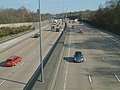
 Walton on the Hill, the M25 - geograph.org.uk - 2747897.jpg 640 × 480; 47 KB
-
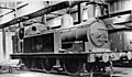 Walton-on-the Hill Engine Shed geograph-2380624-by-Ben-Brooksbank.jpg 2,394 × 1,399; 884 KB
-
 Walton-on-the-Hill, Deans Lane - geograph.org.uk - 3595972.jpg 3,456 × 2,304; 5.6 MB
-
 Walton-on-the-Hill, Footpath off Love Lane - geograph.org.uk - 3596005.jpg 3,456 × 2,304; 5.51 MB
-

-
 Walton-on-the-Hill, Love Lane - geograph.org.uk - 3596010.jpg 3,456 × 2,304; 4.88 MB
-
 Walton-on-the-Hill, The White Lodge - geograph.org.uk - 3595987.jpg 3,456 × 2,304; 3.62 MB
-
 Walton-on-the-Hill, Wingfield Stud Farm - geograph.org.uk - 3597536.jpg 3,456 × 2,304; 5.05 MB
-

-
 Footpath North from Mount Hill - geograph.org.uk - 369799.jpg 640 × 481; 127 KB
-
 Junction at Merrywood Grove - geograph.org.uk - 369909.jpg 640 × 481; 119 KB
-

-
 Mere Pond, Walton-on-the-Hill, Surrey (2) - geograph.org.uk - 518421.jpg 640 × 537; 127 KB
-
 Private Road near Mount Hill - geograph.org.uk - 369816.jpg 640 × 481; 108 KB
-
 The Chequers Pub - geograph.org.uk - 174953.jpg 640 × 480; 135 KB


.JPG)


.JPG)


_-_geograph.org.uk_-_1690582.jpg)
_-_geograph.org.uk_-_1690590.jpg)
.jpg)
.JPG)


_-_geograph.org.uk_-_518411.jpg)
_-_geograph.org.uk_-_518421.jpg)

