Category:Walpole, Norfolk
Jump to navigation
Jump to search
civil parish in Norfolk, UK  | |||||
| Upload media | |||||
| Instance of |
| ||||
|---|---|---|---|---|---|
| Location | King's Lynn and West Norfolk, Norfolk, East of England, England | ||||
| Area |
| ||||
 | |||||
Subcategories
This category has the following 4 subcategories, out of 4 total.
S
W
- Walpole railway station (2 F)
Media in category "Walpole, Norfolk"
The following 115 files are in this category, out of 115 total.
-
 "The Map of the marshland in Norfolk".jpg 4,686 × 4,018; 12.91 MB
-
 Lincoln Shire - By H. Moll Geographer - btv1b530562943.jpg 2,976 × 4,408; 2.19 MB
-
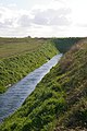
 A dike off Marsh Road - geograph.org.uk - 1525863.jpg 640 × 480; 121 KB
-
 A pylon and its shadow, but look again .... - geograph.org.uk - 2303517.jpg 2,848 × 2,136; 2.96 MB
-
 A17 at Norfolk county boundary sign - geograph.org.uk - 3615279.jpg 640 × 481; 46 KB
-
 A17 eastbound - geograph.org.uk - 5888656.jpg 640 × 403; 37 KB
-
 A17 Westbound, Walpole Cross Keys - geograph.org.uk - 4962449.jpg 640 × 427; 314 KB
-
 A17, Walpole Cross Keys - geograph.org.uk - 4961902.jpg 640 × 427; 293 KB
-
 Abandoned water storage pits near the River Nene - geograph.org.uk - 2303846.jpg 2,848 × 2,136; 3.03 MB
-
 Agricultural building on West Drove (North) - geograph.org.uk - 6151844.jpg 3,456 × 2,592; 3.94 MB
-
 Aisled barn and stubble field - geograph.org.uk - 6231443.jpg 1,024 × 768; 140 KB
-
 Barn at Bustards Farm - geograph.org.uk - 6234876.jpg 1,024 × 768; 188 KB
-
 Barns and sheds, Goose's Lane, Walpole St Andrew - geograph.org.uk - 5982731.jpg 1,600 × 1,141; 811 KB
-
 Base of war memorial, Walpole St Andrew - geograph.org.uk - 5982726.jpg 1,160 × 1,600; 1,006 KB
-
 Boundary Post - geograph.org.uk - 4103243.jpg 683 × 1,024; 240 KB
-
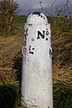 Boundary post No. 8 - geograph.org.uk - 734540.jpg 2,000 × 3,008; 2.63 MB
-
 Bridleway (farm track) near Walpole Marsh - geograph.org.uk - 2303483.jpg 2,848 × 2,136; 3.08 MB
-
 Bungalows on The Marsh - geograph.org.uk - 6150948.jpg 3,456 × 2,592; 3.8 MB
-
 Bustards Lane, east of Walpole St Andrew - geograph.org.uk - 5982696.jpg 1,201 × 1,600; 902 KB
-
 Bustards' Lane - geograph.org.uk - 6231453.jpg 1,024 × 768; 200 KB
-
 Bustards' Lane and communications mast - geograph.org.uk - 6234871.jpg 1,024 × 768; 194 KB
-
 Churchyard and War Memorial, Walpole St. Peter - geograph.org.uk - 6231456.jpg 1,024 × 768; 153 KB
-
 Churchyard, Walpole St Peter - geograph.org.uk - 5982846.jpg 1,600 × 1,200; 1.02 MB
-
 Construction site at Walpole Marsh - geograph.org.uk - 6150943.jpg 3,456 × 2,592; 3.78 MB
-
 Cottage on Goose's Lane - geograph.org.uk - 6151835.jpg 3,456 × 2,592; 3.55 MB
-
 Crop field near Rose Hall Farm - geograph.org.uk - 4716986.jpg 640 × 480; 57 KB
-
 Derelict farm building - geograph.org.uk - 6151830.jpg 3,456 × 2,592; 1.36 MB
-
 Derelict farm building - geograph.org.uk - 6151833.jpg 3,456 × 2,592; 3.96 MB
-
 Distant pylons crossing the River Nene - geograph.org.uk - 2303895.jpg 2,848 × 2,136; 2.85 MB
-
 Dovecot Farmhouse, Walpole St Peter - geograph.org.uk - 5608085.jpg 640 × 360; 66 KB
-
 Drain to Cross Stiles Bank - geograph.org.uk - 734556.jpg 2,000 × 3,008; 2.9 MB
-
 Dry drain, Walpole Marsh - geograph.org.uk - 4717000.jpg 640 × 480; 112 KB
-
 Early winter snow - geograph.org.uk - 2182277.jpg 2,848 × 2,136; 2.93 MB
-
 East end and east window, Walpole St Peter church - geograph.org.uk - 5982848.jpg 1,600 × 1,200; 986 KB
-

-
 Entrance to the Walpole electricity sub station - geograph.org.uk - 6151802.jpg 3,456 × 2,592; 3.89 MB
-
 Expansion work at Walpole electricity substation - geograph.org.uk - 2182198.jpg 2,848 × 2,136; 2.91 MB
-
 Farm buildings, Walpole Marsh - geograph.org.uk - 4717001.jpg 640 × 480; 62 KB
-
 Farmland and copse near Walpole Marsh - geograph.org.uk - 2303490.jpg 2,848 × 2,136; 3.19 MB
-
 Farmland and pylon - geograph.org.uk - 4717006.jpg 640 × 480; 40 KB
-
 Fertile fields on an area named The Salts - geograph.org.uk - 6150952.jpg 3,456 × 2,592; 3.89 MB
-
 Field and drain - geograph.org.uk - 4716992.jpg 640 × 480; 59 KB
-
 Flat fields and power lines - geograph.org.uk - 6231479.jpg 1,024 × 768; 145 KB
-
 Follens Road - geograph.org.uk - 3408211.jpg 2,256 × 1,504; 2.62 MB
-
 Four big feet on Walpole Marsh - geograph.org.uk - 2303998.jpg 2,848 × 2,136; 3.06 MB
-
 French's Road - geograph.org.uk - 4716997.jpg 640 × 480; 56 KB
-
 French's Road, Walpole Marsh - geograph.org.uk - 6150959.jpg 3,456 × 2,592; 3.9 MB
-

-
 Goose's Lane from King John Bank - geograph.org.uk - 6151793.jpg 3,456 × 2,592; 3.94 MB
-
 Grass verge and paddock fence - geograph.org.uk - 5965255.jpg 3,456 × 2,592; 3.89 MB
-
 Green Lane - geograph.org.uk - 6231498.jpg 1,024 × 768; 158 KB
-
 Headstones in the snow - geograph.org.uk - 2182217.jpg 2,848 × 2,136; 2.91 MB
-
 House on Mill Road - geograph.org.uk - 4716985.jpg 640 × 480; 77 KB
-
 Houses on French's Road - geograph.org.uk - 4716998.jpg 640 × 480; 65 KB
-
 Junction of King John Bank and Gooses Lane - geograph.org.uk - 3408974.jpg 2,256 × 1,504; 2.23 MB
-
 Junction off Goose's Lane with a yellow grit-box - geograph.org.uk - 6151858.jpg 3,456 × 2,592; 3.89 MB
-
 Longfour Farm, Market Lane, Walpole St. Andrew - geograph.org.uk - 5965248.jpg 3,456 × 2,592; 3.82 MB
-
 Mill Road between Walpole St. Peter and Walpole Highway - geograph.org.uk - 6151880.jpg 3,456 × 2,592; 1.12 MB
-
 Mill Road, looking towards Walpole St Peter - geograph.org.uk - 6151877.jpg 3,456 × 2,592; 3.91 MB
-
 Mill Road, south of Walpole St. Peter - geograph.org.uk - 6151872.jpg 3,456 × 2,592; 3.92 MB
-
 New house, Chalk Road - geograph.org.uk - 3117150.jpg 640 × 495; 81 KB
-
 Old Boundary Post - geograph.org.uk - 4103247.jpg 1,024 × 683; 185 KB
-
 Old Inclosed Marsh - geograph.org.uk - 6258568.jpg 1,024 × 768; 202 KB
-
 On the bank of Kindersley's Cut, Walpole Marsh - geograph.org.uk - 2304033.jpg 2,848 × 2,136; 2.93 MB
-
 Porch and tower, Walpole St Peter church - geograph.org.uk - 5982849.jpg 1,200 × 1,600; 1.03 MB
-
 Postbox .. - geograph.org.uk - 6151885.jpg 3,456 × 2,592; 3.88 MB
-
 Pylon country near Walpole substation - geograph.org.uk - 2182205.jpg 2,848 × 2,136; 3.04 MB
-

-
 Road safety mirror on a bend opposite Newton Lodge Farm - geograph.org.uk - 5965237.jpg 3,456 × 2,592; 3.94 MB
-
 Rose and Crown farm in the snow - geograph.org.uk - 2182179.jpg 2,848 × 2,136; 2.96 MB
-
 Rose ^ Crown Farm - geograph.org.uk - 4716984.jpg 640 × 480; 43 KB
-
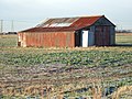 Rusting fenland shed, West Drove (North) - geograph.org.uk - 2199504.jpg 2,848 × 2,136; 2.97 MB
-
 Rusting gate on Walpole Marsh - geograph.org.uk - 2304013.jpg 2,848 × 2,136; 2.87 MB
-
 Slippery slope from Roman Bank - geograph.org.uk - 2182089.jpg 2,848 × 2,136; 2.99 MB
-
 Small, medium and large - pylons near Foul Anchor - geograph.org.uk - 2303538.jpg 2,848 × 2,136; 2.9 MB
-

-
 St Andrew's church, Walpole St Andrew - geograph.org.uk - 5982715.jpg 1,600 × 1,200; 1.02 MB
-
 Stable barn with three horses - geograph.org.uk - 283741.jpg 640 × 427; 71 KB
-
 Stubble field, Walpole Marsh - geograph.org.uk - 4716995.jpg 640 × 480; 67 KB
-
 Stud Moor Holme Field by Cobblers Lane - geograph.org.uk - 5982857.jpg 1,600 × 1,200; 709 KB
-
 Sub station for the Lincs offshore windfarm - geograph.org.uk - 6151814.jpg 3,456 × 2,592; 3.69 MB
-
 Sun Dial at Walpole St Peters - geograph.org.uk - 6157680.jpg 5,593 × 4,361; 4.38 MB
-
 The bolt-hole, Walpole St Peter church - geograph.org.uk - 5982851.jpg 1,200 × 1,600; 1.08 MB
-
 The church lych gate, Walpole St Peter - geograph.org.uk - 5982742.jpg 1,600 × 1,200; 1 MB
-
 The Marsh, Walpole Marsh - geograph.org.uk - 4717004.jpg 640 × 480; 55 KB
-
 The pulpit, Walpole St Peter church - geograph.org.uk - 5982847.jpg 1,200 × 1,600; 947 KB
-
 The tower of St Andrew's church, Walpole St Andrew - geograph.org.uk - 5982711.jpg 1,200 × 1,600; 1.03 MB
-
 The village sign at Walpole St Andrew - geograph.org.uk - 5982713.jpg 1,200 × 1,600; 1.02 MB
-

-
 Walpole Bank - geograph.org.uk - 4716988.jpg 640 × 480; 72 KB
-
 Walpole Bank - geograph.org.uk - 6150956.jpg 3,328 × 2,469; 1.65 MB
-
 Walpole Bank on the site of the old Sea Bank - geograph.org.uk - 6151798.jpg 3,456 × 2,592; 3.94 MB
-
 Walpole cemetery - geograph.org.uk - 6151855.jpg 3,456 × 2,592; 3.84 MB
-
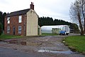
 Walpole Electricity sub-station - geograph.org.uk - 335680.jpg 640 × 480; 242 KB
-
 Walpole Highway and St. Peter's War Memorial - geograph.org.uk - 6151028.jpg 3,456 × 2,592; 3.38 MB
-
 Walpole Highway Village Sign - geograph.org.uk - 1570202.jpg 2,304 × 3,072; 1.3 MB
-
 Walpole Highway Village Sign - geograph.org.uk - 1570210.jpg 3,072 × 2,304; 1.29 MB
-
 Walpole Lane - geograph.org.uk - 6231447.jpg 1,024 × 768; 127 KB
-
 Walpole St Peter church - geograph.org.uk - 5982852.jpg 1,600 × 1,200; 1,005 KB
-
 Walpole St Peter church hall - geograph.org.uk - 5982854.jpg 1,600 × 1,200; 950 KB
-
 Walpole St Peter, detail - geograph.org.uk - 5608036.jpg 640 × 360; 68 KB
-

-
 War memorial, Walpole St Andrew - geograph.org.uk - 5982719.jpg 1,200 × 1,600; 1.06 MB
-
 West Drove (North) looking south - geograph.org.uk - 6151848.jpg 3,456 × 2,592; 3.75 MB
-
 Wheat field near Walpole St. Andrew - geograph.org.uk - 6231465.jpg 1,024 × 768; 171 KB
-
 Wisbech Road - geograph.org.uk - 4716994.jpg 640 × 480; 56 KB
-
 Wisbech Road from Pigeon Street, Walpole St. Peter - geograph.org.uk - 6151842.jpg 3,456 × 2,592; 3.82 MB
-
 Wren Green and Walpole St. Peter War Memorial - geograph.org.uk - 6151867.jpg 3,456 × 2,592; 3.89 MB
-
 Young crop field off Mill Road - geograph.org.uk - 4716982.jpg 640 × 480; 55 KB
-

-
-
 Gardens in front of Waterloo Farm - geograph.org.uk - 283738.jpg 640 × 427; 71 KB
-
 Jankinsfield Farm - geograph.org.uk - 283748.jpg 640 × 427; 73 KB
-
 Radio mast by Bustards Farm - geograph.org.uk - 283740.jpg 640 × 427; 83 KB
-
 Reeds and sky near Walton Highway - geograph.org.uk - 335852.jpg 640 × 480; 222 KB


_-_geograph.org.uk_-_6151844.jpg)


_near_Walpole_Marsh_-_geograph.org.uk_-_2303483.jpg)


_-_geograph.org.uk_-_2199504.jpg)


_looking_south_-_geograph.org.uk_-_6151848.jpg)


