Category:Walls in Nottinghamshire
Jump to navigation
Jump to search
Ceremonial counties of England: Bedfordshire · Berkshire · Buckinghamshire · Cambridgeshire · Cheshire · Cornwall · Cumbria · Derbyshire · Devon · Dorset · Durham · East Riding of Yorkshire · East Sussex · Essex · Gloucestershire · Greater London · Greater Manchester · Hampshire · Herefordshire · Hertfordshire · Isle of Wight · Kent · Lancashire · Leicestershire · Lincolnshire · Merseyside · Norfolk · North Yorkshire · Northamptonshire · Northumberland · Nottinghamshire · Oxfordshire · Rutland · Shropshire · Somerset · South Yorkshire · Staffordshire · Suffolk · Surrey · Tyne and Wear · Warwickshire · West Midlands · West Sussex · West Yorkshire · Wiltshire · Worcestershire
City-counties: Bristol ·
Former historic counties:
Other former counties:
City-counties: Bristol ·
Former historic counties:
Other former counties:
Subcategories
This category has the following 4 subcategories, out of 4 total.
Media in category "Walls in Nottinghamshire"
The following 69 files are in this category, out of 69 total.
-
 1 Kirklington Road, Southwell.jpg 1,280 × 1,280; 434 KB
-
 86 Main Street, Sutton Bonington.jpg 1,024 × 768; 216 KB
-
 Beauvale Priory from the east - geograph.org.uk - 4265827.jpg 1,280 × 859; 384 KB
-
 Beside The Forest fence - geograph.org.uk - 604554.jpg 480 × 640; 151 KB
-
 Boundary Wall At Ivy Cottage, Wollaton Village, Notts (1).jpg 4,032 × 3,024; 3.35 MB
-
 Boundary Wall, Easthorpe House, Southwell.jpg 1,280 × 960; 458 KB
-
 Boundary Wall, Gates, Piers And Overthrow At Church Of St Peter And St Paul.jpg 4,048 × 3,036; 4.55 MB
-
 Boundary Wall, Woodthorpe House Community Centre, Nottingham.jpg 1,024 × 680; 293 KB
-
 Bradmore Church - geograph.org.uk - 112265.jpg 502 × 600; 37 KB
-
 Bradmore Church - geograph.org.uk - 1771503.jpg 1,280 × 1,023; 266 KB
-
 Cavendish Hall's roof - geograph.org.uk - 600745.jpg 640 × 480; 83 KB
-
 Church Lane, South Muskham.jpg 1,600 × 1,065; 858 KB
-
 Church of St Laurence, Norwell - geograph.org.uk - 4096186.jpg 1,280 × 910; 535 KB
-
 Churchyard wall and gateway, North Wheatley - geograph.org.uk - 4191201.jpg 1,280 × 878; 481 KB
-
 Churchyard wall, Sturton le Steeple - geograph.org.uk - 4189749.jpg 1,280 × 960; 456 KB
-

-
 Entrance to Canal Wharf, Worksop.jpg 1,280 × 862; 284 KB
-
 Entrance to Hill House, Southwell.jpg 1,280 × 960; 535 KB
-
 Fernery Wall, Newstead Abbey.jpg 1,280 × 960; 624 KB
-
 Garden Buildings And Adjoining Boundary Wall At Castle Museum.jpg 4,608 × 3,456; 4.56 MB
-
 Garden wall and railings at Manor Farm - geograph.org.uk - 4320222.jpg 1,280 × 853; 428 KB
-
 Garden Wall, Old Hall, Car Colston.jpg 1,280 × 960; 333 KB
-
 Garden Wall, The Burgage, Southwell.jpg 1,280 × 960; 666 KB
-
 Gates at Lenton Priory - geograph.org.uk - 3060566.jpg 1,280 × 960; 267 KB
-
 Gateway And Boundary Wall At Wollaton House, Wollaton Village, Notts (1).jpg 4,032 × 3,024; 3.06 MB
-
 Gateway to the Friary - geograph.org.uk - 3113150.jpg 1,280 × 960; 383 KB
-
 Haydn Road, Sherwood, NG5. - geograph.org.uk - 3508980.jpg 3,032 × 2,291; 1.19 MB
-
 History in a wall - Chilwell - geograph.org.uk - 628143.jpg 640 × 427; 134 KB
-
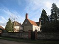
 Honing House, Southwell.jpg 1,280 × 960; 422 KB
-

-
 Kitchen Garden Wall, Norwood Park.jpg 1,280 × 861; 468 KB
-
 Lych gate and churchyard wall, Darlton - geograph.org.uk - 4140479.jpg 1,280 × 960; 404 KB
-
 Manor Farmhouse And Adjoining Boundary Wall, Church Warsop (2).jpg 3,840 × 2,160; 2.85 MB
-
 Church of St. Radegund, Maplebeck - geograph.org.uk - 53830.jpg 640 × 480; 160 KB
-
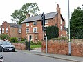
 Mapperley Road, Malvern House - geograph.org.uk - 4549794.jpg 1,024 × 1,024; 1.31 MB
-
 Metcalfe House, High Street - geograph.org.uk - 4243513.jpg 1,280 × 960; 259 KB
-
 No 3 South Road (geograph 1831705).jpg 1,024 × 683; 373 KB
-
 North Wall, Kitchen Garden, Wollaton Hall.jpg 1,280 × 953; 369 KB
-
 Not so busy bee - geograph.org.uk - 1218540.jpg 451 × 640; 120 KB
-
 Nottingham (2021-05-28) 37.jpg 5,568 × 3,712; 17.27 MB
-
 Nottingham - NG3 (Bellevue) - geograph.org.uk - 2997031.jpg 800 × 600; 176 KB
-
 Parish church (3) - geograph.org.uk - 5344227.jpg 4,320 × 3,240; 4.07 MB
-
 Park Wall, Wollaton Road.jpg 1,280 × 960; 585 KB
-
 Railings and Wall, Wellington Circus, Nottingham.jpg 1,280 × 960; 491 KB
-
 Remaining walls, Lenton Priory.jpg 1,280 × 960; 589 KB
-

-
 Retaining wall, Sneinton - geograph.org.uk - 318446.jpg 640 × 427; 101 KB
-
 The Great Garden - 2 (geograph 1663068).jpg 1,632 × 1,224; 953 KB
-
 The Manor House And Adjoining Boundary Wall (1).jpg 3,200 × 2,400; 2.65 MB
-
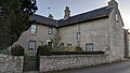
 The Old Hall, Collingham - geograph.org.uk - 2285329.jpg 1,024 × 768; 163 KB
-
 The Old Rectory And Adjoining Garden Wall, Buttery Lane, Teversal, Mansfield (20).jpg 4,048 × 3,036; 2.37 MB
-
 The Old Rectory, Gringley - geograph.org.uk - 4242209.jpg 1,280 × 909; 353 KB
-
 Thorpe Village Nottinghamshire.jpg 3,200 × 2,368; 2.85 MB
-
 Top Farm, Hawksworth - geograph.org.uk - 2336834.jpg 1,024 × 768; 149 KB
-
 Wall and gate, Dunham House, Southwell.jpg 1,280 × 960; 542 KB
-
 Wall and Lodges, St John's Primary School, Stapleford.jpg 1,280 × 960; 529 KB
-
 Wall and Railings, Hollowstone, Nottingham.jpg 1,280 × 960; 352 KB
-
 Wall at Stanton Hall.jpg 3,456 × 2,304; 3.6 MB
-
 Wall, Former House of Correction, Southwell.jpg 1,280 × 960; 383 KB
-
 Wall, Rampton Prebend, Southwell.jpg 1,280 × 856; 419 KB
-
 Wall, Sacrista Prebend, Southwell.jpg 1,280 × 960; 524 KB
-
 Wall, The Hollies, Southwell.jpg 1,280 × 960; 493 KB
-
 Walls and Railings, Castle Grove, Nottingham.jpg 960 × 1,280; 431 KB
-
 Watson Fothergill houses 411 Mansfield Road 5711.jpg 4,608 × 3,456; 3.42 MB
-
 Watson Fothergill houses 411, 413-419 Mansfield Road 5712.jpg 3,410 × 2,554; 1.25 MB
-
 Welbeck Abbey outbuildings - geograph.org.uk - 2943229.jpg 3,456 × 2,304; 3.31 MB
-
 2014 West Drayton Old London Road.jpg 2,344 × 1,563; 2.26 MB
-

-
 Wollaton Road - Nottingham - geograph.org.uk - 623628.jpg 640 × 427; 136 KB


.jpg)


_-_Central_Atrium_-_geograph.org.uk_-_913732.jpg)


.jpg)


.jpg)


.jpg)


.jpg)


_37.jpg)
_-_geograph.org.uk_-_2997031.jpg)
_-_geograph.org.uk_-_5344227.jpg)


.jpg)

.jpg)
.jpg)

.jpg)


