Category:Walls in Aberdeenshire
Jump to navigation
Jump to search
Subcategories
This category has only the following subcategory.
D
Media in category "Walls in Aberdeenshire"
The following 16 files are in this category, out of 16 total.
-
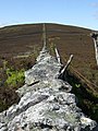 Boundary wall up Benaquhallie - geograph.org.uk - 440069.jpg 480 × 640; 110 KB
-
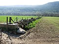 Cattle trough and field boundary - geograph.org.uk - 793007.jpg 640 × 480; 119 KB
-
 Deer Abbey, the great wall - geograph.org.uk - 1775240.jpg 1,600 × 1,064; 558 KB
-
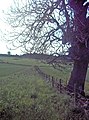 Fence and Wall - geograph.org.uk - 452215.jpg 476 × 640; 201 KB
-
 Harbour wall - geograph.org.uk - 808162.jpg 640 × 480; 68 KB
-

-
 Ruined Wall, Drummy Muir - geograph.org.uk - 38206.jpg 640 × 480; 81 KB
-
 Ruined Wall, Muir of Drummy - geograph.org.uk - 33910.jpg 640 × 480; 88 KB
-
 Stone conservation wall - geograph.org.uk - 773530.jpg 640 × 480; 123 KB
-
 Tillyronach - geograph.org.uk - 486313.jpg 640 × 480; 113 KB
-
 Upper Balfour Farm, near Woodlands - geograph.org.uk - 178319.jpg 640 × 480; 77 KB
-
 View ESE from the graveyard by Galton - geograph.org.uk - 592196.jpg 640 × 480; 53 KB
-
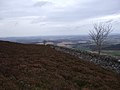
 View NE from near West Cullerley - geograph.org.uk - 613845.jpg 640 × 480; 83 KB
-
-
 View north from near Easter Ord - geograph.org.uk - 613746.jpg 640 × 480; 78 KB
-
 Whitehill - geograph.org.uk - 768564.jpg 640 × 427; 253 KB


