Category:Wallasey Cemetery
Jump to navigation
Jump to search
| Object location | | View all coordinates using: OpenStreetMap |
|---|
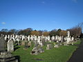
municipal cemetery in Liscard, Wallasey, Wirral, Merseyside UK  Former cemetery chapel | |||||
| Upload media | |||||
| Instance of | |||||
|---|---|---|---|---|---|
| Location | Liscard, Wirral, Merseyside, North West England, England | ||||
| Inception |
| ||||
 | |||||
Subcategories
This category has the following 6 subcategories, out of 6 total.
Media in category "Wallasey Cemetery"
The following 4 files are in this category, out of 4 total.
-
 Blitz memorial, Wallasey Cemetery.jpg 4,978 × 3,217; 9.1 MB
-
 Corvid in Wallasey Cemetery.jpg 3,462 × 5,198; 15.72 MB
-
 Rake Lane Cemetery, Wallasey (1).jpg 4,320 × 3,240; 3.24 MB
-
 Rake Lane Cemetery, Wallasey (2).jpg 4,608 × 3,456; 4.3 MB


.jpg)
.jpg)