Category:Walkinstown
Jump to navigation
Jump to search
English: Walkinstown (Baile Bhailcín in Irish) is a suburb in the city of Dublin, Ireland, approximately 6 kilometres south-west of Dublin city centre. Walkinstown is bordered on the east by Crumlin, on the north by Drimnagh, and Bluebell, on the south by Greenhills and Ballymount, and on the west by Clondalkin.
Español: Walkinstown (Baile Bhailcín en irlandés) es un suburbio de Dublín, en Irlanda, el cual incorpora el área de Greenhills (Na Glaschonic o Na Cnoic nGlas) y una zona de Ballymount que está dividida en 3 áreas. Está situado en el lado Sur de la ciudad y es fronterizo con Crumlin, Drimnagh, Clondalkin, Tallaght y Bluebell y algunos estados más pequeños. Pertenece al código postal número 12 de Dublín.
Gaeilge: Is bruachbhaile de chuid Bhaile Átha Cliath, Poblacht na hÉireann é Baile Bhailcín (Walkinstown an Bhéarla) atá suite taobh theas den chathair, timpeall sé chiliméadar ó lár na cathrach. Tá Baile Bhailcín ag críochantacht leis na mbailte eile Cromghlinn san oirthear, Droimeanach sa tuaisceart, na Glaschnoic sa deisceart agus Baile an Mhóta, an Cloigín Gorm agus Cluain Dolcáin san iarthar.
suburb of Dublin, Ireland  | |||||
| Upload media | |||||
| Instance of | |||||
|---|---|---|---|---|---|
| Location | County Dublin, Leinster, Ireland | ||||
 | |||||
Media in category "Walkinstown"
The following 6 files are in this category, out of 6 total.
-
 Kylemore Luas Stop - geograph.org.uk - 440746.jpg 640 × 479; 128 KB
-
 SPAR Walkinstown - 2 Walkinstown Cross, Walkinstown, Dublin 12.jpg 3,264 × 1,836; 1.76 MB
-
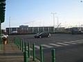
 Superquinn Supermarket, Walkinstown Road. - geograph.org.uk - 477659.jpg 640 × 480; 137 KB
-
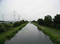 The Grand Canal From Kylemore Road Bridge - geograph.org.uk - 458181.jpg 640 × 476; 127 KB
-
 Walkinstown Roundabout - geograph.org.uk - 440919.jpg 640 × 480; 130 KB
-
 Woodie's Car Park, Kileen Road - geograph.org.uk - 673783.jpg 640 × 477; 46 KB


