Category:Wald-Kapelle (Bělá nad Radbuzou)
Jump to navigation
Jump to search
| Object location | | View all coordinates using: OpenStreetMap |
|---|
 | |||||
| Upload media | |||||
| Instance of | |||||
|---|---|---|---|---|---|
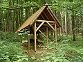
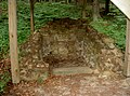
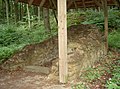
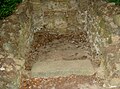
| Location | Bělá nad Radbuzou, Domažlice District, Plzeň Region, Czechia | ||||
 | |||||
Media in category "Wald-Kapelle (Bělá nad Radbuzou)"
The following 13 files are in this category, out of 13 total.
-
 BelaWaldKapelle 01.jpg 2,304 × 1,704; 917 KB
-
 BelaWaldKapelle 02.jpg 2,304 × 1,704; 852 KB
-
 BelaWaldKapelle 03.jpg 2,304 × 1,704; 919 KB
-
 BelaWaldKapelle 04.jpg 2,304 × 1,704; 883 KB
-
 BelaWaldKapelle 05.jpg 2,304 × 1,704; 937 KB
-
 BelaWaldKapelle 06.jpg 2,304 × 1,704; 914 KB
-
 BelaWaldKapelle 07.jpg 2,304 × 1,704; 872 KB
-
 BelaWaldKapelle 08.jpg 2,304 × 1,704; 922 KB
-
 BelaWaldKapelle 09.jpg 2,304 × 1,704; 903 KB
-
 BelaWaldKapelle 10.jpg 2,304 × 1,704; 877 KB
-
 BelaWaldKapelle 11.jpg 2,304 × 1,704; 823 KB
-
 BelaWaldKapelle 12.jpg 2,304 × 1,704; 886 KB
-
 BelaWaldKapelle 13.jpg 2,304 × 1,704; 860 KB


