Category:Waipa District
Jump to navigation
Jump to search
territorial authority district in New Zealand's Waikato region | |||||
| Upload media | |||||
| Instance of | |||||
|---|---|---|---|---|---|
| Location | Waikato Region, New Zealand | ||||
| Population |
| ||||
| Area |
| ||||
 | |||||
Subcategories
This category has the following 12 subcategories, out of 12 total.
Media in category "Waipa District"
The following 29 files are in this category, out of 29 total.
-
Head Quarters Camp Te Rore in 1864.jpg 1,913 × 1,493; 880 KB
-
Kakepuku and Te Kawa.jpg 4,032 × 1,006; 1.2 MB
-
Kiokio 1944.jpg 768 × 568; 209 KB
-
Lake Ngāroto 2016 pou and representing 7 atua (gods) and lizards.jpg 3,024 × 4,032; 4.47 MB
-
Lake Road.jpg 1,142 × 612; 371 KB
-
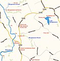
Map of the Waipa Valley 2021-08-25.png 511 × 607; 474 KB
-
New Zealand North Island Highway scenes (50800379188).jpg 2,500 × 2,000; 1.25 MB
-
Ngaroto railway station.jpg 1,058 × 842; 170 KB
-
Ngāhinapōuri Hall.jpg 2,921 × 1,979; 1.66 MB
-
Paterangi pā today.jpg 4,377 × 2,961; 2.75 MB
-
Pukeatua hill.jpg 8,360 × 1,500; 2.01 MB
-
Pukekura butter factory.jpg 1,925 × 1,435; 1.1 MB
-
Puniu River.jpg 4,185 × 3,173; 4.39 MB
-
Rukuhia 1953.jpg 682 × 554; 163 KB
-
Streetside in karapiro - new zealand - 2004 4 2.jpg 1,600 × 1,200; 294 KB
-
Te Awa cycleway near the Velodrome.jpg 4,032 × 3,024; 6.46 MB
-
Te Kawa hill and Kakepuku from air looking west.jpg 1,903 × 2,392; 893 KB
-
Te Mawhai 1949.jpg 1,174 × 854; 324 KB
-
Te Rore 1882.jpg 1,080 × 1,222; 158 KB
-
Te Rore Hall.jpg 2,348 × 881; 347 KB
-
Te Rore sites.jpg 1,391 × 1,413; 276 KB
-
Thursday in the Waikato (51154311491).jpg 6,000 × 4,000; 12.74 MB
-
Waipa DC.PNG 251 × 376; 23 KB
-
Waipa district in NZ 2017.svg 853 × 1,173; 570 KB
-
Waipa Territorial Authority.png 246 × 352; 5 KB
-
Waipā District Council logo.svg 95 × 64; 8 KB
-
Yvonne Rust Waipa war memorial panel.jpg 2,423 × 949; 630 KB


