Category:Waggon & Horses, Lawrence Street, York
Jump to navigation
Jump to search
| Object location | | View all coordinates using: OpenStreetMap |
|---|
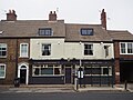
pub in York, North Yorkshire, England, UK  | |||||
| Upload media | |||||
| Instance of | |||||
|---|---|---|---|---|---|
| Location | City of York, North Yorkshire, Yorkshire and the Humber, England | ||||
| Heritage designation |
| ||||
 | |||||
This is a category about listed building number 1257498. |
Media in category "Waggon & Horses, Lawrence Street, York"
The following 9 files are in this category, out of 9 total.
-
 The Waggon & Horses, Lawrence Street (geograph 5320596).jpg 1,024 × 714; 163 KB
-
 The Waggon and Horses - geograph.org.uk - 1164732.jpg 640 × 409; 73 KB
-
 The Waggon and Horses, York (geograph 5506353).jpg 1,280 × 960; 392 KB
-
 Waggon & Horses - Lawrence Street - geograph.org.uk - 2575610.jpg 640 × 480; 85 KB
-
 Waggon & Horses Lawrence Street York 01.jpg 2,048 × 1,536; 1.09 MB
-
 Waggon & Horses Lawrence Street York 02.jpg 2,048 × 1,536; 867 KB
-
 Waggon & Horses Lawrence Street York 03.jpg 2,048 × 1,536; 1.07 MB
-
 Waggon & Horses Lawrence Street York 04.jpg 2,048 × 1,536; 1.14 MB
-
 Waggon & Horses Lawrence Street York 05.jpg 2,048 × 1,536; 1.21 MB
.jpg)
.jpg)


