Category:Wadworth
Jump to navigation
Jump to search
village in United Kingdom | |||||
| Upload media | |||||
| Instance of | |||||
|---|---|---|---|---|---|
| Location | Doncaster, South Yorkshire, Yorkshire and the Humber, England | ||||
| Population |
| ||||
 | |||||
Subcategories
This category has the following 2 subcategories, out of 2 total.
J
W
- Wadworth Hall (2 F)
Media in category "Wadworth"
The following 200 files are in this category, out of 245 total.
(previous page) (next page)-
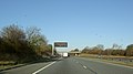
 A1 (M) southbound - geograph.org.uk - 2553654.jpg 1,600 × 1,200; 392 KB
-
 A1 motorway matrix sign near Wadworth - geograph.org.uk - 608342.jpg 640 × 355; 43 KB
-
 A1(M) - junction 35 in 1 mile - geograph.org.uk - 2645820.jpg 640 × 428; 73 KB
-
 A1(M) - junction 36 in 1 mile - geograph.org.uk - 2645856.jpg 640 × 428; 82 KB
-
 A1(M) - M18 bridge - geograph.org.uk - 2645847.jpg 640 × 428; 85 KB
-
 A1(M) - no messages today - geograph.org.uk - 2645810.jpg 640 × 428; 78 KB
-
 A1(M) - Wadworth Hill Bridge - geograph.org.uk - 2645835.jpg 640 × 428; 87 KB
-
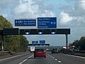
 A1(M) 32 miles to Newark - geograph.org.uk - 4034695.jpg 1,600 × 1,071; 305 KB
-
 A1(M) approaching J35 - geograph.org.uk - 4790320.jpg 640 × 426; 69 KB
-
 A1(M) approaching Junction 35 - geograph.org.uk - 4034688.jpg 3,630 × 2,298; 3.8 MB
-
 A1(M) northbound near Wadworth - geograph.org.uk - 4962632.jpg 1,900 × 1,256; 1.58 MB
-
 A1(M) towards Wadworth - geograph.org.uk - 4962625.jpg 2,068 × 1,336; 1.85 MB
-
 A1(M), half mile to M18 - geograph.org.uk - 4790319.jpg 640 × 426; 60 KB
-
 A1(M), J35 - geograph.org.uk - 4790321.jpg 640 × 640; 54 KB
-
 A1(M), J35 - geograph.org.uk - 4811539.jpg 640 × 398; 26 KB
-
 A1(M), J35 overbridge - geograph.org.uk - 4811540.jpg 640 × 426; 33 KB
-
 A1(M), J35 overbridges - geograph.org.uk - 4790322.jpg 640 × 426; 36 KB
-
 A1(M), southbound - geograph.org.uk - 5442574.jpg 640 × 426; 54 KB
-
 A1(M), Wadsworth Hill Bridge - geograph.org.uk - 4790328.jpg 640 × 426; 46 KB
-
 A1M Southbound - geograph.org.uk - 4832259.jpg 640 × 427; 392 KB
-
 Across the Warmsworth Beck valley - geograph.org.uk - 3833013.jpg 1,797 × 647; 182 KB
-
 Approaching Grange Farm - geograph.org.uk - 4402122.jpg 1,600 × 1,200; 502 KB
-
 Approaching the farm on Short Gate - geograph.org.uk - 4402095.jpg 1,600 × 1,200; 427 KB
-
 At junction 2 on the M18 - geograph.org.uk - 2040643.jpg 640 × 480; 52 KB
-
 B6064 towards Conisbrough - geograph.org.uk - 2553642.jpg 1,600 × 1,200; 398 KB
-
 Bridge over the A1 (M) - geograph.org.uk - 2556822.jpg 1,600 × 1,022; 193 KB
-
 Bridleway alongside Wadworth Wood - geograph.org.uk - 3982618.jpg 1,600 × 1,064; 500 KB
-
 Bridleway alongside Wadworth Wood - geograph.org.uk - 4675294.jpg 1,024 × 768; 229 KB
-
 Bridleway at Wilsic - geograph.org.uk - 4675126.jpg 1,024 × 768; 195 KB
-
 Bridleway heading south from Long Gate - geograph.org.uk - 5542520.jpg 5,067 × 3,801; 5.28 MB
-
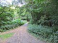
 Bridleway Through the Wood - geograph.org.uk - 238918.jpg 640 × 480; 106 KB
-
 Bridleway to Lodge Farm - geograph.org.uk - 238919.jpg 640 × 480; 79 KB
-
 Bridleway towards Lodge Farm - geograph.org.uk - 2553640.jpg 1,600 × 1,200; 375 KB
-
 Carr Bank heading east - geograph.org.uk - 2556148.jpg 1,600 × 1,200; 437 KB
-
 Carr Lane - geograph.org.uk - 170841.jpg 640 × 427; 72 KB
-
 Carr Lane - geograph.org.uk - 5139563.jpg 4,608 × 3,456; 3.97 MB
-
 Carr Lane Bridge, A1(M) - geograph.org.uk - 4790318.jpg 640 × 426; 50 KB
-
 Carr Lane in Wadworth - geograph.org.uk - 6783527.jpg 1,024 × 768; 201 KB
-
 Carr Lane Overbridge, A1(M) - geograph.org.uk - 2515258.jpg 640 × 430; 45 KB
-
 Carr Lane railway bridge - geograph.org.uk - 4402124.jpg 1,600 × 1,200; 536 KB
-
 Cattle feeder - geograph.org.uk - 4693951.jpg 1,024 × 768; 249 KB
-
 Coal train heading south - geograph.org.uk - 4402127.jpg 1,600 × 1,200; 933 KB
-
 Cricket ground at Wadworth - geograph.org.uk - 4112020.jpg 1,874 × 2,342; 1.48 MB
-
 Crossgates, Wadworth - geograph.org.uk - 4112022.jpg 1,942 × 2,428; 1.69 MB
-
 Crow Wood - geograph.org.uk - 4675097.jpg 1,024 × 768; 180 KB
-
 End of Stancil Lane - geograph.org.uk - 2556137.jpg 1,600 × 1,200; 552 KB
-
 Entering Wadworth Wood - geograph.org.uk - 4675231.jpg 1,024 × 768; 267 KB
-
 Entrance to Wilsic Hall School - geograph.org.uk - 5137210.jpg 4,315 × 3,112; 3.33 MB
-
 Farmland near Spring Farm - geograph.org.uk - 2553669.jpg 1,600 × 1,200; 389 KB
-
 Farmland off Wilsic Road - geograph.org.uk - 2553635.jpg 1,600 × 1,200; 358 KB
-
 Farmland off Wood Lane - geograph.org.uk - 2553663.jpg 1,600 × 1,200; 460 KB
-
 Farmland, Stancil Carr - geograph.org.uk - 2556140.jpg 1,600 × 1,200; 486 KB
-
 Farmland, Wadworth Carr - geograph.org.uk - 2556122.jpg 1,600 × 1,200; 431 KB
-
 Farmland, Wadworth Hill - geograph.org.uk - 2553655.jpg 1,600 × 1,200; 328 KB
-
 Fencing and newly planted trees at Carr Bank - geograph.org.uk - 6816286.jpg 4,778 × 3,290; 3.39 MB
-
 Field boundary - geograph.org.uk - 3399049.jpg 640 × 480; 100 KB
-
 Field boundary near Wadworth - geograph.org.uk - 4695674.jpg 1,024 × 768; 181 KB
-
 Field entrance off Carr Bank - geograph.org.uk - 2556146.jpg 1,600 × 1,200; 579 KB
-
 Field entrance off White Cross Lane - geograph.org.uk - 2553657.jpg 1,600 × 1,200; 511 KB
-
 Field next to a bridleway off Long Gate, Wadworth - geograph.org.uk - 4739155.jpg 2,048 × 1,536; 1,021 KB
-
 Field with cattle off Carr Lane - geograph.org.uk - 4693955.jpg 1,024 × 768; 200 KB
-
 Fields by Springwell Lane - geograph.org.uk - 3399126.jpg 640 × 480; 99 KB
-
 Flat and muddy farmland Stancil Carr - geograph.org.uk - 4268419.jpg 1,024 × 768; 280 KB
-
 Fly tip on the bridleway off Wood Lane - geograph.org.uk - 1105927.jpg 587 × 640; 121 KB
-
 Flytipping in Wadworth Wood - geograph.org.uk - 3982611.jpg 1,600 × 1,064; 833 KB
-
 Footbridge over the River Torne - geograph.org.uk - 4112032.jpg 2,592 × 1,944; 2.54 MB
-
 Footbridge over the River Torne - geograph.org.uk - 4402138.jpg 1,600 × 1,200; 418 KB
-
 Footpath in Wadworth Wood - geograph.org.uk - 5192711.jpg 4,608 × 3,456; 3.93 MB
-
 Footpath near Wadworth - geograph.org.uk - 5137215.jpg 4,608 × 3,456; 2.99 MB
-
 Footpath to Wadworth - geograph.org.uk - 4675244.jpg 1,024 × 768; 275 KB
-
 Forested tip - geograph.org.uk - 3399102.jpg 640 × 480; 91 KB
-
 Former chapel at Wadworth - geograph.org.uk - 4402113.jpg 1,600 × 1,200; 825 KB
-
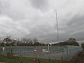 Gas installation at Wadworth Carr - geograph.org.uk - 4402136.jpg 1,600 × 1,200; 402 KB
-
 Gospel well Wadworth - geograph.org.uk - 1725028.jpg 480 × 640; 141 KB
-
 Grange Farm - geograph.org.uk - 4112024.jpg 2,527 × 1,805; 1.28 MB
-
 Grass field between Stancil Lane and Carr Bank - geograph.org.uk - 4696645.jpg 1,024 × 768; 246 KB
-
 Green Lane near Wadworth - geograph.org.uk - 5137212.jpg 4,608 × 3,456; 3.74 MB
-
-
 High Street, Wadworth - geograph.org.uk - 2553648.jpg 1,600 × 1,200; 367 KB
-
 IPort from the air - geograph.org.uk - 6549165.jpg 1,024 × 768; 367 KB
-
 Junction 2-35, M18-A1(M) - geograph.org.uk - 2515264.jpg 640 × 430; 43 KB
-
 Junction 35, A1(M) - M18 - geograph.org.uk - 2515263.jpg 640 × 430; 40 KB
-
 Lane by Wadworth Wood - geograph.org.uk - 3399180.jpg 640 × 480; 99 KB
-
 Limestone quarries by the M18 from the air - geograph.org.uk - 5953614.jpg 1,024 × 914; 382 KB
-
 Little Mother Drain - geograph.org.uk - 4695598.jpg 1,024 × 768; 170 KB
-
 Little Mother Drain Stancil - geograph.org.uk - 4268422.jpg 1,024 × 768; 293 KB
-
 Lodge at entrance to Spring Farm - geograph.org.uk - 4711186.jpg 1,024 × 768; 158 KB
-
 Lodge Farm on Springwell Lane - geograph.org.uk - 5179215.jpg 4,608 × 3,456; 3.77 MB
-
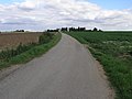
 Long Gate (B6094) - geograph.org.uk - 2553636.jpg 1,600 × 1,200; 293 KB
-
 Looking down onto Junction 35 on the A1M - geograph.org.uk - 2658274.jpg 800 × 600; 210 KB
-
 Looking towards Wadworth Wood - geograph.org.uk - 4675103.jpg 1,024 × 768; 191 KB
-
 M18 accident at Junction 2 - geograph.org.uk - 6125681.jpg 1,024 × 767; 96 KB
-
 M18 approaching junction 2 - geograph.org.uk - 6337615.jpg 640 × 426; 76 KB
-
 M18 at Wadworth Wood - geograph.org.uk - 6125683.jpg 1,024 × 770; 107 KB
-

-
 M18 north at Wadworth wood - geograph.org.uk - 6337631.jpg 640 × 426; 68 KB
-
 M18 overbridge junction 2-35, A1(M) - geograph.org.uk - 2515265.jpg 640 × 430; 41 KB
-
 M18 south of Doncaster - geograph.org.uk - 2707308.jpg 1,600 × 831; 187 KB
-
 Main Street in Wadworth - geograph.org.uk - 5137247.jpg 4,528 × 3,335; 3.52 MB
-
 Manor Rise in Wadworth - geograph.org.uk - 5137242.jpg 4,608 × 3,456; 3.91 MB
-
 Manor Rise, Wadworth - geograph.org.uk - 2553645.jpg 1,600 × 1,200; 379 KB
-
 Motorway bridge over Springwell Lane - geograph.org.uk - 2553678.jpg 1,600 × 1,200; 440 KB
-
 Motorway over White Cross Lane - geograph.org.uk - 2553661.jpg 1,600 × 1,200; 296 KB
-
 Narrow bridge over the A1 motorway - geograph.org.uk - 764670.jpg 640 × 480; 71 KB
-

-
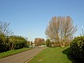
 New Road Wadworth - geograph.org.uk - 764686.jpg 640 × 388; 58 KB
-
 New security fence on Carr Lane, Wadworth Carr - geograph.org.uk - 6816280.jpg 4,934 × 3,608; 4.07 MB
-

-
 Northbound A1(M) near to Wadworth - geograph.org.uk - 4886572.jpg 640 × 427; 324 KB
-
 Northbound A1(M) near to Wadworth, - geograph.org.uk - 4886568.jpg 640 × 480; 381 KB
-
 Northbound A1(M), Wadworth Hill Bridge - geograph.org.uk - 4886566.jpg 640 × 480; 391 KB
-
 On the A1(M) - geograph.org.uk - 2040649.jpg 640 × 480; 43 KB
-
 On the M18 in Wadworth Wood - geograph.org.uk - 2040641.jpg 640 × 480; 65 KB
-
 On the M18 in Wadworth Wood - geograph.org.uk - 2040642.jpg 640 × 480; 56 KB
-

-
 Ordnance Survey Cut Mark - geograph.org.uk - 4963135.jpg 640 × 549; 146 KB
-
 Ordnance Survey Cut Mark - geograph.org.uk - 4963143.jpg 640 × 617; 192 KB
-
 Ordnance Survey Rivet - geograph.org.uk - 4963153.jpg 640 × 607; 120 KB
-
 Overbridge Junction 35, A1(M) - geograph.org.uk - 2515267.jpg 640 × 430; 40 KB
-
 Paddock Lane (Bridleway) - geograph.org.uk - 5447949.jpg 3,264 × 2,448; 3.56 MB
-
 Paddock Lane - geograph.org.uk - 4675227.jpg 1,024 × 768; 162 KB
-
 Paddock Lane - geograph.org.uk - 6753100.jpg 1,024 × 768; 246 KB
-
 Paddock Lane at Long Gate - geograph.org.uk - 3982708.jpg 1,600 × 1,064; 744 KB
-
 Paddock Lane towards Long Gate - geograph.org.uk - 3981875.jpg 1,600 × 1,064; 817 KB
-
 Paddock Lane towards Long Gate - geograph.org.uk - 3982700.jpg 1,600 × 1,064; 849 KB
-
 Paddock Lane towards Long Gate - geograph.org.uk - 3982703.jpg 1,600 × 1,064; 867 KB
-
 Pasture with manure heap - geograph.org.uk - 3399149.jpg 640 × 480; 92 KB
-
 Path across a stubble field - geograph.org.uk - 4675288.jpg 1,024 × 768; 197 KB
-
 Path leading to Wadworth Wood - geograph.org.uk - 3981842.jpg 1,600 × 1,064; 1,014 KB
-
 Path leading to Wadworth Wood - geograph.org.uk - 3982605.jpg 1,600 × 1,064; 796 KB
-
 Path through the sugar beet to Wadworth - geograph.org.uk - 4675107.jpg 1,024 × 768; 174 KB
-
 Path west from Wadworth - geograph.org.uk - 4112017.jpg 2,592 × 1,944; 1.73 MB
-
 Pit Wood path - geograph.org.uk - 3399043.jpg 480 × 640; 103 KB
-
 Ploughed Field and Long Shadows - geograph.org.uk - 5179196.jpg 4,608 × 3,456; 3.57 MB
-
 Ploughed Fields near Stump Cross - geograph.org.uk - 5179170.jpg 4,608 × 3,456; 4.26 MB
-
 Pond near Gospel Well - geograph.org.uk - 5137226.jpg 4,608 × 3,456; 3.99 MB
-
 Power lines from Stancil Lane - geograph.org.uk - 4268425.jpg 1,024 × 768; 205 KB
-
 Power lines near the M18 motorway - geograph.org.uk - 1105950.jpg 480 × 640; 47 KB
-
 Professional kitchen fitter^ - geograph.org.uk - 1105931.jpg 589 × 640; 90 KB
-
 Railway towards Doncaster - geograph.org.uk - 2556118.jpg 1,600 × 1,200; 552 KB
-
 Railway track across Wadworth Carr - geograph.org.uk - 4112026.jpg 1,944 × 2,592; 2.22 MB
-
 Rapeseed field by Stancil Lane - geograph.org.uk - 6816269.jpg 3,527 × 4,737; 5.18 MB
-
 River Torne - geograph.org.uk - 2556154.jpg 1,600 × 1,200; 677 KB
-
 River Torne Footbridge seen from Spoil Heap - geograph.org.uk - 5148613.jpg 4,517 × 3,317; 3.58 MB
-
 Road to Grange Farm - geograph.org.uk - 764679.jpg 640 × 325; 44 KB
-
 Screening alongside the A1(M) - geograph.org.uk - 4711188.jpg 1,024 × 768; 214 KB
-
 Slip road to the A1(M) - geograph.org.uk - 5442573.jpg 640 × 426; 41 KB
-
 Smoke gets in your eyes - geograph.org.uk - 1203683.jpg 640 × 480; 49 KB
-
 Southbound A1(M) at Red Hill - geograph.org.uk - 4886434.jpg 640 × 427; 353 KB
-
 Southbound A1(M) near to Wadworth - geograph.org.uk - 4886480.jpg 640 × 427; 343 KB
-

-
 Southbound A1M, Alverley - geograph.org.uk - 4832263.jpg 640 × 427; 339 KB
-
 Springwell Lane at Alverley View - geograph.org.uk - 3982536.jpg 1,600 × 1,064; 623 KB
-
 Springwell Lane at Wood Lane - geograph.org.uk - 3982571.jpg 1,600 × 1,064; 683 KB
-
 Springwell Lane heading north - geograph.org.uk - 2553681.jpg 1,600 × 1,200; 498 KB
-
 Springwell Lane towards Alverley View - geograph.org.uk - 3982465.jpg 1,600 × 1,064; 671 KB
-
 Springwell Lane towards Stump Cross - geograph.org.uk - 3982551.jpg 1,600 × 1,064; 847 KB
-
 St Catherine's Well Stream - geograph.org.uk - 2425479.jpg 1,600 × 1,200; 727 KB
-
 St Catherines well stream. - geograph.org.uk - 2363848.jpg 480 × 640; 79 KB
-
 Stancil Lane (track) - geograph.org.uk - 2556133.jpg 1,600 × 1,200; 368 KB
-
 Stockpile of sugar beet, Wadworth Carr - geograph.org.uk - 4693971.jpg 1,024 × 768; 187 KB
-
 Straight hedge - geograph.org.uk - 686758.jpg 640 × 480; 84 KB
-
 Summit group - geograph.org.uk - 3399038.jpg 640 × 480; 100 KB
-
 The end of Wilsic Road - geograph.org.uk - 6753126.jpg 1,024 × 768; 233 KB
-
 The entrance to Wilsic Hall School - geograph.org.uk - 686757.jpg 640 × 480; 135 KB
-
 The Green at Wadworth - geograph.org.uk - 713962.jpg 640 × 407; 88 KB
-
 The M18 crosses the A1(M) - geograph.org.uk - 4962635.jpg 2,164 × 1,430; 1.33 MB
-
 The M18 motorway at Wadworth Wood - geograph.org.uk - 3982664.jpg 1,600 × 1,064; 824 KB
-
 The rear of houses at Wadworth - geograph.org.uk - 4695683.jpg 1,024 × 768; 129 KB
-
 The South Yorkshire Joint Railway - geograph.org.uk - 4694124.jpg 1,024 × 768; 185 KB
-
 The South Yorkshire Joint Railway - geograph.org.uk - 4695705.jpg 1,024 × 768; 176 KB
-
 The White Hart at Wadworth - geograph.org.uk - 4402107.jpg 1,600 × 1,200; 376 KB
-
 Three levels - geograph.org.uk - 4675070.jpg 1,024 × 768; 170 KB
-
 Tofield Road - geograph.org.uk - 3399207.jpg 640 × 480; 99 KB
-
 Tolfield Road - geograph.org.uk - 4675087.jpg 1,024 × 768; 266 KB
-
 Top of former colliery at Edlington. - geograph.org.uk - 1725016.jpg 480 × 640; 68 KB
-
 Track Crossing Former Spoilheap - geograph.org.uk - 5179154.jpg 4,608 × 3,456; 3.86 MB
-
 Track from spring Farm - geograph.org.uk - 4711218.jpg 1,024 × 768; 204 KB
-
 Track junction in Wadworth Wood - geograph.org.uk - 4402087.jpg 1,600 × 1,200; 949 KB
-
 Track leading to Paddock Lane - geograph.org.uk - 3982673.jpg 1,600 × 1,064; 963 KB
-
 Track leading to Paddock Lane - geograph.org.uk - 3982677.jpg 1,600 × 1,064; 816 KB
-
 Track leading to Paddock Lane - geograph.org.uk - 3982679.jpg 1,600 × 1,064; 845 KB
-
 Track leading to Paddock Lane - geograph.org.uk - 3982681.jpg 1,600 × 1,064; 1,015 KB
-
 Track leading to Spring Farm - geograph.org.uk - 3982544.jpg 1,600 × 1,064; 444 KB
-
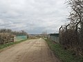
 Track to Grange Farm - geograph.org.uk - 2556113.jpg 1,600 × 1,200; 498 KB
-
 Track to Spring Farm - geograph.org.uk - 2553666.jpg 1,600 × 1,200; 410 KB
-
 Trees in mist - geograph.org.uk - 1725020.jpg 480 × 640; 93 KB
-
 Triple Confluence - geograph.org.uk - 1203226.jpg 640 × 480; 86 KB
-
 Tunnel beneath the motorway - geograph.org.uk - 4675252.jpg 1,024 × 768; 236 KB
-
 Tween Woods Lane - geograph.org.uk - 4675831.jpg 1,024 × 768; 288 KB
-

-

-
 Vicarage Drive, Wadworth - geograph.org.uk - 2553651.jpg 1,600 × 1,200; 540 KB
-
 View from Former Colliery Spoil Heap - geograph.org.uk - 5179122.jpg 4,608 × 3,456; 3.65 MB
-
 View towards a plantation by Long Gate - geograph.org.uk - 4675115.jpg 1,024 × 768; 240 KB
-
 View towards Alverley Grange Caravan Park - geograph.org.uk - 4711224.jpg 1,024 × 768; 163 KB
-
 View towards Balby - geograph.org.uk - 4675323.jpg 1,024 × 768; 173 KB
-
 View towards Quarry Farm - geograph.org.uk - 5183947.jpg 1,600 × 1,067; 250 KB
-
 View towards the M18 - geograph.org.uk - 4675319.jpg 1,024 × 768; 137 KB
-

_southbound_-_geograph.org.uk_-_2553654.jpg)

_-_junction_35_in_1_mile_-_geograph.org.uk_-_2645820.jpg)
_-_junction_36_in_1_mile_-_geograph.org.uk_-_2645856.jpg)
_-_M18_bridge_-_geograph.org.uk_-_2645847.jpg)
_-_no_messages_today_-_geograph.org.uk_-_2645810.jpg)
_-_Wadworth_Hill_Bridge_-_geograph.org.uk_-_2645835.jpg)
_32_miles_to_Newark_-_geograph.org.uk_-_4034695.jpg)
_approaching_J35_-_geograph.org.uk_-_4790320.jpg)
_approaching_Junction_35_-_geograph.org.uk_-_4034688.jpg)
_northbound_near_Wadworth_-_geograph.org.uk_-_4962632.jpg)
_towards_Wadworth_-_geograph.org.uk_-_4962625.jpg)
,_half_mile_to_M18_-_geograph.org.uk_-_4790319.jpg)
,_J35_-_geograph.org.uk_-_4790321.jpg)
,_J35_-_geograph.org.uk_-_4811539.jpg)
,_J35_overbridge_-_geograph.org.uk_-_4811540.jpg)
,_J35_overbridges_-_geograph.org.uk_-_4790322.jpg)
,_southbound_-_geograph.org.uk_-_5442574.jpg)
,_Wadsworth_Hill_Bridge_-_geograph.org.uk_-_4790328.jpg)


_-_geograph.org.uk_-_2556822.jpg)


_-_geograph.org.uk_-_4790318.jpg)

_-_geograph.org.uk_-_2515258.jpg)


_-_geograph.org.uk_-_2515264.jpg)
_-_M18_-_geograph.org.uk_-_2515263.jpg)


_-_geograph.org.uk_-_2553636.jpg)


_-_geograph.org.uk_-_2515265.jpg)


_Approaching_Junction_35_at_Wadworth_-_geograph.org.uk_-_4886565.jpg)
_near_to_Wadworth_-_geograph.org.uk_-_4886572.jpg)
_near_to_Wadworth,_-_geograph.org.uk_-_4886568.jpg)
,_Wadworth_Hill_Bridge_-_geograph.org.uk_-_4886566.jpg)
_-_geograph.org.uk_-_2040649.jpg)


_-_geograph.org.uk_-_2040645.jpg)


_-_geograph.org.uk_-_2515267.jpg)
_-_geograph.org.uk_-_5447949.jpg)


_-_geograph.org.uk_-_4711188.jpg)
_-_geograph.org.uk_-_5442573.jpg)

_at_Red_Hill_-_geograph.org.uk_-_4886434.jpg)
_near_to_Wadworth_-_geograph.org.uk_-_4886480.jpg)


_-_geograph.org.uk_-_2556133.jpg)


_-_geograph.org.uk_-_4962635.jpg)


_near_to_Wadworth_-_geograph.org.uk_-_4886570.jpg)


