Category:Wacton, Herefordshire
Jump to navigation
Jump to search
village and civil parish in Herefordshire, UK | |||||
| Upload media | |||||
| Instance of | |||||
|---|---|---|---|---|---|
| Location | Herefordshire, West Midlands, England | ||||
 | |||||
Cymraeg: Pentref yn Swydd Henffordd, Gorllewin Canolbarth Lloegr, Lloegr ydy Wacton. (→Wacton, Swydd Henffordd)
English: Wacton is a small village and civil parish in the English county of Herefordshire. It is located north west of Bromyard. The population of the civil parish at the 2011 census was 106. (→Wacton, Herefordshire)
Polski: Wacton – wieś w Anglii, w hrabstwie Herefordshire. Leży 21 km na północny wschód od miasta Hereford i 185 km na północny zachód od Londynu. (→Wacton (Herefordshire))

Media in category "Wacton, Herefordshire"
The following 86 files are in this category, out of 86 total.
-

-
 A field of oats - geograph.org.uk - 6316674.jpg 1,024 × 576; 225 KB
-
 A44 in Bredenbury - geograph.org.uk - 2670918.jpg 640 × 480; 73 KB
-
 Arable land - geograph.org.uk - 3927319.jpg 640 × 480; 277 KB
-
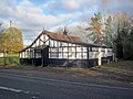
 Barneby Inn - geograph.org.uk - 6004109.jpg 1,024 × 683; 309 KB
-

-
 Bredenbury village hall - geograph.org.uk - 2182124.jpg 1,024 × 768; 238 KB
-
 Bredenbury Village Hall - geograph.org.uk - 5934463.jpg 3,648 × 2,736; 4.57 MB
-
 Bridleway indicators - geograph.org.uk - 4778179.jpg 800 × 531; 154 KB
-
 Butterley - geograph.org.uk - 6316681.jpg 1,024 × 683; 277 KB
-
 Butterley Brook - geograph.org.uk - 4800559.jpg 800 × 531; 195 KB
-
 Cattle grid at the end of the road - geograph.org.uk - 1008302.jpg 640 × 480; 136 KB
-
 Cottages at Wacton - geograph.org.uk - 4800565.jpg 800 × 531; 133 KB
-
 Detail of the railway bridge near Wacton - geograph.org.uk - 2182227.jpg 1,024 × 768; 233 KB
-
 End of the road - geograph.org.uk - 1008256.jpg 640 × 480; 136 KB
-
 End of the road - geograph.org.uk - 4800558.jpg 800 × 531; 147 KB
-
 Entrance to Wacton Court - geograph.org.uk - 955452.jpg 640 × 480; 110 KB
-
 Farm roll and track - geograph.org.uk - 4778225.jpg 800 × 531; 165 KB
-
 Farm track - geograph.org.uk - 6316683.jpg 1,024 × 683; 271 KB
-
 Farmland south of Ganderland - geograph.org.uk - 2181813.jpg 1,024 × 768; 337 KB
-
 Field near Bredenbury - geograph.org.uk - 6317195.jpg 1,024 × 683; 238 KB
-
 Field near Wacton Green - geograph.org.uk - 4800582.jpg 1,024 × 680; 253 KB
-
 Footbridge over Butterley Brook - geograph.org.uk - 4800642.jpg 800 × 531; 196 KB
-
 Footpath and track - geograph.org.uk - 4800586.jpg 800 × 531; 150 KB
-
 Footpath at Great Wacton - geograph.org.uk - 4800608.jpg 1,024 × 680; 383 KB
-

-
 Footpath to Great Wacton - geograph.org.uk - 4800644.jpg 800 × 531; 117 KB
-
 Former filling station, Bredenbury - geograph.org.uk - 2670921.jpg 640 × 480; 73 KB
-
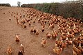 Free-range chickens - geograph.org.uk - 4800568.jpg 800 × 531; 154 KB
-
 Frome valley from Great Wacton Farm - geograph.org.uk - 1008529.jpg 640 × 480; 92 KB
-
 Great Wacton lane - geograph.org.uk - 955471.jpg 640 × 480; 87 KB
-
 Harvested maize field - geograph.org.uk - 4800637.jpg 1,024 × 680; 314 KB
-
 Haymaking, Wacton - geograph.org.uk - 6316667.jpg 1,024 × 683; 293 KB
-
 Haymaking, Wacton - geograph.org.uk - 6316670.jpg 1,024 × 683; 292 KB
-
 Headland bridleway - geograph.org.uk - 4778162.jpg 800 × 531; 109 KB
-
 Herefordshire farmland - geograph.org.uk - 4778197.jpg 800 × 531; 126 KB
-
 Hillside by the Ganderland footpath - geograph.org.uk - 1008516.jpg 640 × 480; 85 KB
-
 Horses on the footpath to Ganderland - geograph.org.uk - 1008524.jpg 640 × 480; 100 KB
-
 House building, Wacton - geograph.org.uk - 6316532.jpg 1,024 × 683; 264 KB
-
 Lower Butterley - geograph.org.uk - 6316685.jpg 1,024 × 683; 237 KB
-
 Motte at Wacton.jpg 1,024 × 768; 230 KB
-
 Muck bury - geograph.org.uk - 4778231.jpg 800 × 531; 129 KB
-
 Muddy gateway - geograph.org.uk - 4800584.jpg 800 × 531; 183 KB
-
 North of Bredenbury - geograph.org.uk - 6316530.jpg 1,024 × 683; 234 KB
-
 Oats, Wacton - geograph.org.uk - 6316671.jpg 1,024 × 683; 287 KB
-
 Old railway bridge - geograph.org.uk - 4800556.jpg 531 × 800; 138 KB
-
 Path, Butterley - geograph.org.uk - 6316672.jpg 1,024 × 683; 421 KB
-
 Path, Butterley - geograph.org.uk - 6316676.jpg 1,024 × 1,024; 655 KB
-
 Path, Butterley - geograph.org.uk - 6316680.jpg 1,024 × 1,024; 657 KB
-
 Pond at Butterley Mill - geograph.org.uk - 2181713.jpg 1,024 × 768; 373 KB
-
 Railway bridge near Wacton - geograph.org.uk - 2182213.jpg 1,024 × 768; 449 KB
-
 Railway bridge, Wacton - geograph.org.uk - 6316669.jpg 683 × 1,024; 314 KB
-
 Railway carriage at Rowden Mill Station - geograph.org.uk - 5697105.jpg 1,024 × 680; 336 KB
-
 Railway embankment at Wacton - geograph.org.uk - 2181856.jpg 1,024 × 768; 311 KB
-
 Railway trackbed - geograph.org.uk - 4800617.jpg 800 × 531; 109 KB
-
 Road to High Acres - geograph.org.uk - 4778159.jpg 1,024 × 680; 281 KB
-
 Rolling countryside near Horton - geograph.org.uk - 1008253.jpg 640 × 480; 102 KB
-
 Rowden Mill Railway Station - geograph.org.uk - 5977848.jpg 2,048 × 1,360; 1.4 MB
-
 Rowden Mill Road Bridge - geograph.org.uk - 5977817.jpg 2,048 × 1,360; 1.4 MB
-
 Rowden Mill Station - 1 - geograph.org.uk - 2181861.jpg 1,024 × 768; 240 KB
-
 Rowden Mill Station - 2 - geograph.org.uk - 2181864.jpg 1,024 × 768; 242 KB
-
 Rowden Mill Station - geograph.org.uk - 2126138.jpg 1,024 × 686; 252 KB
-
 Sheep pasture near Butterley Mill - geograph.org.uk - 2181746.jpg 1,024 × 767; 314 KB
-
 The Barneby Inn - geograph.org.uk - 2182142.jpg 1,024 × 768; 183 KB
-

-

-

-
 Three Pines Garage - geograph.org.uk - 6004110.jpg 1,024 × 683; 343 KB
-
 Three Pines garage, Bredenbury - geograph.org.uk - 2672811.jpg 640 × 480; 63 KB
-
 Three Rivers Ride - geograph.org.uk - 4778228.jpg 800 × 531; 141 KB
-
 Trackbed of a dismantled railway - geograph.org.uk - 4800615.jpg 800 × 531; 170 KB
-
 Trees near Rowden Mill - geograph.org.uk - 5697102.jpg 680 × 1,024; 310 KB
-
 Utterly Butterly^ - geograph.org.uk - 1008311.jpg 640 × 480; 116 KB
-
 Very wet farmland at Wacton - geograph.org.uk - 4800670.jpg 1,024 × 680; 228 KB
-
 Wacton Court - geograph.org.uk - 113417.jpg 640 × 479; 126 KB
-
 Wacton Court - geograph.org.uk - 4800538.jpg 1,024 × 680; 324 KB
-
 Wacton Court - geograph.org.uk - 4800563.jpg 1,024 × 680; 376 KB
-
 Wacton hamlet - geograph.org.uk - 955434.jpg 640 × 480; 97 KB
-
 Wacton pop graph.jpg 755 × 452; 39 KB
-
 Worcester, Bromyard and Leominster Railway - geograph.org.uk - 6317193.jpg 1,024 × 683; 296 KB
-
 Bed of Disused Railway, Great Wacton - geograph.org.uk - 123466.jpg 640 × 479; 168 KB
-
 Butterley Brook - Orchard Place - geograph.org.uk - 120503.jpg 640 × 479; 133 KB
-
 Disused Railway Bridge, Great Wacton - geograph.org.uk - 123613.jpg 640 × 479; 165 KB
-
 Great Wacton Farm - geograph.org.uk - 123593.jpg 640 × 479; 98 KB
-
 Lower Butterley Farm - geograph.org.uk - 113463.jpg 640 × 479; 94 KB
-
 Old Road to Great Wacton - geograph.org.uk - 123731.jpg 640 × 479; 104 KB


_-_geograph.org.uk_-_5977822.jpg)
_-_geograph.org.uk_-_5977827.jpg)
_-_geograph.org.uk_-_5977829.jpg)


