Category:Waarland
Jump to navigation
Jump to search
| Object location | | View all coordinates using: OpenStreetMap |
|---|
farm village in the Netherlands   | |||||
| Upload media | |||||
| Instance of | |||||
|---|---|---|---|---|---|
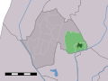
| Location | Schagen, North Holland, Netherlands | ||||
 | |||||
Subcategories
This category has the following 5 subcategories, out of 5 total.
Media in category "Waarland"
The following 5 files are in this category, out of 5 total.
-

-

-
 Map NL - Harenkarspel - Waarland.svg 800 × 600; 19 KB
-
 Boerderij - Waarland - 20248407 - RCE.jpg 1,200 × 800; 284 KB
-
 Overzicht - Waarland - 20248408 - RCE.jpg 1,200 × 791; 256 KB


