Category:Vypin Island
Jump to navigation
Jump to search
Vypin, also spelled Vypeen (Malaylam: വൈപ്പിന്) is an island in Ernakulam district of Kerala. The island which is about 27 km long was formed in the year 1341 after a heavy flood. It is connected to Kochi by a bridge from en:Kalamuku. There are regular boat services from Fort Kochi to Vypin Island. In 2004 a bridge was built thus Vypin was connected to the main land. The Goshree bridges also connects the islands en:Mulavukadu and en:Vallarpadam. 9°58′0″N 76°15′0″E / 9.96667°N 76.25°E
village in Ernakulam District, Kerala, India  | |||||
| Upload media | |||||
| Instance of | |||||
|---|---|---|---|---|---|
| Location | Ernakulam district, Kerala, India | ||||
| Located in or next to body of water | |||||
 | |||||
Subcategories
This category has the following 10 subcategories, out of 10 total.
C
E
- Edavanakad (empty)
K
- Kuzhuppilly (5 F)
M
O
- Our Lady of Hope Church, Vypin (15 F)
P
V
- Vypin jetty (8 F)
- Vypin lighthouse (38 F)
Media in category "Vypin Island"
The following 22 files are in this category, out of 22 total.
-
 AMH-5358-NA Map of the island of Waipin.jpg 2,400 × 1,451; 365 KB
-
 Ayyampilly Mahadeva temple vypin.jpg 3,865 × 2,527; 8.04 MB
-
 BhagavathyTempleNblm.jpg 773 × 572; 515 KB
-
 Boatmann.jpg 4,000 × 3,000; 3.75 MB
-
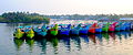 Boats in Vyppin.jpg 3,705 × 1,540; 2.67 MB
-
 Crab at Vypin beach, Kochi 2021.jpg 2,751 × 4,032; 5.6 MB
-
 Crushedice.jpg 2,048 × 1,468; 238 KB
-
 Evening fish market.jpg 3,008 × 2,000; 2.59 MB
-
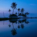
 Fine morning view from vypin beach.jpg 2,833 × 2,069; 813 KB
-
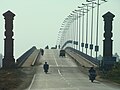 Goshree bridge kochi.jpg 3,264 × 2,448; 2.02 MB
-
 Island ships.jpg 5,152 × 3,864; 3.87 MB
-
 Kuzuppilly Beach.jpg 4,959 × 3,306; 6.28 MB
-
 LNG Terminal.jpg 1,920 × 1,280; 191 KB
-
 Nedungad2.jpg 960 × 960; 72 KB
-
 Nedungad3.jpg 1,365 × 2,048; 295 KB
-
 Rain at Vypin.jpg 886 × 553; 113 KB
-
 Sungazing at vypin beach.jpg 3,040 × 2,274; 1.23 MB
-
 Treasury Nblm.jpg 390 × 277; 33 KB
-
 Vypeen Island (127169767).jpg 555 × 416; 128 KB
-
 Vypin - walkway.jpg 1,728 × 1,152; 659 KB
-
 Vypin strike.jpg 1,000 × 563; 688 KB
-
 Vypin.jpg 507 × 450; 63 KB


.jpg)

