Category:Vredenhoef
Jump to navigation
Jump to search
| Object location | | View all coordinates using: OpenStreetMap |
|---|
 | |||||
| Upload media | |||||
| Instance of | |||||
|---|---|---|---|---|---|
| Location | Maarssen, Utrecht, Netherlands | ||||
| Has part(s) | |||||
| Heritage designation |
| ||||
 | |||||
Nederlands: Vredenhoef of Vreedenhoef is een buitenplaats langs de rivier de Vecht in het Nederlandse dorp Maarssen
|
This is a category about rijksmonumentcomplex number 520320
|
Hoofdgebouw
|
This is a category about rijksmonument number 520321
|
Historische aanleg
|
This is a category about rijksmonument number 520322
|
Koetshuis
|
This is a category about rijksmonument number 520323
|
Toegangshek
|
This is a category about rijksmonument number 520324
|
| Address |
|
Media in category "Vredenhoef"
The following 19 files are in this category, out of 19 total.
-
 Exterieur TOEGANGSHEK (XVIII), BIJ VOORMALIG KOETSHUIS - Maarssen - 20311712 - RCE.jpg 1,200 × 1,192; 495 KB
-
 Exterieur TOEGANGSHEK (XVIII), BIJ VOORMALIG KOETSHUIS - Maarssen - 20311713 - RCE.jpg 1,188 × 1,200; 401 KB
-

-

-
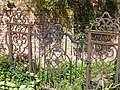
 Hek - Maarssen - 20143706 - RCE.jpg 1,195 × 1,200; 357 KB
-

-

-
 Huize Vreedenhoef, koetshuis - Maarssen - 20143615 - RCE.jpg 1,195 × 1,200; 453 KB
-
 Huize Vreedenhoef, koetshuis - Maarssen - 20143616 - RCE.jpg 1,200 × 1,200; 419 KB
-
 Huize Vreedenhoef, koetshuis - Maarssen - 20143617 - RCE.jpg 1,183 × 1,200; 389 KB
-
 Huize Vreedenhoef, koetshuis - Maarssen - 20143618 - RCE.jpg 1,200 × 1,200; 470 KB
-
 Huize Vreedenhoef, toegangshek - Maarssen - 20143621 - RCE.jpg 1,197 × 1,200; 464 KB
-
 Maarssen 520321 Vredenhoef.JPG 3,021 × 2,248; 5.09 MB
-
 Maarssen 520322 tuin Vredenhoef.JPG 3,072 × 2,304; 1.27 MB
-
 Maarssen 520323 hek koetshuis Vredenhoef.JPG 3,072 × 2,304; 1.22 MB
-
 Maarssen 520323 Koetshuis Vredenhoef.JPG 3,072 × 2,304; 1.44 MB
-
 Toegangshek verdwenen - Maarssen - 20143707 - RCE.jpg 1,200 × 866; 199 KB
-

-
 Vecht & Steyn, koetshuis - Maarssen - 20143598 - RCE.jpg 807 × 1,200; 257 KB
,_BIJ_VOORMALIG_KOETSHUIS_-_Maarssen_-_20311712_-_RCE.jpg)
,_BIJ_VOORMALIG_KOETSHUIS_-_Maarssen_-_20311713_-_RCE.jpg)
,_BIJ_VOORMALIG_KOETSHUIS,_DETAIL_-_Maarssen_-_20311714_-_RCE.jpg)
,_BIJ_VOORMALIG_KOETSHUIS,_DETAIL_-_Maarssen_-_20311715_-_RCE.jpg)


