Category:Voorstraat 11, Delfshaven
Jump to navigation
Jump to search
| Object location | | View all coordinates using: OpenStreetMap |
|---|
 | |||||
| Upload media | |||||
| Instance of |
| ||||
|---|---|---|---|---|---|
| Location | Rotterdam, South Holland, Netherlands | ||||
| Street address |
| ||||
| Located on street | |||||
| Heritage designation |
| ||||
 | |||||
|
This is a category about rijksmonument number 32893
|
| Address |
|
Media in category "Voorstraat 11, Delfshaven"
The following 8 files are in this category, out of 8 total.
-
 Achterzijde, overzicht - Delfshaven - 20048463 - RCE.jpg 3,216 × 2,143; 1.42 MB
-
 Overzicht - Delfshaven - 20048466 - RCE.jpg 1,200 × 960; 329 KB
-
 Overzicht - Delfshaven - 20048469 - RCE.jpg 1,200 × 802; 247 KB
-
 Overzicht achtergevels - Rotterdam - 20192501 - RCE.jpg 1,200 × 958; 250 KB
-
 Overzicht voorgevels - Rotterdam - 20192499 - RCE.jpg 962 × 1,200; 235 KB
-
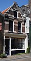 Rotterdam voorstraat11.jpg 1,332 × 2,600; 471 KB
-
 Voorgevels - Delfshaven - 20048467 - RCE.jpg 949 × 1,200; 238 KB
-
 Voorgevels - Rotterdam - 20192500 - RCE.jpg 959 × 1,200; 237 KB


