Category:Voorhaven 17, Schoonhoven
Jump to navigation
Jump to search
| Object location | | View all coordinates using: OpenStreetMap |
|---|
building in Krimpenerwaard, Netherlands  | |||||
| Upload media | |||||
| Instance of | |||||
|---|---|---|---|---|---|
| Location | Schoonhoven, Krimpenerwaard, South Holland, Netherlands | ||||
| Street address |
| ||||
| Located on street | |||||
| Heritage designation |
| ||||
 | |||||
|
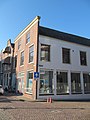
This is a category about rijksmonument number 33532
|
| Address |
|
Media in category "Voorhaven 17, Schoonhoven"
The following 6 files are in this category, out of 6 total.
-
 Overzicht gevels - Schoonhoven - 20198779 - RCE.jpg 1,200 × 969; 244 KB
-
 RM33531 Schoonhoven - Voorhaven 15.jpg 1,944 × 2,592; 1.23 MB
-
 RM33532 Schoonhoven - Voorhaven 17.jpg 1,944 × 2,592; 1.28 MB
-
 RM33533 Schoonhoven - Voorhaven 19.jpg 1,944 × 2,592; 1.27 MB
-
 Voorgevels - Schoonhoven - 20198782 - RCE.jpg 1,200 × 811; 190 KB
-
 Voorgevels - Schoonhoven - 20198783 - RCE.jpg 802 × 1,200; 187 KB


