Category:Voor Clarenburg 7, Utrecht
Jump to navigation
Jump to search
| Object location | | View all coordinates using: OpenStreetMap |
|---|
 | |||||
| Upload media | |||||
| Instance of |
| ||||
|---|---|---|---|---|---|
| Location | Utrecht, Netherlands | ||||
| Street address |
| ||||
| Located on street |
| ||||
| Heritage designation |
| ||||
 | |||||
|
This is a category about rijksmonument number 36065
|
| Address |
|
Media in category "Voor Clarenburg 7, Utrecht"
The following 6 files are in this category, out of 6 total.
-
 Achtergevel - Utrecht - 20237127 - RCE.jpg 1,200 × 1,200; 231 KB
-
 Exterieur OVERZICHT - Utrecht - 20288059 - RCE.jpg 960 × 1,200; 233 KB
-
 Exterieur VOORGEVEL - Utrecht - 20288060 - RCE.jpg 960 × 1,200; 238 KB
-
 Overzicht vanaf Mariastraat - Utrecht - 20237120 - RCE.jpg 1,187 × 1,200; 288 KB
-
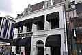 Voor Clarenburg 7 - Utrecht.JPG 4,288 × 2,848; 4.47 MB
-
 Voorgevel - Utrecht - 20237126 - RCE.jpg 950 × 1,200; 200 KB


