Category:Volcanological maps of New Zealand
Jump to navigation
Jump to search
Media in category "Volcanological maps of New Zealand"
The following 9 files are in this category, out of 9 total.
-
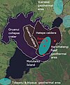
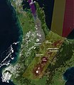
Lake taupo landsat & volcanic features.jpg 619 × 743; 132 KB
-
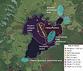
Lake taupo landsat volcanic features vents.jpg 1,102 × 948; 277 KB
-
Map Mount Tarawera 1888 with pre 1886 eruption features.gif 2,750 × 1,600; 1.77 MB
-
Maroa.Caldera.Rift.Zone.North.Island.NZ.jpg 1,302 × 1,506; 544 KB
-
Ohakuri.Rotorua.Paired.Eruptions.Rift.Zone.North.Island.NZ.jpg 1,302 × 1,506; 558 KB
-
Oruanui.North.Island.NZ.jpg 2,380 × 3,368; 1.18 MB
-
Paeroa-Ngapouri-Rotomahana Faults.jpg 762 × 957; 280 KB
-
Rotorua.Caldera.Mount.Tarawera.JPG 1,280 × 948; 399 KB
-
Whakamaru.Eruption.jpg 1,100 × 1,450; 472 KB


