Category:Volcanological maps of Iceland
Jump to navigation
Jump to search
Subcategories
This category has the following 6 subcategories, out of 6 total.
M
- Maps of volcanism of Iceland (7 F)
Media in category "Volcanological maps of Iceland"
The following 5 files are in this category, out of 5 total.
-
 14april-Iceland-earthquakes.png 374 × 444; 166 KB
-
 Eruption Holuhraun sketch.png 1,324 × 968; 3.67 MB
-
 Hot spots on Iceland’s Eyjafjallajökull Volcano 04-19-2011.png 719 × 479; 733 KB
-
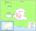 Location of Katlas caldera.png 1,769 × 1,553; 229 KB
-
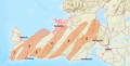 Reykjanes volcanic systems.png 2,360 × 1,196; 2.37 MB


