Category:Volcanic SO2 distribution maps
Jump to navigation
Jump to search
Subcategories
This category has only the following subcategory.
*
Media in category "Volcanic SO2 distribution maps"
The following 7 files are in this category, out of 7 total.
-
 Mount Agung Erupts in Bali, Indonesia (NESDIS 2017-11-27).jpg 1,920 × 1,080; 184 KB
-
 Sarychev Eruption Generates Large Cloud of Sulfur Dioxide.png 1,314 × 755; 469 KB
-
 SO2 concentration after Mount Agung eruption.png 1,920 × 1,080; 205 KB
-
 SO2 Galapagos 20051101.jpg 1,294 × 1,251; 224 KB
-
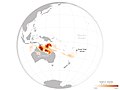 Sulphur dioxide from Tonga eruption spreads over Australia ESA23907514.jpeg 1,920 × 1,440; 469 KB
-
 Sulphur dioxide spewing from the Litli-Hrútur volcano ESA25024720.gif 1,920 × 1,440; 705 KB
-
 TOMS SO2 Jun17 91.gif 800 × 590; 64 KB
.jpg)


